If you have ever searched for the best hikes in Zermatt, the Hörnlihütte hike is probably already on your radar. Also known as the Hornli Hut hike, this legendary route is one of the most iconic trails in the Swiss Alps, taking hikers directly beneath the Matterhorn to the historic mountain hut used by climbers attempting the summit.
Sitting at 3,260 metres above sea level, Hörnlihütte is more than just a viewpoint. It is the base camp for Matterhorn climbers and one of the most dramatic destinations in the entire Zermatt hiking network. The trail delivers huge alpine scenery, close-up Matterhorn views, rocky terrain, exposed sections and a real sense of mountain history, all without needing technical mountaineering equipment.
The Hornlihutte day hike is a serious but achievable adventure for experienced hikers. Most people complete the route from Schwarzsee to Hörnlihütte along the Hörnliweg trail, while stronger hikers can start directly from Zermatt town for a much bigger day with significantly more ascent. Either way, the reward is unforgettable: standing beneath the Matterhorn, close enough to appreciate the scale, drama and beauty of Switzerland’s most famous mountain.
If there is one Zermatt day hike that feels like a true alpine achievement, this is it. In this guide, I’ll explain how to hike to Hörnlihütte from Zermatt town or Schwarzsee, what to expect on the trail, how difficult the route is, what gear to pack, and the key planning tips for making this one of the best hiking days possible in Zermatt.
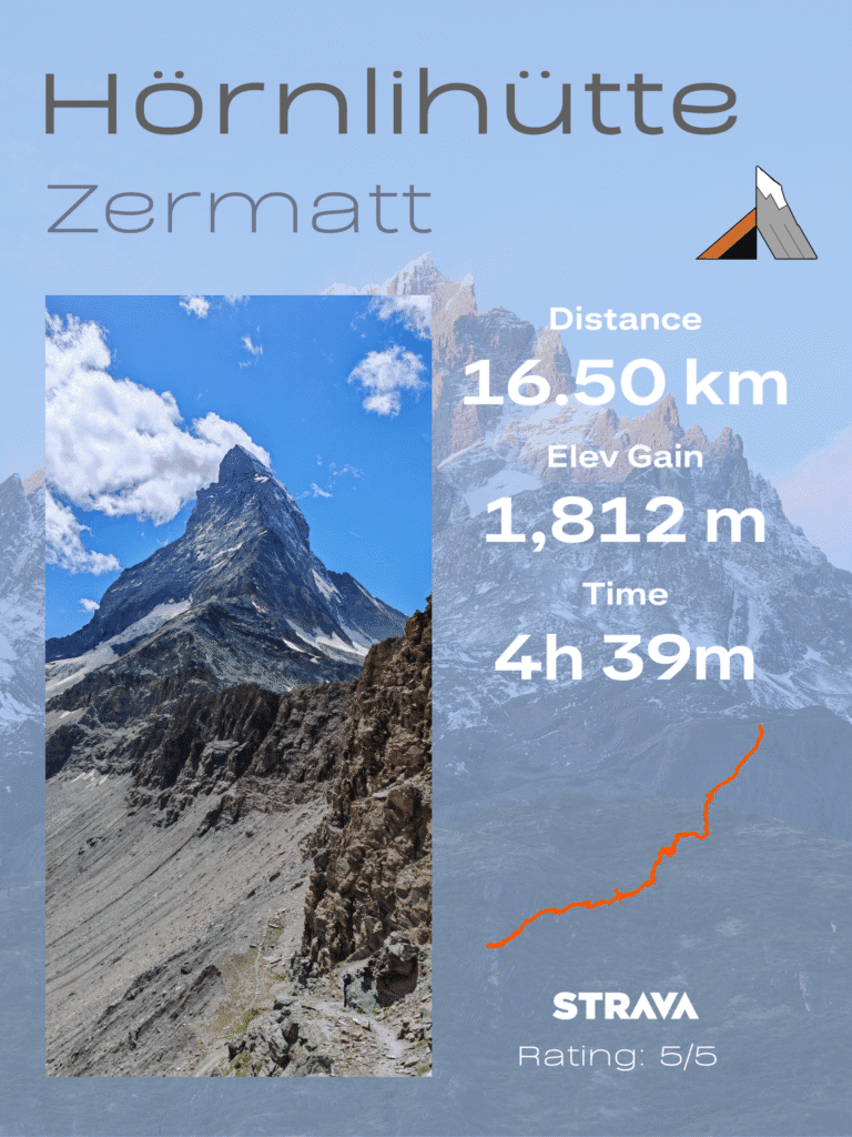
Hörnlihütte Key Stats
The popular route is to take the cable car from Zermatt to Schwarzee (see the stats below), but for the hardcore hikers, it’s a great challenge to hike from the town to the base of the Matterhorn. Don’t worry, as you can get the cable car back down to save our knees!
Hörnlihütte Hike Overview
Key route details for the classic Schwarzsee to Hörnlihütte hike beneath the Matterhorn.
| Stat | Detail |
|---|---|
| Trail Name | Hörnliweg — Trail #27 |
| Total Distance | ~8.5 km / 5.3 miles out-and-back from Schwarzsee |
| Total Ascent | ~725 m / 2,380 ft |
| Lowest Point | Schwarzsee — 2,580 m / 8,465 ft |
| Highest Point | Hörnlihütte — 3,260 m / 10,700 ft |
| Difficulty | Strenuous / Alpine — T4 rating |
| Estimated Time | 3.5–4 hours including a stop at the hut |
| Best Season | Late June through September |
| Best Time of Day | Early morning — aim to start by 9 am |
| Trail Marking | Blue signs and blue-and-white blazes — alpine route |
When researching Zermatt hikes, I soon discovered this hike on AllTrails, and it ticked all the boxes for ideal day hikes. The original plan was to hike down the Glaciers Trail from Trockener Steg station to Schwarzsee, up to Hörnlihütte, then descend to Zermatt. But with not much ascending and a little uninspiring Glacier Trail, we changed the plan at the last minute.
We started in Zermatt town and decided to hike up past Furi up to Schwarzsee, then onto Hörnlihütte. Most people take the cable car straight to Schwarzsee, where the hike is around 3 hours to the hut. Overall, we spent 5 nights in Zermatt and did 4 incredible alpine hikes, so check out the best Zermatt Hikes.
Hike Start: Zermatt
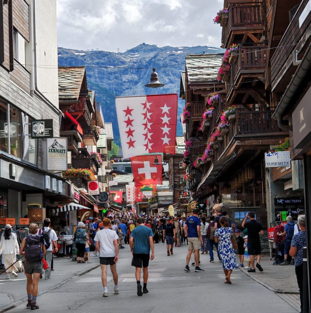
The adventure begins the moment you step out of Zermatt village, and trust us, this town sets the scene perfectly. Picture pedestrianised streets, wooden chalets, and the Matterhorn literally looming behind the town. There’s a picture postcard around most corners. We were in luck with the alpine weather hovering around 20°C, and the clouds looking to lift to unveil the beautiful landscapes. The Hörnlihütte hike starts gently along the river as you head towards the Zermatt Bergbahnen. The main cable car station for Kleine Matterhorn and Matterhorn Glacier Paradise is at the southern end of the village — it’s about a 15-minute walk from the train station.
A quick note on tickets: a return ticket to Schwarzsee will run you around CHF 64. If you have a Swiss Half-Fare Card, you’ll cut that in half — well worth looking into if you’re spending more than a couple of days in Switzerland.
Next stop: Schwarzsee
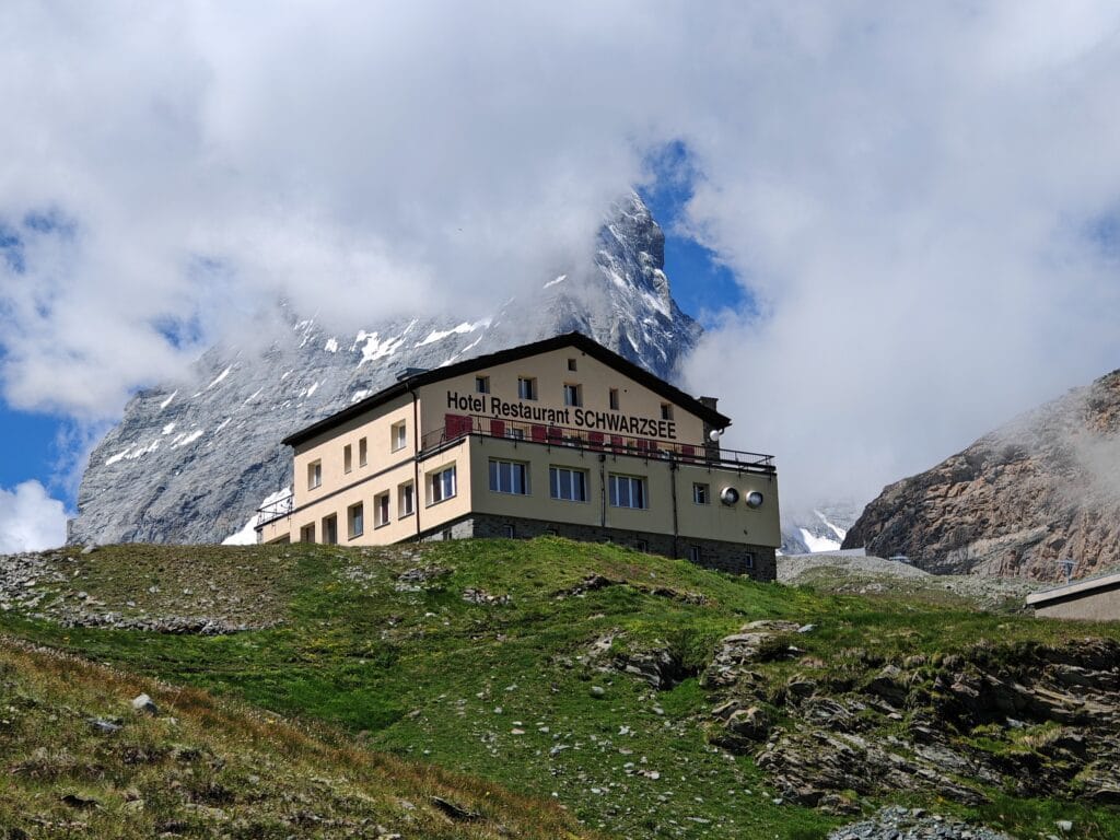
Next hike through little chalet hamlets while steadily climbing towards Furi, another cable car station that heads towards Schwarzsee. The trail ramps up through the forests, providing some glimpses back towards Zermatt far below and offering peaks of the snow-capped Breithorn. For a few hours in the morning, the trees provide some shelter from the early sun before arriving at the alpine meadows. By the time we arrived at Schwarzsee, we had already climbed 1200m to see the fresh hikers straight off the cable car. Another 600m of higher altitude ascending on rocky and steep terrain awaited us.
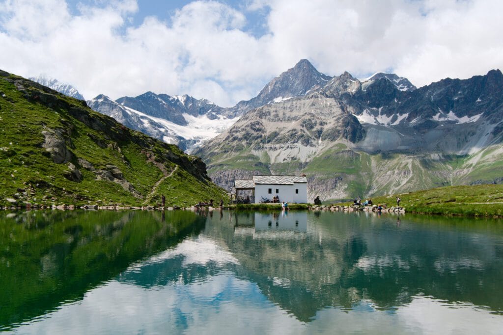
Schwarzsee is located at 2,580 metres and is the first viewpoint of the Matterhorn… when the clouds aren’t hiding its beauty. There’s a gorgeous little alpine lake with a tiny chapel, and a generic photograph opportunity with the iconic ZERMATT sign right near the station. You’ll also start spotting climbers here, kitted out with helmets, ropes, and all the gear, either heading up towards or coming back down from the Matterhorn. It’s a trail that mountain climbing legends have walked en route to battle with the famous Matterhorn.
The Climb: Schwarzsee to Hörnlihütte
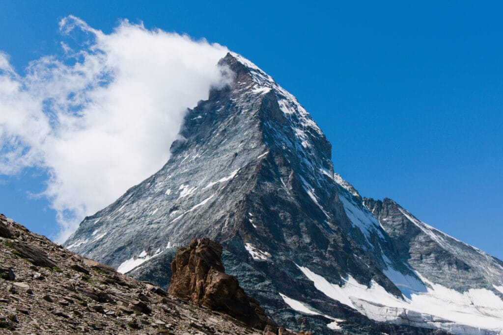
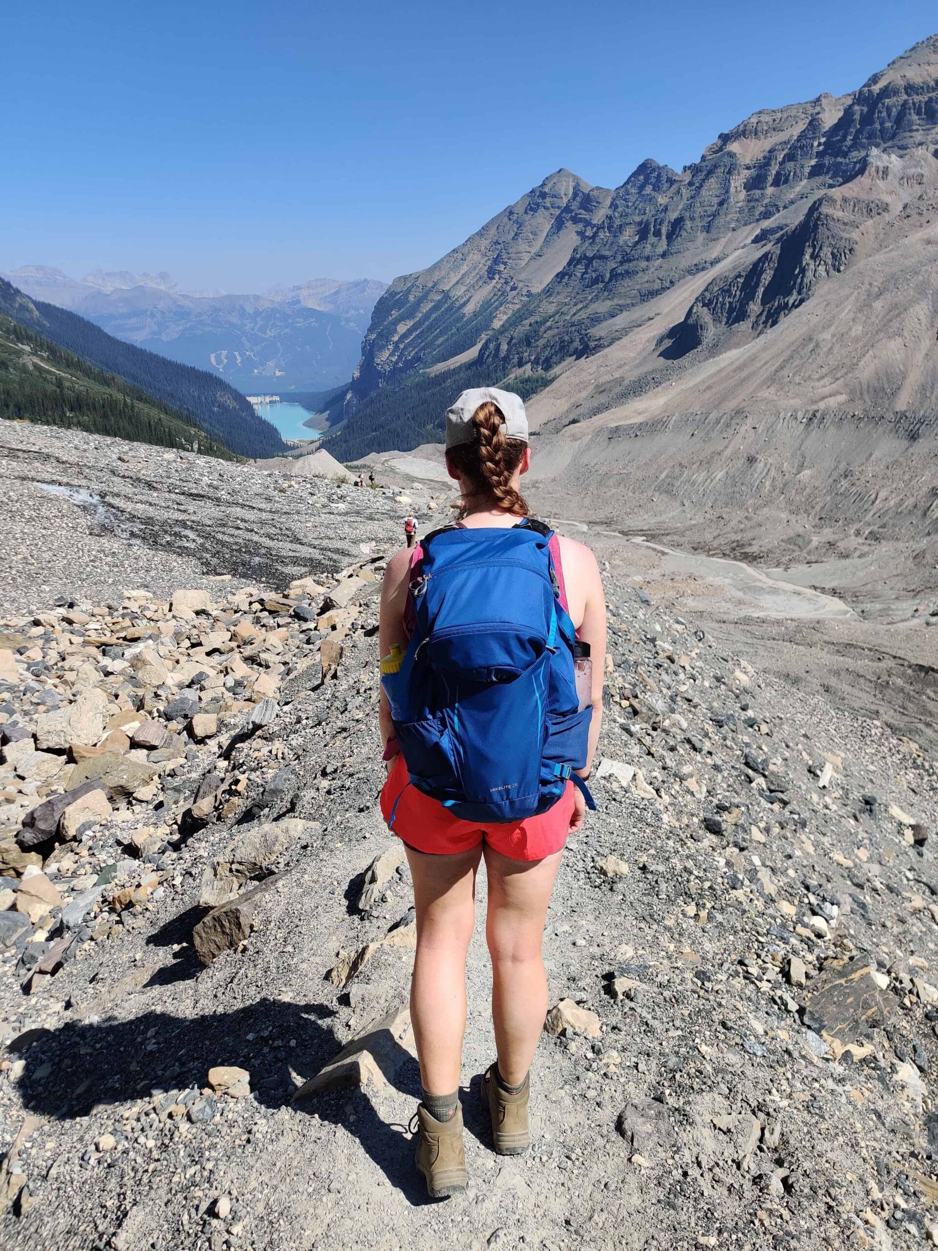
This is where things get properly epic. If the 1200m climb was a warm-up, then the fun is about to begin, as well as the business. The trail starts out relatively gently, winding around Schwarzsee Lake on a broad, well-beaten path. The ground is rocky, but the gradient is easy for now. You’ll quickly find yourself curving uphill on a series of switchbacks. The views at this stage are already ridiculous, and it’s easy to stop every 5 minutes for a photograph. Don’t forget to also look back, and you’ll see glaciers, lakes, and mountain peaks stretching out in every direction along the Zermatt Valley.
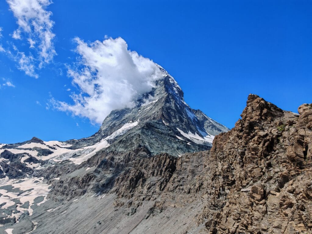
But the Matterhorn is straight ahead, and it is absolutely dominating the skyline and hard to peel your eyes away from. The path is busy with casual hikers not wearing the correct gear, all the way to seasoned climbers preparing for a bigger challenge above. My only drawback of this hike is the popularity and traffic; some hikers aren’t patient, and it can be hard to pass slower people, too.
Hörnli Ridge
As you gain altitude, the landscape shifts as you approach the Hörnli Ridge. The grassy patches give way to talus slopes and raw, jagged rock. The trail narrows and starts to feel more serious. This is where you’ll begin to encounter the metal platforms, staircases, and safety chains that are bolted into the cliff face.
This easy Via Ferrata means you need to keep focus as the danger increases. Don’t stress, as it sounds scarier than it is with many other hikers on the trail. The infrastructure is solid and well-maintained, and as long as you’ve got a decent head for heights, you’ll be just fine. The fixed ropes and chains are there to help, not to scare you off.
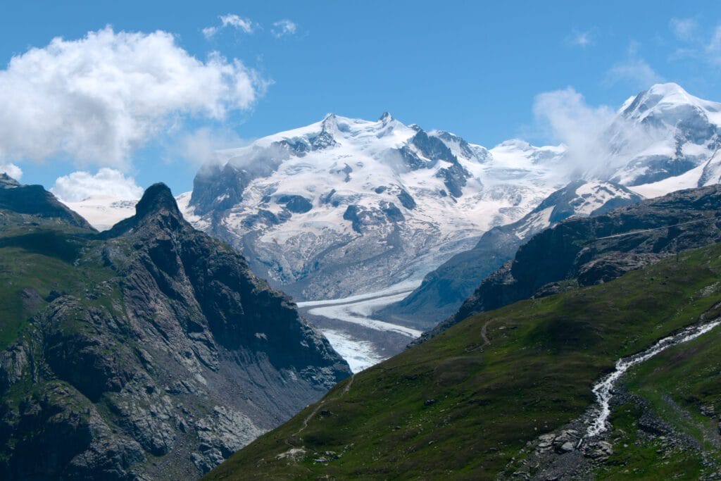
The views keep getting better with every step up. To your north, a wall of 4,000-metre peaks stretches across the horizon — the Dent Blanche, the Weisshorn, the Mischabel Range. To the southeast, Monte Rosa and the Breithorn put on an incredible show of peaks and glaciers along the Swiss-Italian border. And straight ahead? The Matterhorn just keeps growing. It’s one of those rare moments in hiking where you genuinely feel like you’re walking towards something mythical.
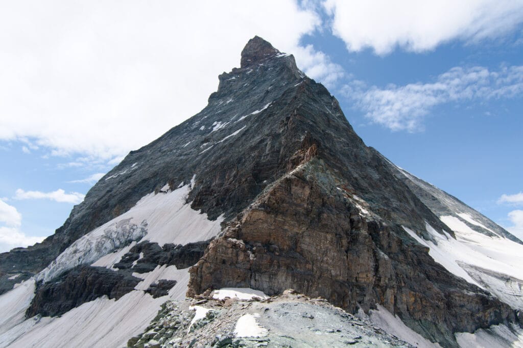
After about two hours of steady climbing from Schwarzsee, you’ll crest a ridge, and there it is — Hornlihütte, perched on its rocky shelf at 3,260 metres, with the Matterhorn rising almost vertically above it. The scale of it hits you in a way that photos never quite capture. You’re standing at the foot of one of the most famous mountains in history, and the air is thin, the wind is cool, and everything feels a little bit surreal. And it’s time for a well-earned rest and some lunch with a spectacular view.
At Hörnlihütte: Fuel Up and Soak It In
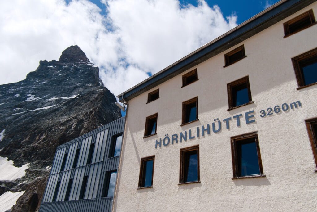
Hornlihütte isn’t just a waypoint — it’s a proper alpine lodge. Built in 1880 and renovated in 2015, it offers accommodation for up to 170 guests, a restaurant, and toilets. For a day hiker, the restaurant is the main draw. Grab a warm meal, a coffee, or a slice of cake, and recharge before the descent. The terrace and restaurant are busy, so prepare to share a bench, and there’s a strict rule for only consuming food and drink from the hut. We found a spot around the back of Hornlihütte to enjoy our lunch with a more direct view of the Matterhorn.
If you’ve got binoculars, this is the place to use them. Early in the morning, you can watch climbers ascending the next part of Hörnli Ridge — the same route that Edward Whymper and his team used for the very first ascent of the Matterhorn back in 1865. This hut has been the launchpad for over 130 years of mountaineering attempts on the world’s most famous peak and is bustling with ambitious climbers. We went the extra bit and touched the base of the Matterhorn next to the helipad. This allowed us to see climbers ascending and descending the north face.

The Descent: Back to Schwarzsee and Up to Klein Matterhorn
The walk back down to Schwarzsee is the same trail in reverse, and while it’s easier on the legs, don’t underestimate it. Descending rocky, uneven terrain — especially when you’re a bit tired — demands just as much attention as the climb. Take your time, watch your footing on the loose gravel sections, and enjoy the views one last time.
Once you’re near Schwarzsee, it’s worth diverting down to the Schwarzsee lake for a view of the chapel across the still waters. This hike broke my personal best of hiking ascent in a day by the time we reached the cable car station, maxing out at over 1800m climbed! There is now a choice to be made, and we’d highly recommend this one: don’t head straight back to Zermatt. Instead, hop back on the cable car and ride it all the way up to Matterhorn Glacier Paradise on the Klein Matterhorn at 3,883 metres — the highest cable car station in Europe.
Matterhorn Glacier Paradise
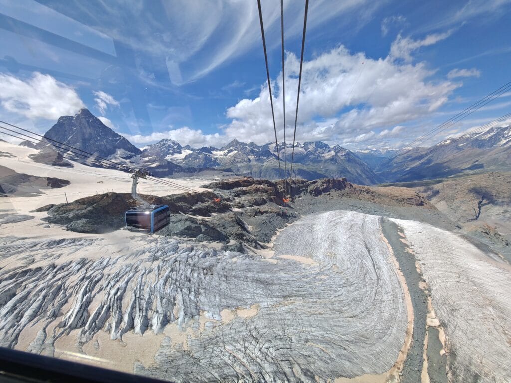
Here’s how it works: from Schwarzsee, take the gondola to Trockener Steg (about 9 minutes), then board the stunning Matterhorn Glacier Ride cable car up to the summit station (another 8 minutes) above the glaciers. The cable cars are modern, panoramic, and incredibly smooth — and the views on the way up are on another level entirely. At the top, you’ll be above the clouds, surrounded by a 360-degree panorama of the Swiss, Italian, and French Alps. There’s a viewing platform, an ice cave called the Glacier Palace carved right into the mountain, and a restaurant if you fancy warming up with something hot.
We managed to arrive at the top station for a few quick pics before getting the last cable car down. If you start the Hörnlihütte from Schwarzsee, then you’ll have plenty of time to enjoy the top station views with Briethorn (one of the most accessible 4000m mountaineering climbs) next door. Finally, make your way back down the cable car route through Trockener Steg, Schwarzsee, Furi, and back into Zermatt. The descent by cable car takes around 30–40 minutes in total, and by the time you’re back in the village, you’ll feel like you’ve lived an entire epic adventure in a single day.
At Schwarzsee, we were joined in a gondola by an American couple who inspired us. The woman had just climbed Breithorn, and her Husband had literally just climbed the Matterhorn! I was in awe and spoke about the technical difficulty, and traded stories about Nepal with them eagerly. I wish that the Gondola ride could have gone on further, but I had met an aspirational couple.
Hörnlihütte Planning Tips: How to Make This Day Absolutely Perfect
Start early: If you’re starting from Zermatt, then aim to be before 9 am to give time not miss the last cable car down. The crowds are thinnest before 10 am, and afternoon thunderstorms are common in the Alps during summer.
Check the weather the night before. Alpine weather can shift fast. A clear morning can turn into a whiteout by lunchtime. Use a reliable mountain weather app or check the official Zermatt forecast. If it’s looking sketchy, it’s okay to postpone — this hike deserves a clear day!
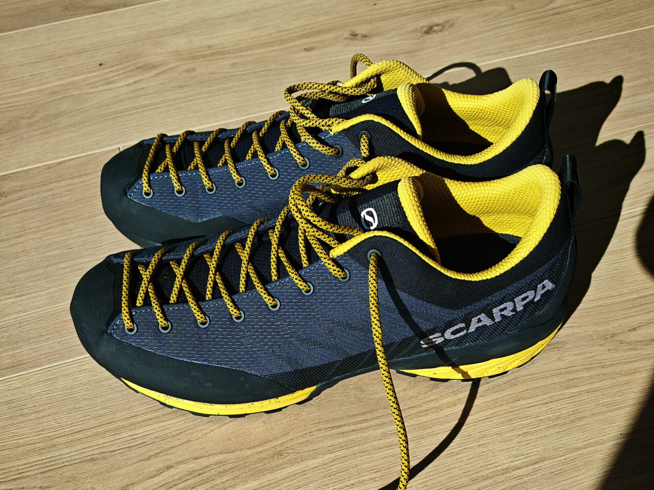
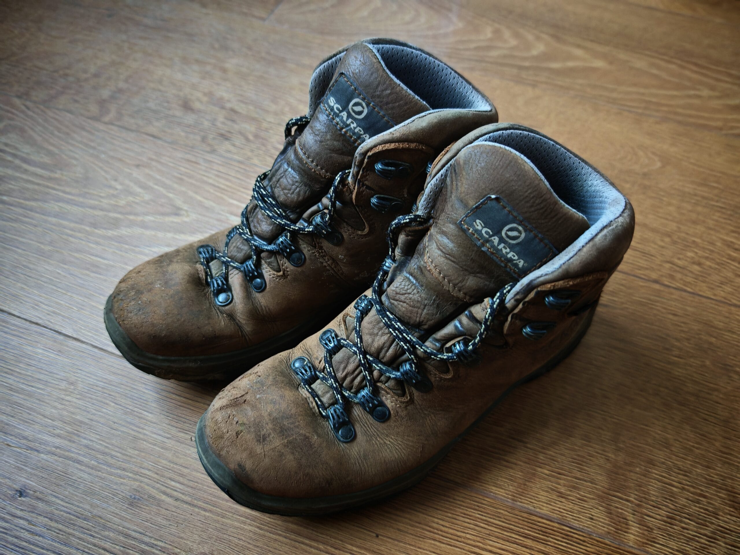
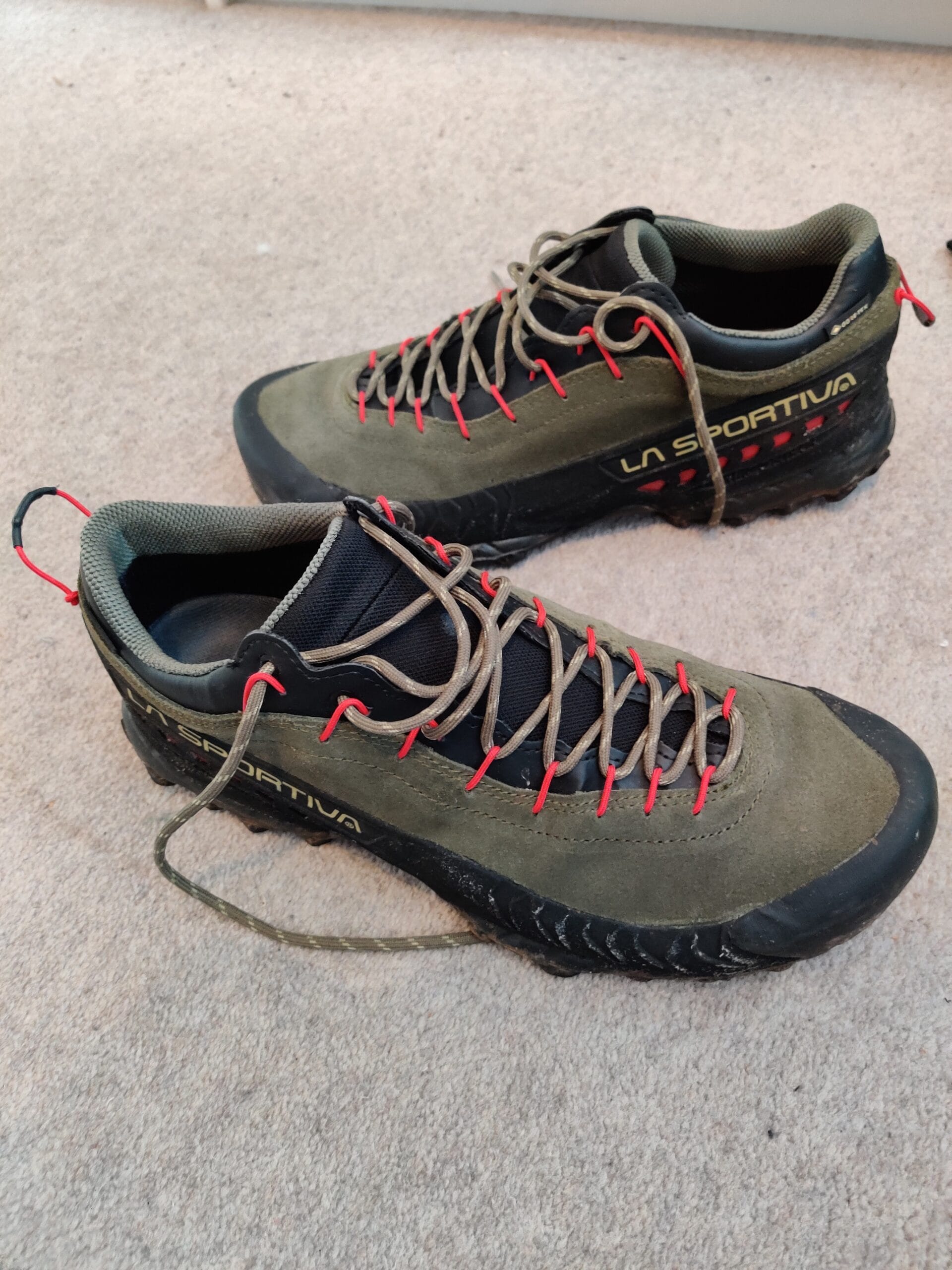
Bring clothes, poles and proper footwear. It might be warm in Zermatt village, but at 3,260 metres the temperature drops significantly, especially if there’s wind. Bring a waterproof jacket, a warm mid-layer, and make sure your base layer wicks moisture away from your skin. Proper broken-in hiking boots, approach shoes or trail running shoes are needed for the technical aspects of the Hornli Ridge. Check out my Hiking Gear List for the best shoes and clothes to bring.
Hydrate and snack. The altitude will make you tire faster than you expect. Carry at least 2 litres of water during summer and pack some high-energy snacks — nuts, bars, fruit. You can refuel properly at the hut even if it’s expensive.
Get a Swiss Half-Fare Card. If you’re in Switzerland for more than a day or two, this is a no-brainer. It costs CHF 120 and gives you 50% off trains, buses, and many cable cars for a month. The cable car savings alone will cover a big chunk of that cost.
Zermatt Hiking Essentials
Hörnlihütte Hiking Summary
The Hörnlihütte hike is one of those rare trails that genuinely lives up to the hype. I was lucky enough to hike it on my 27th birthday, and it ended up being the perfect alpine day. Starting from Zermatt town made the route much more demanding, with over 1,800 metres of climbing, but reaching the hut beneath the Matterhorn made every step feel worth it.
For most hikers, the best option is the classic Schwarzsee to Hörnlihütte route. It still feels wild, rocky and adventurous, but it is far more manageable than starting from town. This makes the Hörnlihütte day hike one of the best hikes in Zermatt for experienced day hikers who want huge Matterhorn views without committing to a full mountaineering objective.
What makes this route so special is the combination of scenery, history and atmosphere. The Hörnliweg trail takes you through serious alpine terrain towards the most famous mountain in Switzerland, finishing at the historic hut where Matterhorn climbers begin their summit attempts. Standing at the base of the Matterhorn and looking up at the ridge is something that no viewpoint, cable car or photo can fully replicate.
If you have the energy, pairing the hike with a visit to Klein Matterhorn on the way back creates one of the most memorable days you can have in the Swiss Alps. For me, this was the standout Matterhorn hike and one of the most rewarding trails in the entire Zermatt hiking area.
So if you are planning a trip to Zermatt and only have time for one big hike, make it Hörnlihütte. It is challenging, dramatic, unforgettable and easily one of the best alpine day hikes I have ever done.
What is your favourite alpine day hike? Let me know in the comments below.
FAQs
Is the Hörnlihütte hike difficult?
Yes, the Hörnlihütte hike is a strenuous alpine hike, especially if starting from Zermatt town. From Schwarzsee, the route is shorter but still involves rocky terrain, exposure, fixed chains, staircases and around 725m of ascent. The route is listed in the post as a T4 alpine hike, so it is best suited to confident hikers with good footwear and a head for heights.
How long does the Hörnlihütte hike take?
The hike from Schwarzsee to Hörnlihütte usually takes around 3.5 to 4 hours, including a stop at the hut. If you start from Zermatt town instead of taking the cable car to Schwarzsee, the day becomes much longer and more physically demanding, with significantly more ascent.
Can you hike to Hörnlihütte without climbing the Matterhorn?
Yes, you can hike to Hörnlihütte without climbing the Matterhorn. Hörnlihütte is the historic base hut for Matterhorn climbers, but the day hike to the hut is possible for experienced hikers. You do not need ropes or mountaineering equipment for the hiking route, although the trail is still steep, rocky and exposed in places.
What is the best route for the Hörnlihütte hike?
The most popular route is to take the cable car from Zermatt to Schwarzsee and then hike the Hörnliweg trail to Hörnlihütte. This route is around 8.5km out-and-back with roughly 725m of ascent. Strong hikers can also start from Zermatt town for a much bigger day, passing through Furi and Schwarzsee before continuing to the hut
When is the best time to hike to Hörnlihütte?
The best time to hike to Hörnlihütte is usually from late June through September, when the alpine route is more likely to be clear, and the cable cars are operating. Starting early in the morning is recommended because the trail is quieter before 10am and alpine weather can change quickly later in the day.