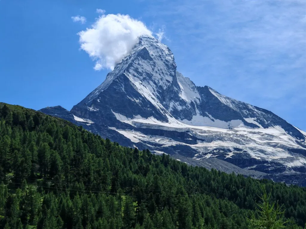
The Edelweiss Höhbalmen Trail Zermatt, also known as the Höhbalmen Trail or Edelweissweg, is one of the best full-day hikes in Zermatt for serious Matterhorn views. Starting directly from Zermatt village, the route climbs steeply towards Edelweiss and Trift before reaching the wide alpine meadows of Höhbalmen, where the Matterhorn suddenly appears in one of the most dramatic reveals of the trip.
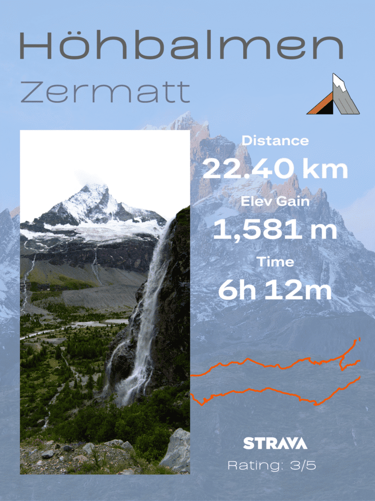
Unlike some of the easier Zermatt hiking trails that rely on cable cars or mountain trains, this route is earned entirely on foot. Officially, the Edelweiss path / Höhbalmen No. 30 is listed as a demanding mountain hiking trail, with a circular route from Zermatt via Trift, Höhbalmen and Zmutt. My recorded route came out slightly longer, at around 22.4km with 1,581m of elevation gain, making it one of the biggest hiking days of the Zermatt trip. [zermatt.swiss] [backpacker…tality.com]
This guide covers everything you need to know before hiking the Edelweissweg Zermatt route, including trail stats, difficulty, route direction, Matterhorn viewpoints, gear, timing and whether it deserves a place among the best hikes in Zermatt.
The Best Zermatt Hiking Trails
Edelweiss Höhbalmen Trail – This is a fantastic hike in the Zermatt valley without cable cars or trains. The beautiful alpine meadows and views of the Matterhorn are mesmerising. It’s a hard climb to start and a long day out!
Hörnlihütte – My favourite of the Zermatt hiking trails and No.1 on my Best Mountain Hikes list. A hike normally from Schwarzee to Hörnlihütte at the base of the Matterhorn. A popular day hike and overnight stay for climbers attempting to summit the Matterhorn.
Gornergrat & Riffelsee – The famous Gornergrat Railway offers great views across to the Matterhorn, and Riffelsee has a perfect reflection of the iconic Swiss mountain. My second favourite for Zermatt hiking is No.5 on the Best Mountain Hikes.
Five Lakes Walk & Oberrothorn– The 5 Lakes Walk is a family-friendly hike taking in lovely trails and water reflections. The 5 Lakes are: Stellisee, Grindjisee, Grünsee, Moosjisee, and Leisee (from Blauherd to Sunegga direction). It can be made more challenging with an ascent of Oberrothorn (3,414m) above Unterrothorn.
Edelweiss Trail Zermatt Overview
Key route details for the demanding Edelweissweg / Höhbalmen loop from Zermatt via Trift, Höhbalmen and Zmutt, with some of the best Matterhorn views in the region.
| Stat | Detail |
|---|---|
| Trail Name | Edelweissweg / Höhbalmen Trail — Trail #30 |
| Route | Zermatt — Edelweiss — Trift — Höhbalmen — Zmutt — Zermatt |
| Recorded Distance | ~22.4 km / 13.9 miles loop from Zermatt |
| Official Distance | ~20.1 km / 12.5 miles depending on exact route choice |
| Recorded Elevation Gain | ~1,581 m / 5,187 ft |
| Official Ascent / Descent | ~1,190 m ascent and ~1,190 m descent |
| Lowest Point | Zermatt — around 1,605–1,620 m |
| Highest Point | Höhbalmen area — around 2,745 m |
| Difficulty | Demanding mountain hike — long distance, steep ascent and big elevation gain |
| Estimated Time | 6–8 hours depending on pace, stops and conditions |
| Best Season | Summer to early autumn, when the higher trail is snow-free |
| Best For | Strong hikers wanting a quieter full-day Zermatt hike with panoramic Matterhorn views |
Edelweiss Höhbalmen Trail (Day 2)
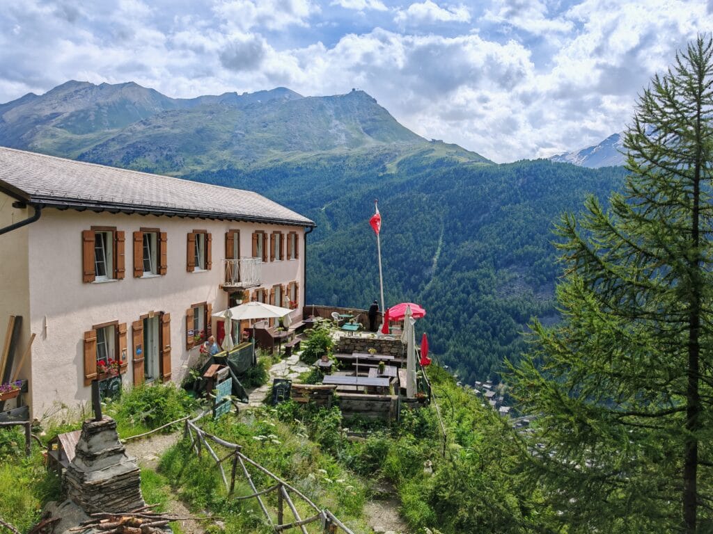
Edelweiss Mountain Hut
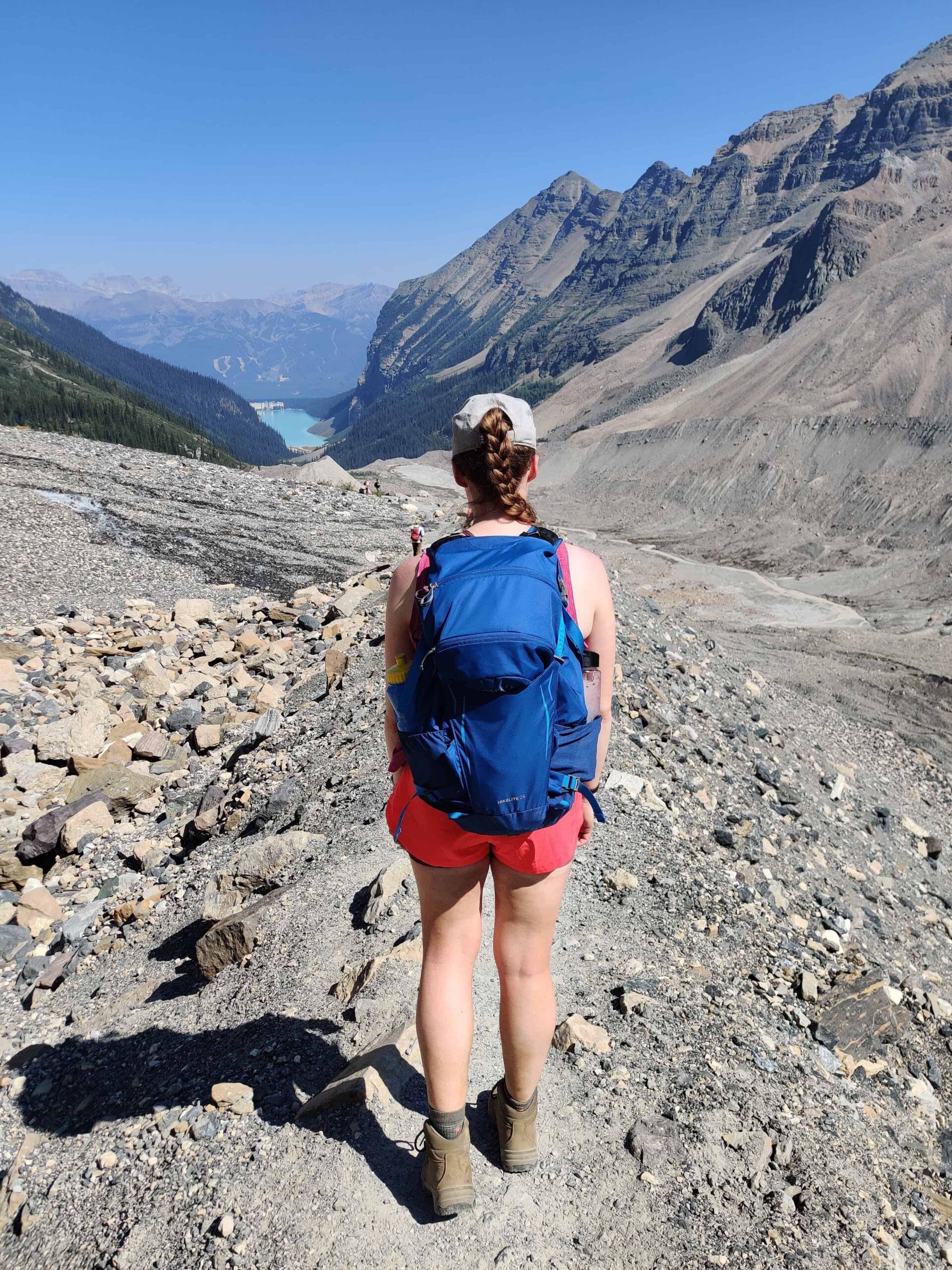
After a hearty homemade breakfast on the balcony overlooking Zermatt, we prepared for the day. The hiking backpacks were sorted, and we hit the mountain paths from our apartment for our first of the Zermatt hiking trails planned. Our plan for most of the best Zermatt hikes was to save money by hiking from the town to the epic trails instead of using the expensive cable cars.
First up was the Edelweiss Höhbalmen, which was highly rated on AllTrails for its Matterhorn views. The day was looking unpredictable with a confusing start. Under Mammut Klettersteig (Via Ferrata Region), the signposts told of a trail closure up towards Berggasthaus Trift. This threw a spanner in the works at the beginning of our first Zermatt hiking adventure.
We retraced our steps and used AllTrails to find a different route up towards the Eldelweiss Mountain Hut. The path was steep, yet we eventually arrived at the Hut perched neatly above Zermatt. To our dismay, we found the path up to Berggasthaus Trift was still closed, so once again we hit reverse back through the Alpine flower-covered meadow. Our luck was running low with dark clouds approaching fast.
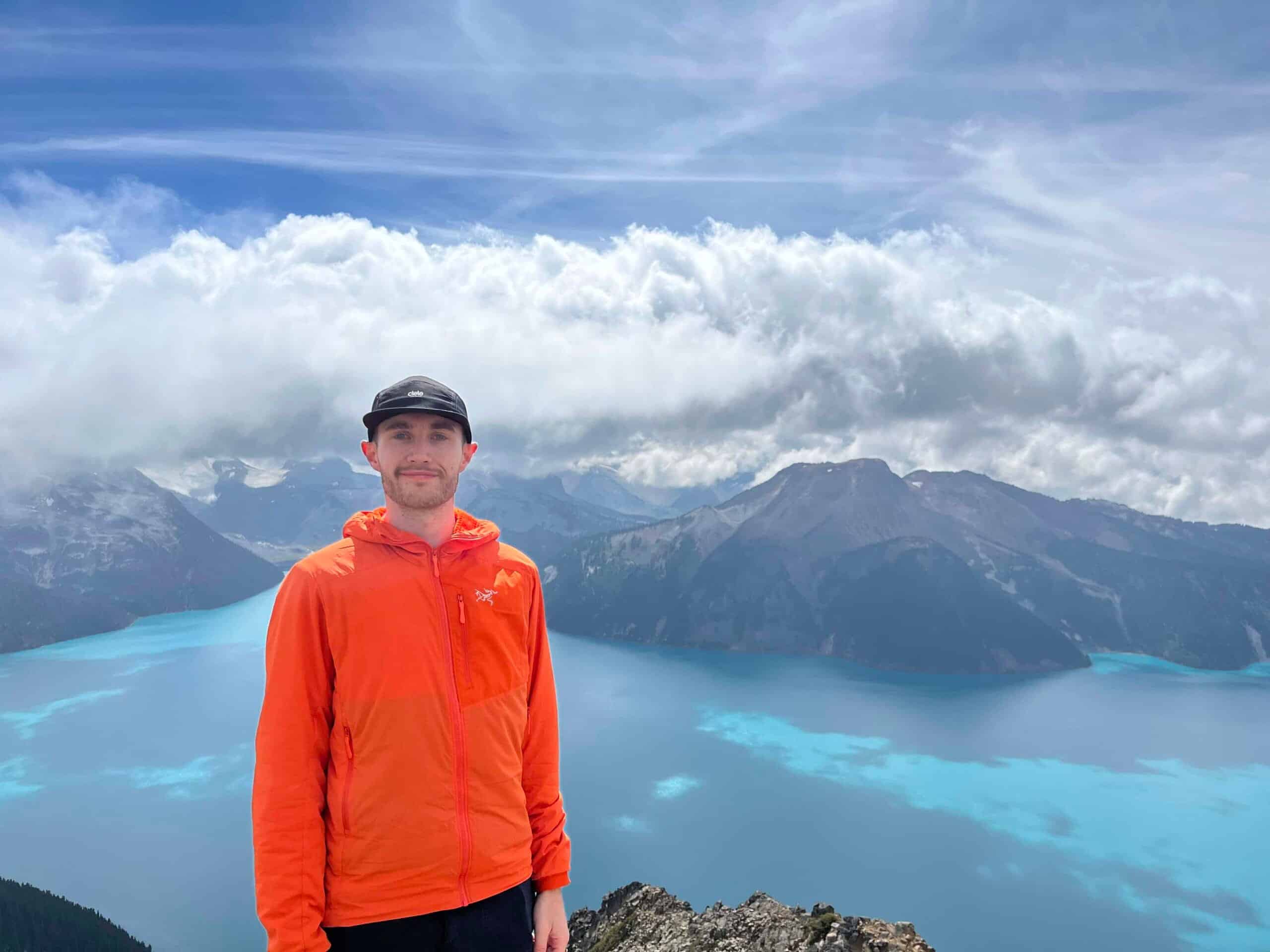
Höhbalmen Viewpoint
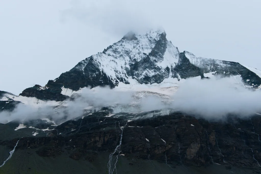
We hiked up a steep trail towards Bänkli auf Höhbalmen. This is a 1,100m brutal ascent from the town to the Höhbalmen viewpoint. We were not fast enough, however. A torrential downpour engulfed us, forcing us to quickly put on waterproof jackets, trousers, and backpack rain covers. The next hour was fairly miserable, with the mighty Matterhorn half covered in cloud, and our appetite for lunch was disappearing. It shows that even the best of plans can be changed with poor weather. Slowly, the rain eased, and the clouds began to lift for some moody views and images of the Matterhorn and the Zmuttgletscher valley. The saving grace was the Arben Wasserfall (see Infographic) for an impressive photo opportunity.
Zmutt Trail
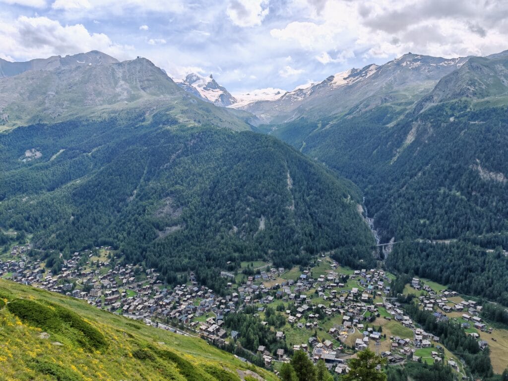
The Zmutt trail itself was easy, just wet as we hiked back along the Edelweissweg past Zmutt towards Zermatt. The afternoon was wearing on as we hadn’t eaten lunch, but the blue skies had appeared to our surprise. Typically, we didn’t get these conditions at the Höhbalmen viewpoint. On the opposite ridge, we could see the Hörnlihütte, which was the objective for Day 4.
The views behind us were jaw-dropping in the sun, but still, the Matterhorn summit teased us by remaining hidden in clouds. The Edelweiss Höhbalmen trail is one of the best Zermatt hiking trails with easy pathfinding and probably good views; however, my experience means I can only rate it 3/5, given the weather and closed trail.
Want more Zermatt hiking trails near the Matterhorn?
Compare the best hikes around Zermatt, including Matterhorn viewpoints, alpine lakes, ridge walks and demanding mountain routes, with trail stats, planning tips and route recommendations.
Read the Zermatt Hiking Guide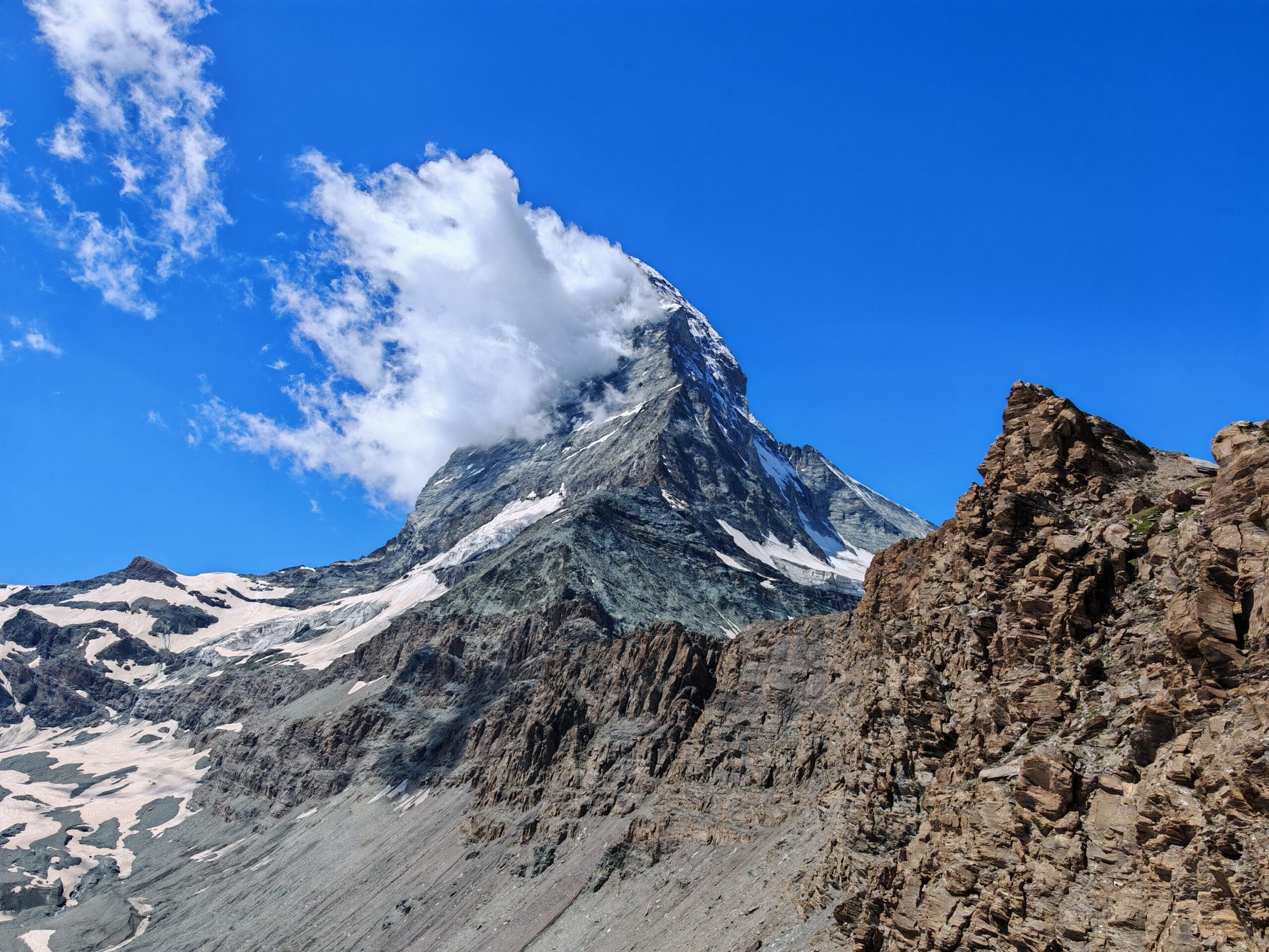
Zermatt Hiking Planning
Hörnlihütte Planning Tips: How to Make This Day Absolutely Perfect
Start early: If you’re starting from Zermatt, then aim to be before 9 am to give time not to miss the last cable car down. The crowds are thinnest before 10 am, and afternoon thunderstorms are common in the Alps during summer.
Check the weather the night before. Alpine weather can shift fast. A clear morning can turn into a whiteout by lunchtime. Use a reliable mountain weather app or check the official Zermatt forecast. If it’s looking sketchy, it’s okay to postpone — this hike deserves a clear day!
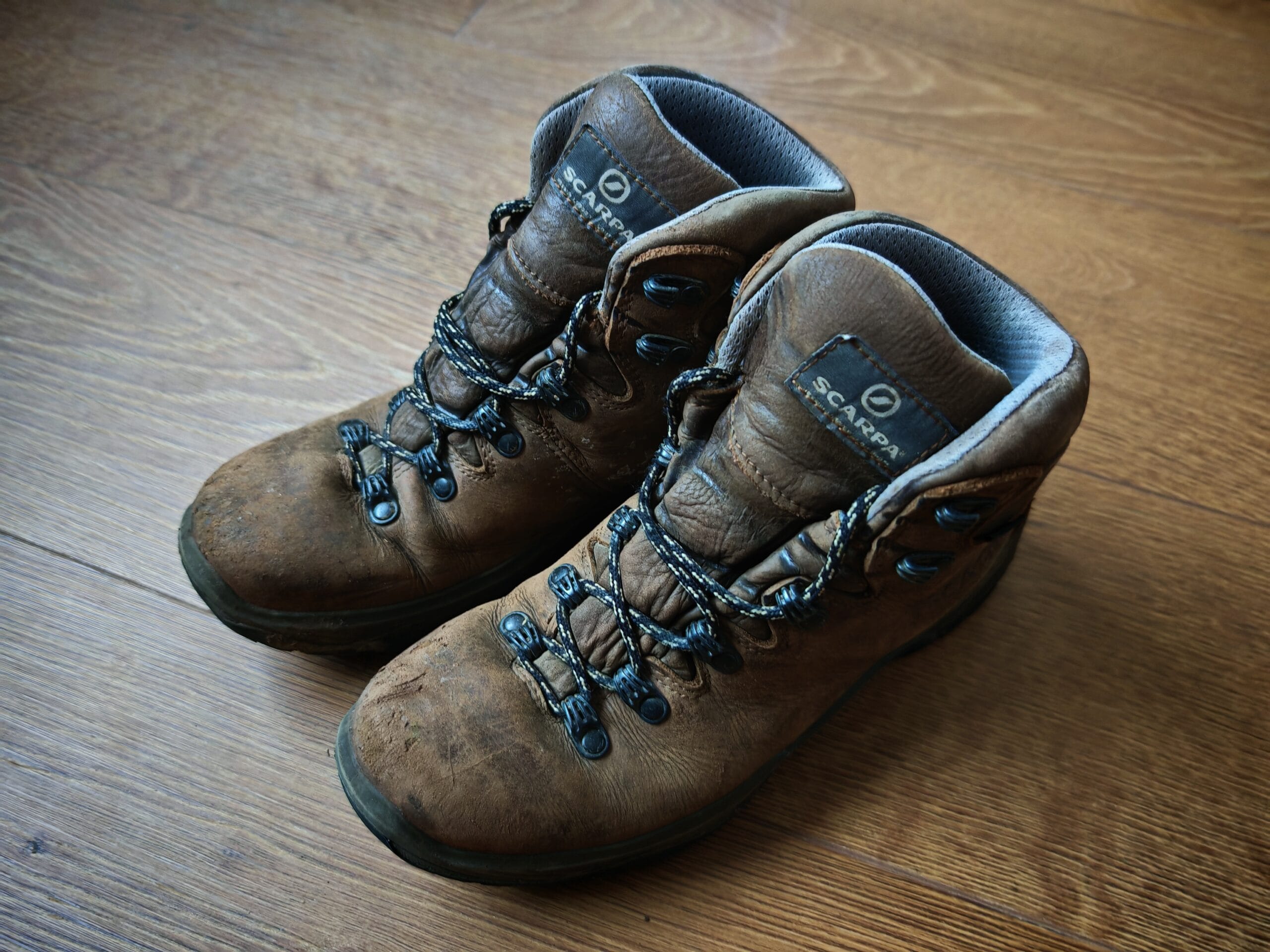
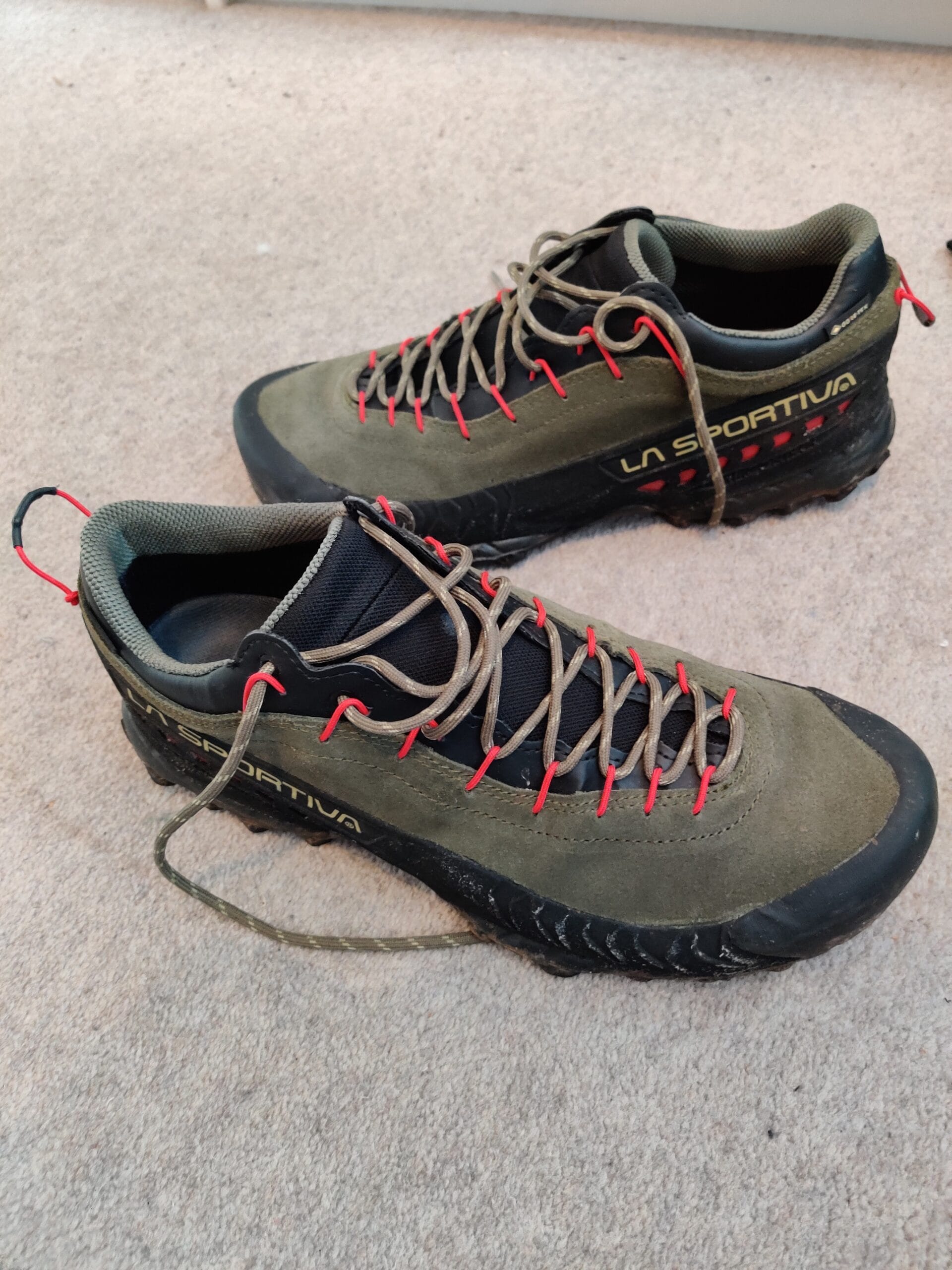
Bring clothes, poles and proper footwear. It might be warm in Zermatt village, but at 3,260 metres the temperature drops significantly, especially if there’s wind. Bring a waterproof jacket, a warm mid-layer, and make sure your base layer wicks moisture away from your skin. Proper broken-in hiking boots, approach shoes or trail running shoes are needed for the technical aspects of the Hornli Ridge. Check out my Hiking Gear List for the best shoes and clothes to bring.
Hydrate and snack. The altitude will make you tire faster than you expect. Carry at least 2 litres of water during summer and pack some high-energy snacks — nuts, bars, fruit. You can refuel properly at the hut even if it’s expensive.
Get a Swiss Half-Fare Card. If you’re in Switzerland for more than a day or two, this is a no-brainer. It costs CHF 120 and gives you 50% off trains, buses, and many cable cars for a month. The cable car savings alone will cover a big chunk of that cost.
What to pack?
For this Zermatt hiking trip, we used the trusted Hiking Packing List for the main items, then added in some casual wear for the evenings and Zürich. The weather was forecast to be warm, but as with every mountain resort, expect rain and storms at any point. So we had wet weather gear along with our lightweight summer hiking equipment, too, for the unpredictable Zermatt hikes and weather.
Zermatt Hiking Essentials
Summary
The Edelweiss Höhbalmen Trail Zermatt was one of the most rewarding hikes of the whole Zermatt trip. It is long, steep and demanding, but the payoff is huge: quiet trails, alpine meadows, wildflowers, Trift, Zmutt and some of the best Matterhorn views you can get without stepping onto a glacier or climbing route.
What makes the Höhbalmen Trail special is the way the Matterhorn view builds throughout the day. The early climb from Zermatt is tough, but once the trail opens out above Trift and reaches Höhbalmen, the mountain panorama becomes incredible. Official route descriptions highlight the view from Höhbalmen towards the Matterhorn, Breithorn, Liskamm and Monte Rosa massif, which is exactly why this hike feels so special.
This is not the best choice for a relaxed half-day walk. If you want something easier, the Five Lakes Walk, Riffelsee or Gornergrat routes are better options. But if you want a proper mountain day that starts in town, avoids lift dependency and gives you a wilder side of Zermatt, the Edelweissweg / Höhbalmen loop is hard to beat.
For fit hikers with good weather, enough water and a full day available, this is one of the best Zermatt hiking trails near the Matterhorn. I would recommend starting early, checking trail conditions, and saving plenty of energy for the long descent back through Zmutt.
FAQs
Is the Edelweiss Höhbalmen Trail Zermatt difficult?
Yes, the Edelweiss Trail Zermatt is a demanding mountain hike. The official Zermatt route lists the Edelweiss path / Höhbalmen No. 30 as demanding, with around 20.1km distance and 1,190m ascent/descent.
How long is the Höhbalmen Trail in Zermatt?
The official Höhbalmen / Edelweissweg route is around 20.1km, though recorded GPS routes may be longer depending on exact path choices. My route in the Zermatt hiking guide was around 22.4km.
Where does the Edelweissweg Zermatt route start?
The Edelweissweg / Höhbalmen route starts in Zermatt village and usually follows the route towards Edelweiss, Trift, Höhbalmen, Zmutt and back to Zermatt. Official Zermatt route details list the start and end point as Zermatt.
Is the Edelweiss Trail good for Matterhorn views?
Yes, the Edelweiss Trail is one of the best hikes in Zermatt for Matterhorn views. Official Zermatt route notes highlight the view from Höhbalmen towards the Matterhorn, including its north face and Zmutt ridge, plus surrounding peaks such as Breithorn, Liskamm and Monte Rosa.
When is the best time to hike the Edelweiss Trail Zermatt?
The best time to hike the Edelweiss Trail is usually summer to early autumn, when the higher trail is clear of snow and conditions are stable. Zermatt’s official route page showed the trail as closed at the time it was crawled, so always check the current Zermatt trail status before setting off.