
The Torres del Paine O Circuit is a world-class trek in the remote, wild and beautiful Patagonia. Whilst the Complete Torres del Paine O Circuit Guide explains the highlights and planning you’ll need for an incredible adventure, it doesn’t take you on the journey. This post comes from my daily journal and relives what it feels like to trek the famous and challenging Patagonia O Circuit.
This will cover the day-to-day itinerary for the quieter and rugged O Circuit stages before it joins the much busier and more popular W Trek for the second half of the epic 8-day trek through the Torres del Paine National Park. For many O trekkers, the quieter northern section between Serón, Dickson, and Los Perros to the dramatic crossing of John Gardner Pass and the glacier views above Grey Lake is precious. This itinerary shows exactly how I completed one of the world’s greatest backpacking routes and included the challenging O Circuit, not just the W Trek.
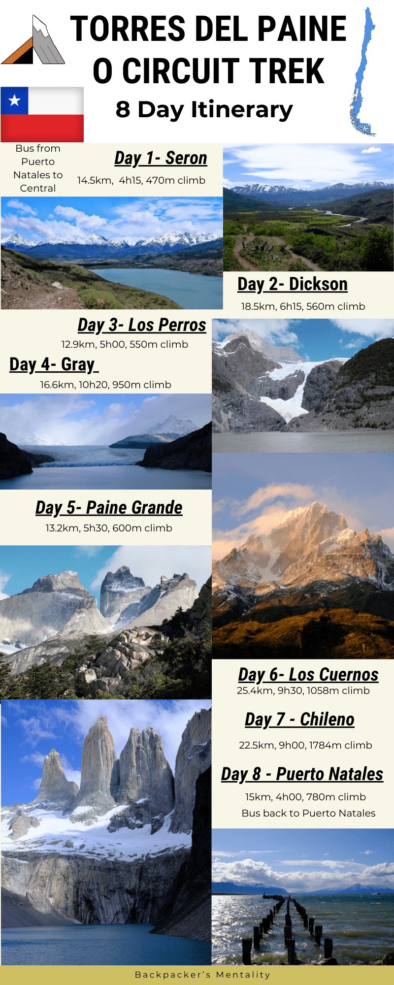
Torres Del Paine O Circuit: Overview
The Torres Del Paine O Circuit is one of the world’s most iconic multi-day treks. It has even been included on Lonely Planet‘s 10 Best Hikes in the World, especially for photographers. It offers a complete circumnavigation of the Cordillera del Paine (Paine Massif), combining the highlights of the shorter W Trek with remote backcountry trails, fewer crowds, and unparalleled views. The Torres del Paine O Circuit (also called Paine Massif Circuit) is more remote than the W, requiring full commitment, proper planning, and reservations at designated campsites or refugios.
The additional 34km adds 3 compulsory campsites (Seron, Dickson and Los Perros) and rewards trekkers with more untouched beauty and a chance to get off the grid with no internet for several days. This route is open from the 1st of November to April, compared to the W-Trek, which is open earlier and later in the season. Is the O Circuit worth it over the W Trek? If you have the time and fitness, then the Torres del Paine O Circuit gives you solitude, more rugged and varied landscapes and a true wilderness feeling away from the crowds.
The Patagonia O Circuit offers a very different experience from the popular W Trek. While both routes visit Torres del Paine’s most iconic landscapes, the O Circuit takes hikers deeper into the wilderness, providing a far greater sense of remoteness and adventure. Whether you’re planning your own O Trek Patagonia adventure or simply want to understand how the route unfolds, this day-by-day itinerary will help you visualise every stage of the journey.
Torres Del Paine O Circuit
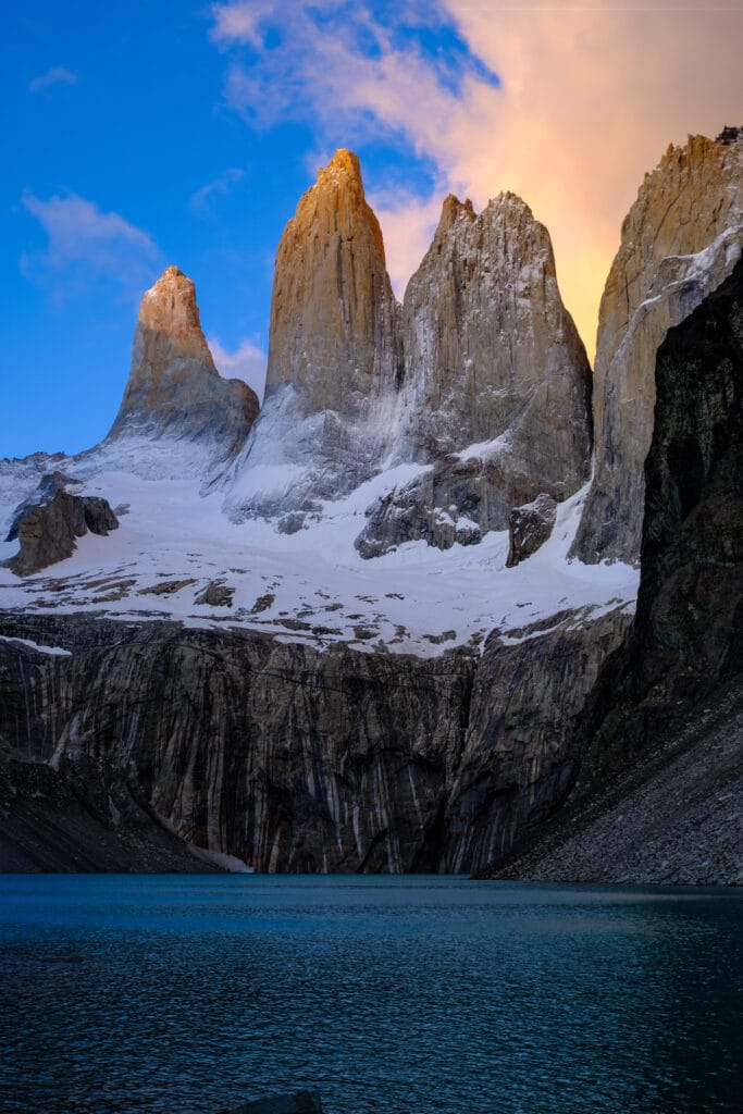
Patagonia O Circuit Itinerary
Torres del Paine O Circuit Planning
Before diving into the day-by-day itinerary, it’s worth spending some time planning your Patagonia O Circuit adventure properly. Unlike shorter treks, the Torres del Paine O Circuit requires advance campsite reservations, careful packing, and a good understanding of Patagonia’s famously unpredictable weather.
The route is typically completed over 7–9 days, travelling counter-clockwise around the Paine Massif. Most hikers begin near Central before following the quieter northern valleys through Serón, Dickson, and Los Perros, eventually crossing the spectacular John Gardner Pass before joining the busier W Trek section of the park.
One of the biggest challenges is securing accommodation. Campsites and refugios often sell out months in advance during the peak trekking season between November and March, so it’s essential to book early. You’ll also need to decide whether to carry all of your own camping equipment or take advantage of the refugio network and equipment rental options available throughout the park. And work out whether to outsource catering or to carry food for each day.
Weather can be equally important as logistics. Patagonia is famous for experiencing four seasons in a single day, with strong winds, rain, sunshine, and even snow all possible within a few hours. Packing appropriately can make the difference between an unforgettable adventure and a miserable one. I certainly experienced all the weather types alongside the strong winds.
Gear I used on the Torres del Paine O Circuit
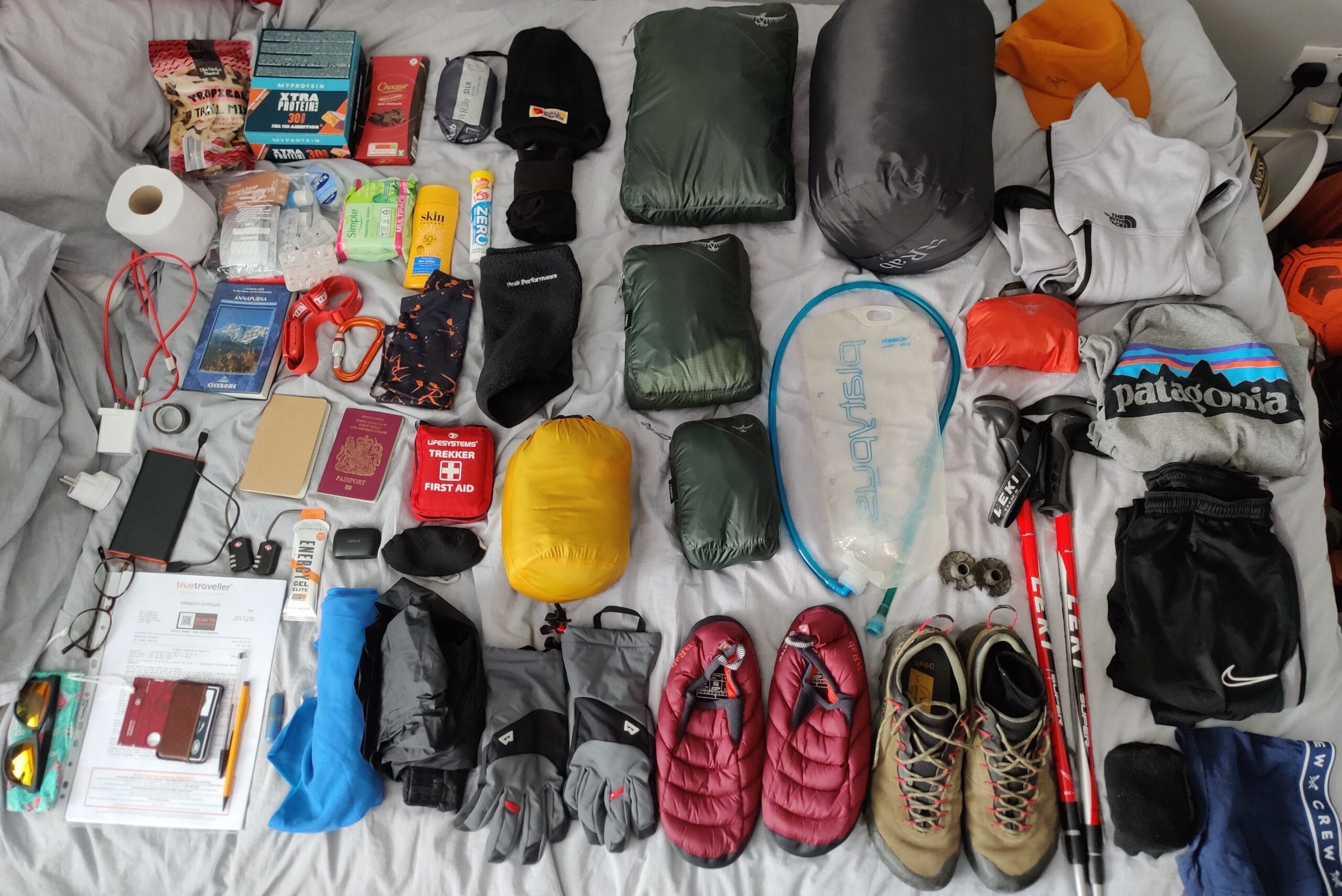
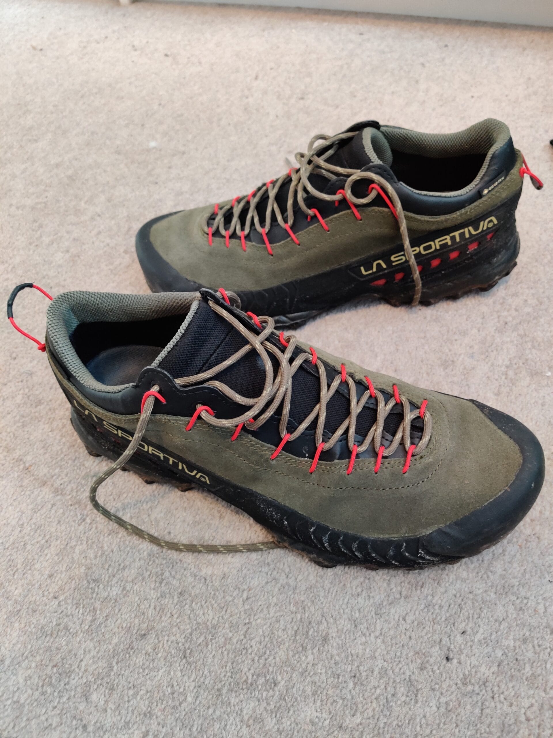
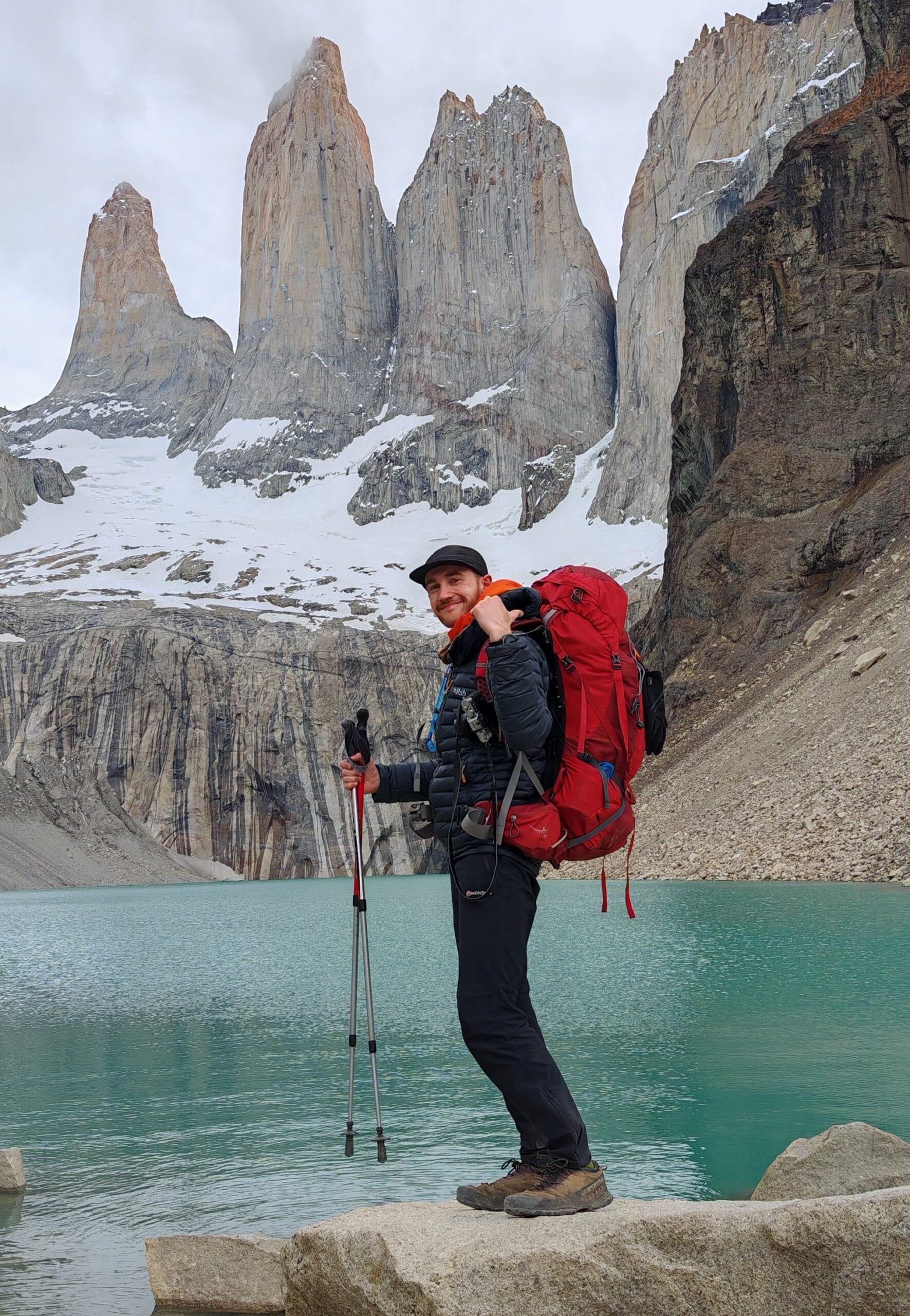
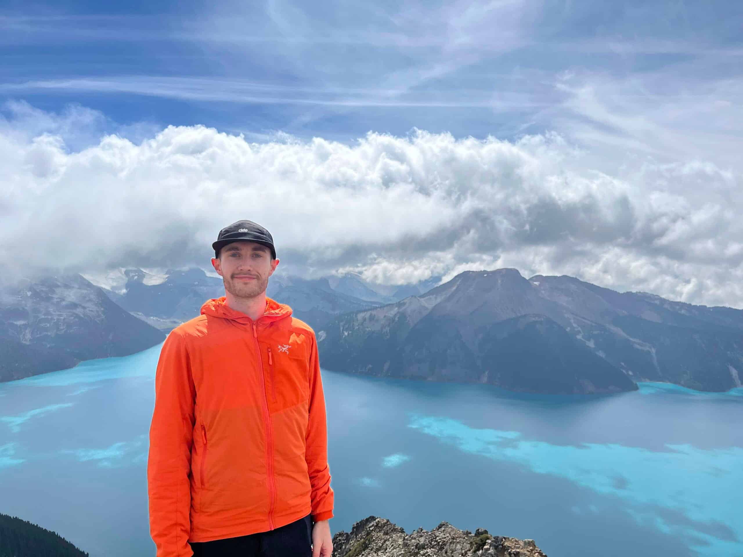
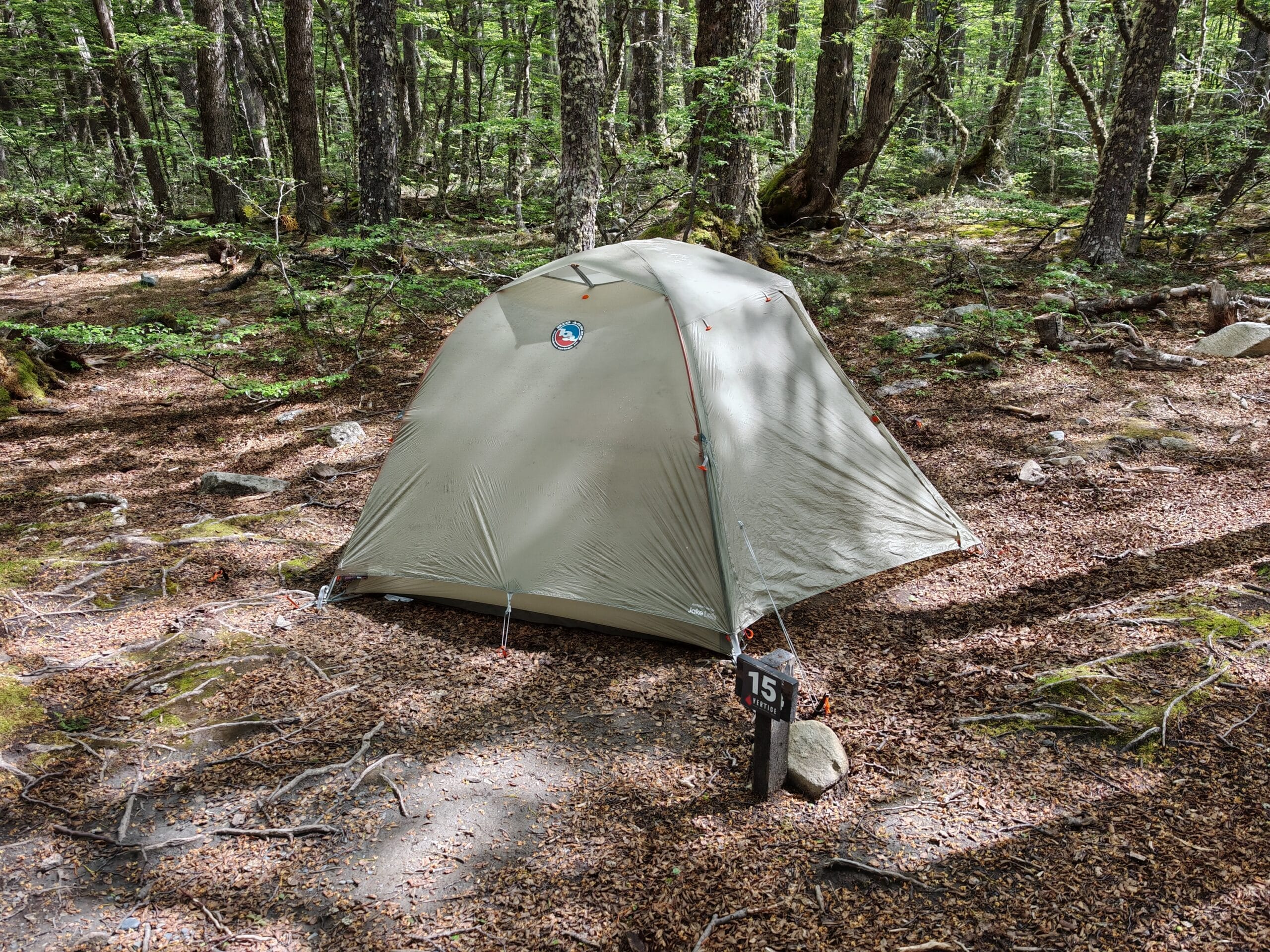
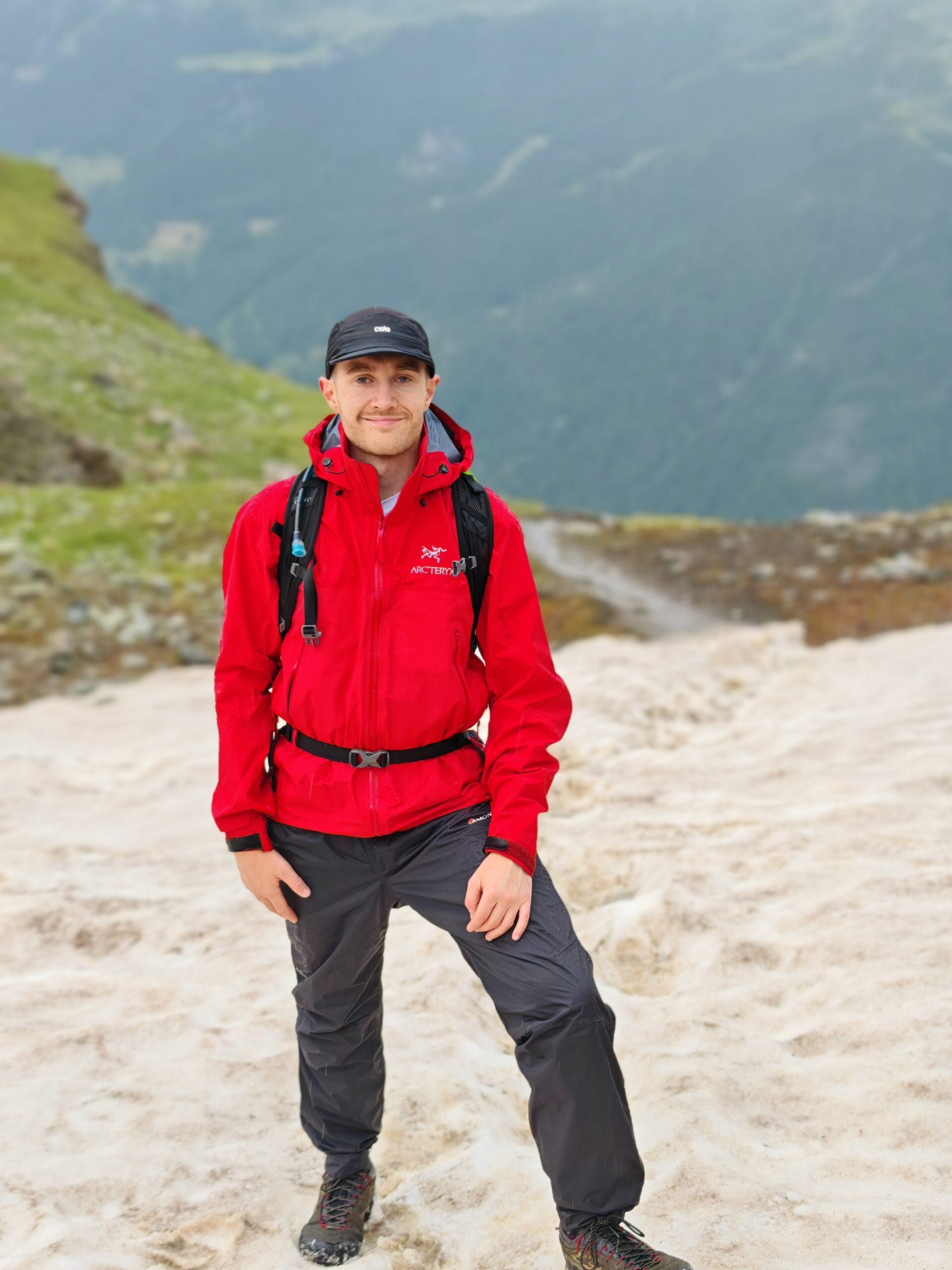
For detailed information on campsite bookings, transport, packing lists, food, budgets, maps, and everything else you’ll need before starting the trek, be sure to read my complete planning guide:
Need Help Planning the Patagonia O Circuit?
This itinerary focuses on the day-by-day experience of hiking the Patagonia O Circuit, but successful planning starts long before you reach the trailhead. Learn how to book campsites, choose refugios, pack for Patagonia’s unpredictable weather, organise transport, and prepare for one of the world’s greatest trekking adventures.
Read the Complete O Circuit Guide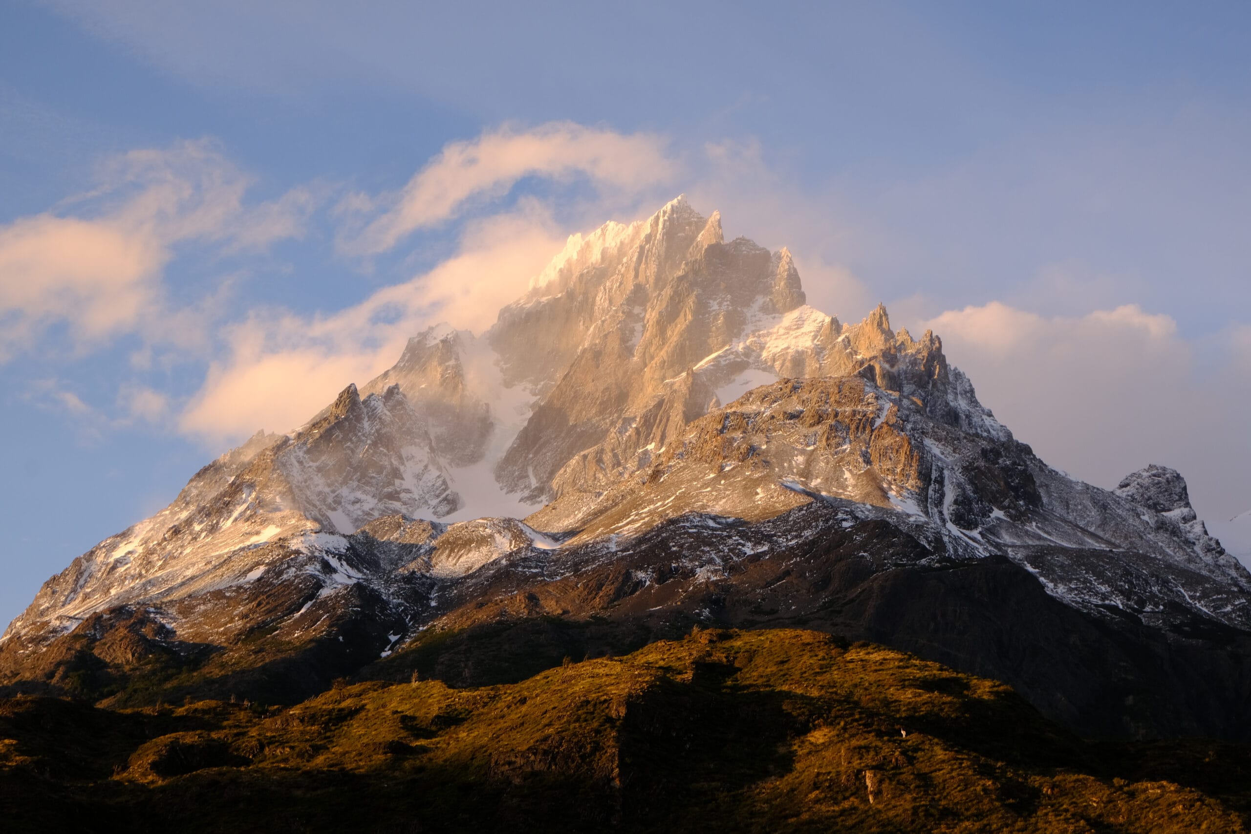
Torres del Paine O Circuit Day 1
Puerto Natales
The day starts bright and early in the Last Hope Hostel with an included breakfast and some last-minute packing. It’s a 15-20 minute walk over to the Puerto Natales (Rodoviario) Bus terminal with a warm uphill whilst carrying the Osprey Trekking Pack. I arrived 20 mins earlier for the 7:00 am departure with Bus Sur and strategically chose a seat on the left side for the best views en route to the Torres del Paine National Paine. My backpack was locked away, and I kept my valuables on board in my collapsible dry stuff sack.
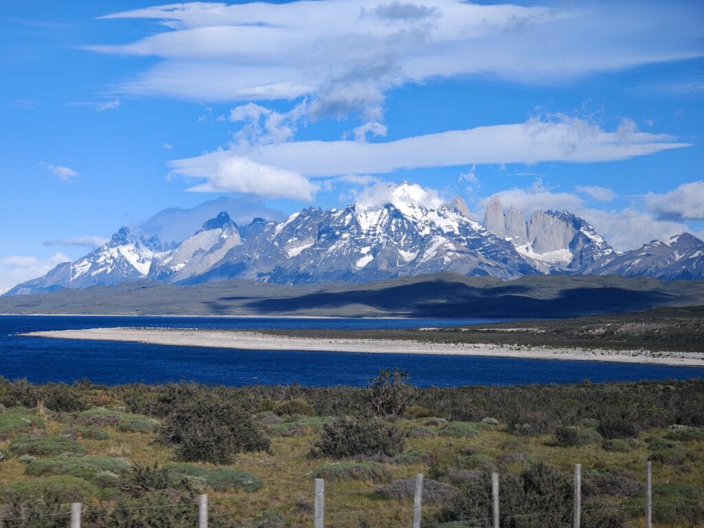
It’s around a 2hour bus ride from Puerto Natales to the National Park Entrance at Amarga, where the bus journey finishes. The road becomes dusty as the Torres del Paine Massif appears in the distance, building the excitement to start the O Circuit. After showing your Park Entrance pass, grab a quick snap from the viewpoint and then join the queue for the shuttle to Central. It’s a short 10-minute ride over towards the start of an epic adventure.
Central – O Circuit Trek Start
After flying to Santiago, then down to Patagonia in Puerto Natales before finally riding a bus to the Park, it’s time to start the Torres del Paine O Circuit. At Central, there is a shop, cafe and toilets, which is ideal to repack things and get ready to start trekking. Once the Backpack and shoes are ready, it’s time to check the AllTrails map and hit the O Circuit trails towards Seron. The path slowly rises up with the famous Torres del Paine towers peaking over a closer hill, giving inspiration for good views on Day 7.
Central to Serón
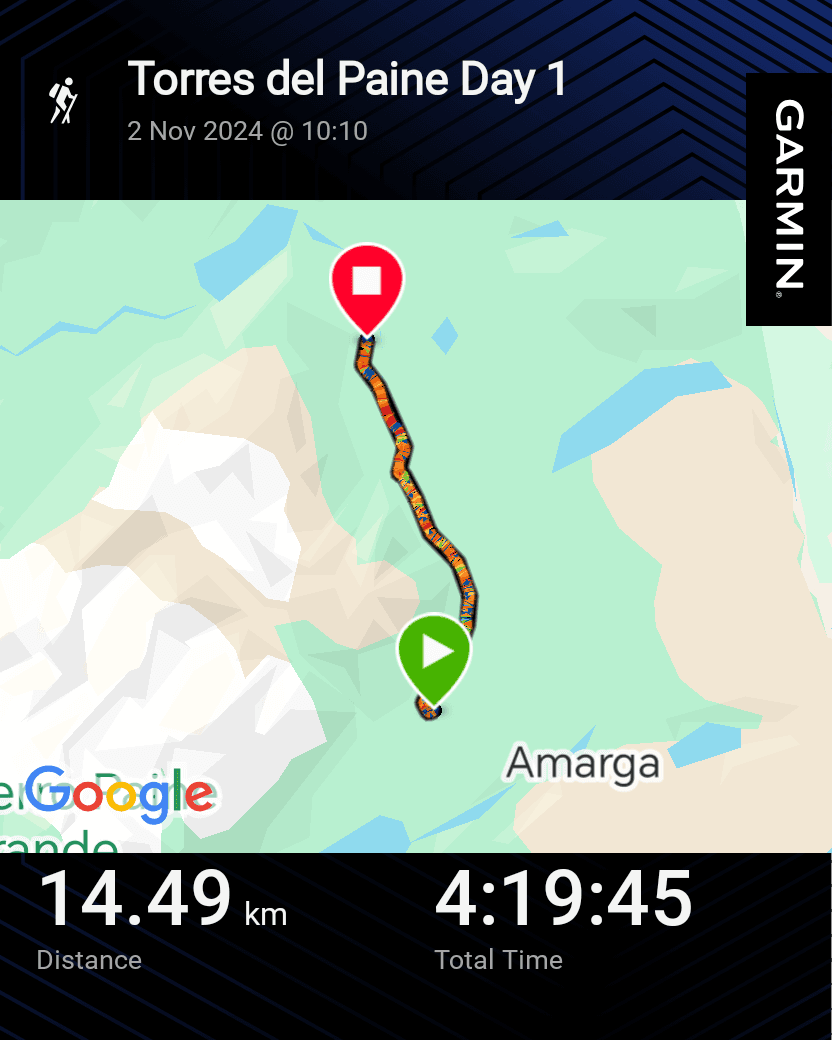
It felt amazing to finally start the O Circuit trekking after months of planning, preparation and training for this solo expedition into the wild and remote Patagonian mountains. The first stage from Central to Serón is a nice 14.5 km hike with less than 500m of climbing. This is important as it’s where the backpack is heaviest, with the most food to carry. I opted for the full board option at 5 out of 7 campsites to avoid carrying cooking equipment and food. Nowadays, I have a great lightweight camp cooking set-up, but also share the camping weight with Roisin. If I were to redo the W trek or O trek, then I would be fully self-supported and independent.
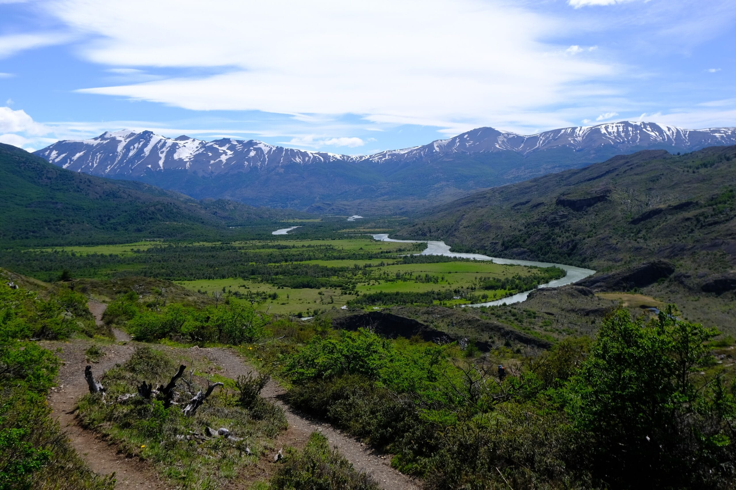
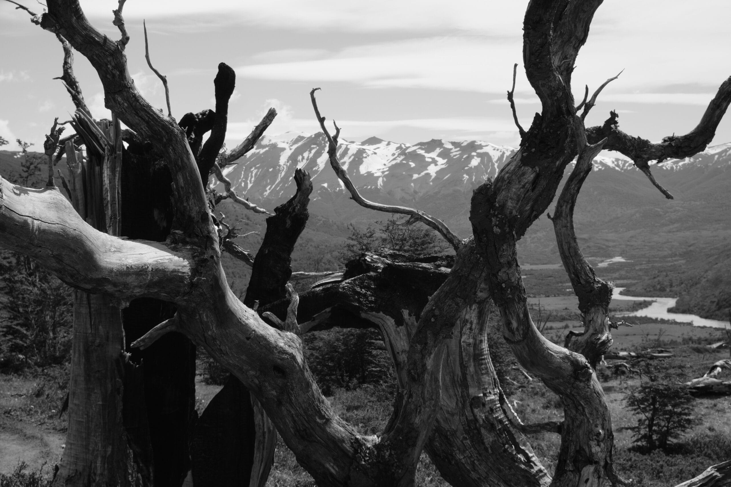
It felt freeing to be on the trail alone, taking my time to soak in the first views of the Patagonian landscape. I wasn’t in a rush to get to Serón, as I would have plenty of time to relax once there and the trekking for the stage was over. The route was surprisingly muddy and waterlogged in places, but this was worth it when the views opened up of mountain peaks, winding rivers and open fields full of wild horses. The first stage wasn’t expected to be the most exciting, but it was a lovely introduction to Torres del Paine before the next few days towards the challenging John Gardner Pass on Day 4.
Serón
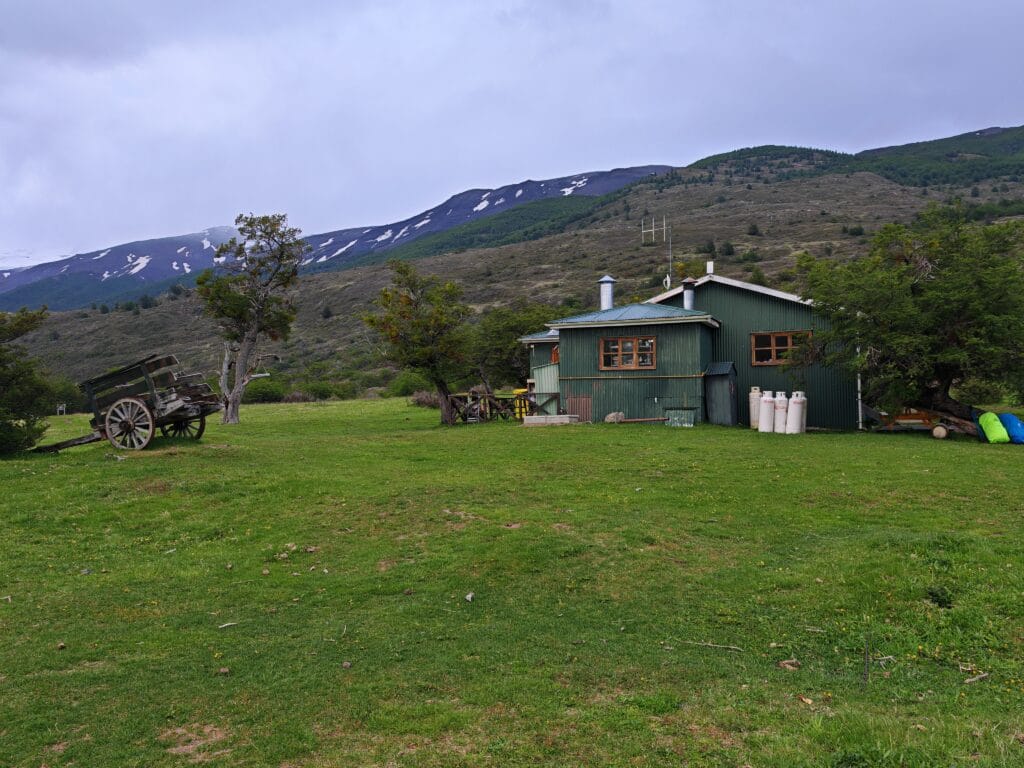
The legs felt fresh on the easy dusty tracks, and I arrived at Serón camp in the middle of the afternoon, where there wasn’t too much wind or sun. After registering at the camp hut, there were 5 or so other tents set up in the field, so I scouted a good spot to pitch my Big Agnes Copper Spur HV UL2 tent. When booking my campsites and catering options via TorresHike, it wasn’t clear whether there was a restaurant open.
So I didn’t risk it and bought my own meal, where I used hot water from the hut to make a dehydrated meal dinner. There is internet at Seron, and this is the last campsite before Grey at the end of Day 4; I mean, this is backcountry Patagonia, so don’t expect to be online.
And for me, this was a key selling point for the Patagonia O Circuit, to have the chance to disconnect from society and be present in beautiful nature, alongside the challenging physical and mental aspects of one of the world’s best treks. I didn’t socialise much on the 1st day as I was finding my feet with my new camping equipment. There is hot water in the shower block, which is something not to take for granted in Patagonia. Afterwards, I took the time to journal, read and do some photography near the campsite before winding down to gain as much rest as possible.
Torres del Paine O Circuit Day 2
Serón to Dickson
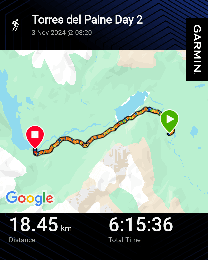
I woke up feeling remarkably refreshed considering I was sleeping in a tent, but my ultralight Sea to Summit sleeping pad and pillow were great additions to my Rab 4-season sleeping bag to get a quality rest. I half enjoyed an overnight oats mix before packing up camp and hitting the trail before my other O trekkers began their day’s hiking. The start of stage 2 was alongside the Paine River before the climbing started.
Lago Paine
As the name suggests, the O Circuit follows an anti-clockwise loop, so after Serón, the path goes northeast before turning the corner to the hidden and unspoilt northern backcountry of Torres del Paine National Park. Before reaching the reward, there is a steep rocky hill to steadily climb, following the steep switchbacks. It’s not just the gradient to tackle, but the ferocious winds push you off balance at this mountain col. If the view back towards Serón along the river is special, then just wait 1 minute. My breath was taken away when I turned the corner and the full view of Lago Paine and the magical snow-capped peaks unveiled themselves.
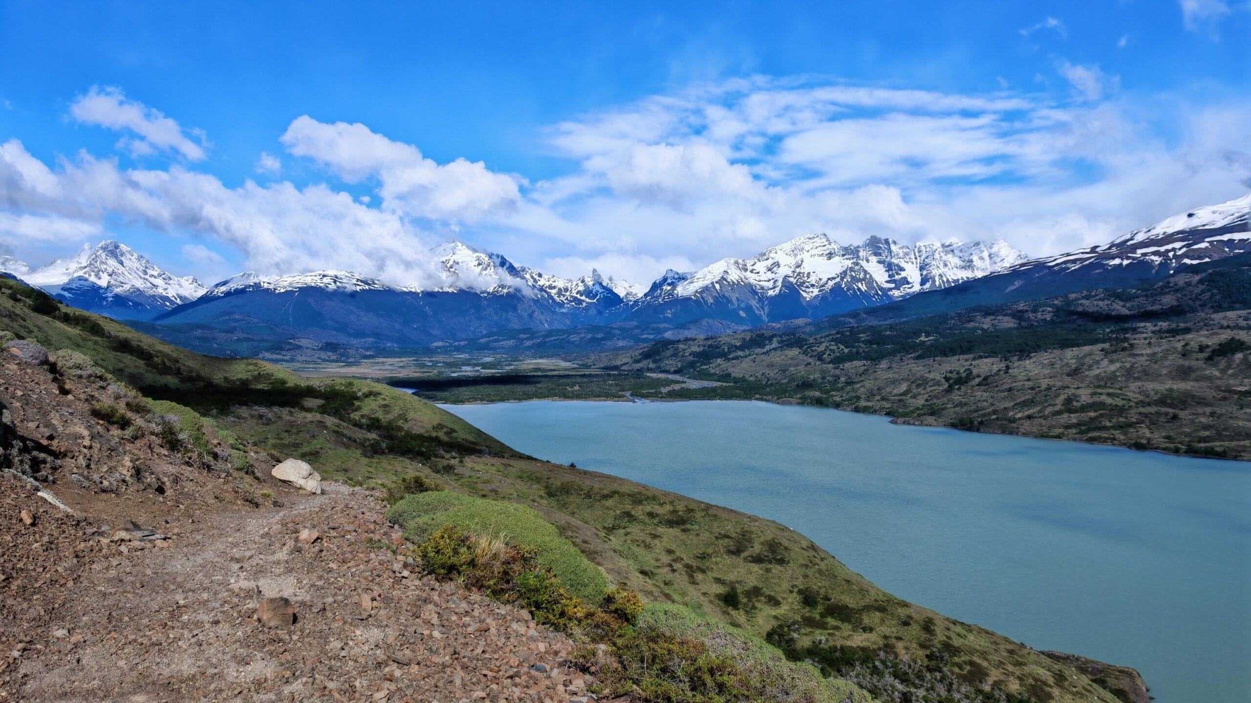
Unfortunately, the images never do the reality justice! The path along the mountainside descends whilst coasting above the blue icy waters below. I couldn’t keep my eyes off the mountains, lake and greenery, which was ideal for photographic opportunities. There were some high-level clouds, but overall it was clear and pleasant conditions for trekking. On the 2nd day, it was much easier to meet and talk with other O Circuit trekkers for photographs or during breaks.
This was nice for a solo traveller like myself to have a mix of friendly encounters and solitude. The trail passes via Coirón Ranger Station, where water can be refilled and is a nice spot to relax. I didn’t exactly have lunch (the issue of no full board at Seron) but enough high-energy snacks to keep fuelled,
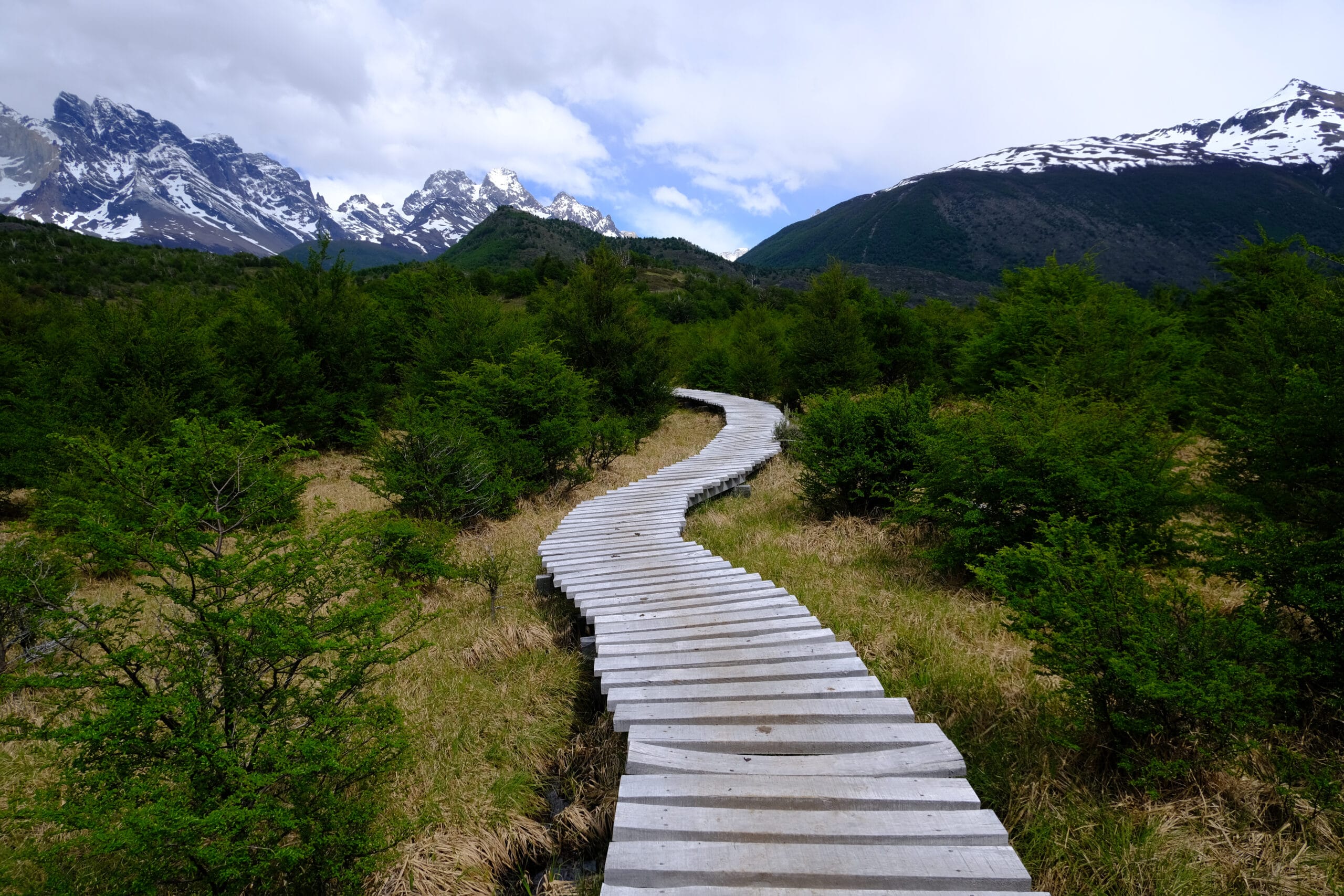
The mountains get closer as I followed the path through flower meadows and past the lake. As expected, the weather can change in a minute, and waterproof jackets and rain covers were quickly put on as a rain storm passed overhead. It felt like as soon as I had put them on, the heavy rain was over and I was overheating, so time to strip back down. After enjoying the wooden boardwalks over the marshy terrain, Dickson Camp wasn’t too far away. The rear of the Towers could be seen south, and it’s always an exciting moment to see the iconic granite Towers.
Dickson Camp
To reach Dickson Campsite, there is one last climb before finally entering the fields to check in. I met a lovely older American Couple at the viewpoint over Dickson Lake with Cerro Ohnet and distant glaciers in Argentina in sight. We exchanged photos and talked our way into the campsite. Given its backcountry location, there was no WiFi, but there was hot water for a shower after a 6-hour day’s trekking. There is a little kiosk for snacks and then a separate hut for the restaurant where I’d be eating later.
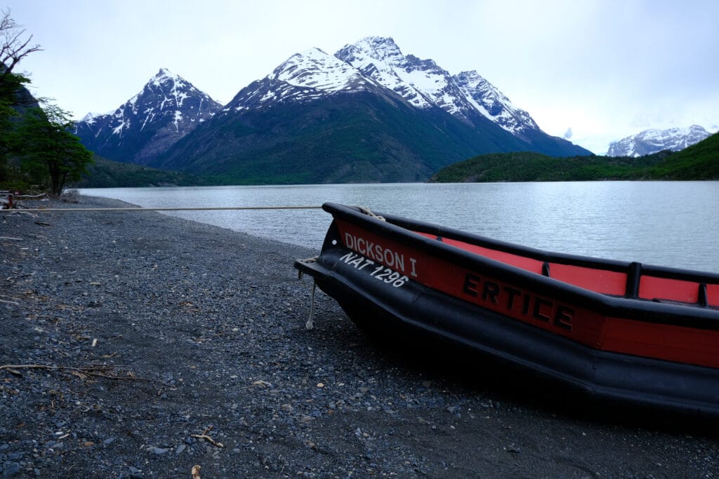
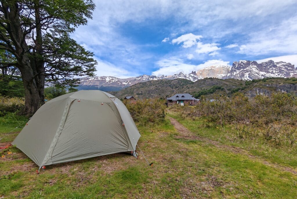
Luckily, I was faster than most trekkers so managed to select a good spot to pitch up the tent with stunning views of Tridente Hill and Cabeza del Indio Hill. I had a few hours to kill before dinner, so after a shower, I took a peaceful walk along the stony shores of Dickson Lake. It was quiet with not many other people exploring from camp, so I reflected and took in the stunning lakeshore views. Without internet, it was great to spend time journaling and document the journey as well as read Nims Purja’s Beyond Possible book. My tent and sleeping gear were all set up before I wandered over for the 3-course set dinner at 6pm.
Trekking for most of the day definitely builds up the appetite, so I hungrily devoured the soup and bread to start with. I didn’t realise there were vegetarian options available, so I enjoyed a rare break and had meat and mash to refuel before a sweet little pot. The tables were shared with a mix of cultures and languages in the hut, and we all knew there were no dining options at Los Perros on Day 3. We shuffled out so the 2nd sitting at 8pm could swap into the dining lodge, so I retired to my tent and read my book before sleeping.
Torres del Paine O Circuit Day 3
Dickson to Los Perros
Dickson Trail
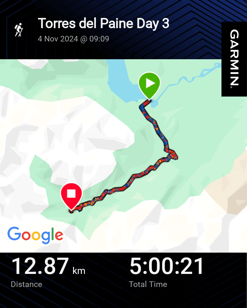
Day 3 started with breakfast at Dickson Camp, which was very filling for the trek to Los Perros. I also picked up my lunch box consisting of a burger/sandwich, trail mix and fruit so healthy and great for hiking! I filled up my water bladder, then returned to camp to pack up my tent and repack my Osprey Backpack. The trekking itself started with a forest trail for the first time on the O Circuit. As per usual, most trekkers left camp around 8am-10am depending on the length of the day ahead. Even taking a casual pace, the 5-6 hours would mean arriving at Los Perros in the middle of the afternoon.
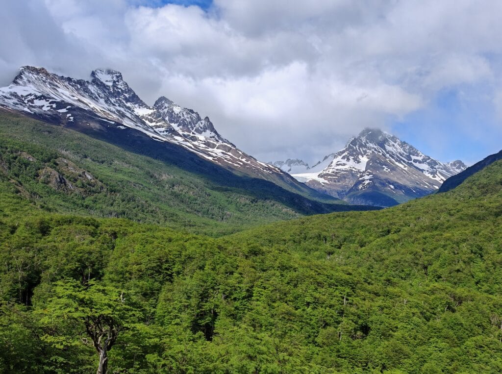
It was pleasant to have some shade and cover in the trees during the morning hilly climb. The sunlight burst through the canopy and hid the distant mountains the O Circuit would head towards. The first viewpoint was Mirador Valle de Los Perros, where Los Gemelos Hill and Blanco Sur Hill can be seen above Los Perros Glacier. The path then descends from the lookout and crosses a stream where the path winds next to the waters in the valley.
Los Perros
The trek crosses the river and slowly climbs up towards Los Perros Glacier with steep moraine banks to scramble up for the best view. The overhanging Glacier is stunning and one of the highlights of the Northern section of the Patagonia O Circuit. The winds increase in the valley bottom, so keep your hats on! From the lookout, it’s a short walk over to the basic and secluded Los Perros campsite.
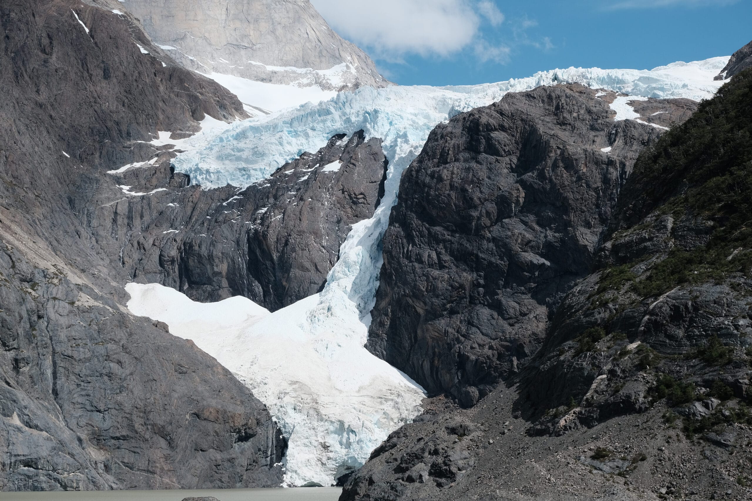
Check-in is simple given the lack of internet, showers or even hot water. There’s no road or infrastructure in this remote wilderness, and this is the furthest trekkers are from civilisation. I chose a free space to pitch my tent and went for an explore back to the Glacier.
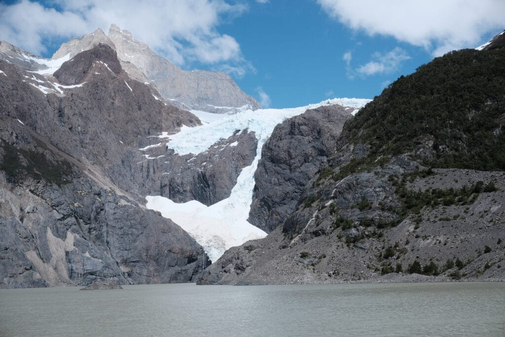
I easily spent an hour admiring Los Perros Glacier and the lake below, taking numerous photographs. As the clouds rolled in, I started to cool off, so I went back to the campsite and started my plan to eat food. I was lucky to meet Henry and Christina at the campsite, who were Australian and kindly let me boil some water on their stove to then eat my 2nd dehydrated meal. It was the first time I sat and started socialising more with my fellow trekkers, which reminded me about my love of trekking and sharing travel stories. After dinner, tea and chatting, we all called it a night before the early start for John Gardner Pass on Day 4.
Torres del Paine O Circuit Day 4
Los Perros to Grey via John Gardner Pass
Los Perros Camp
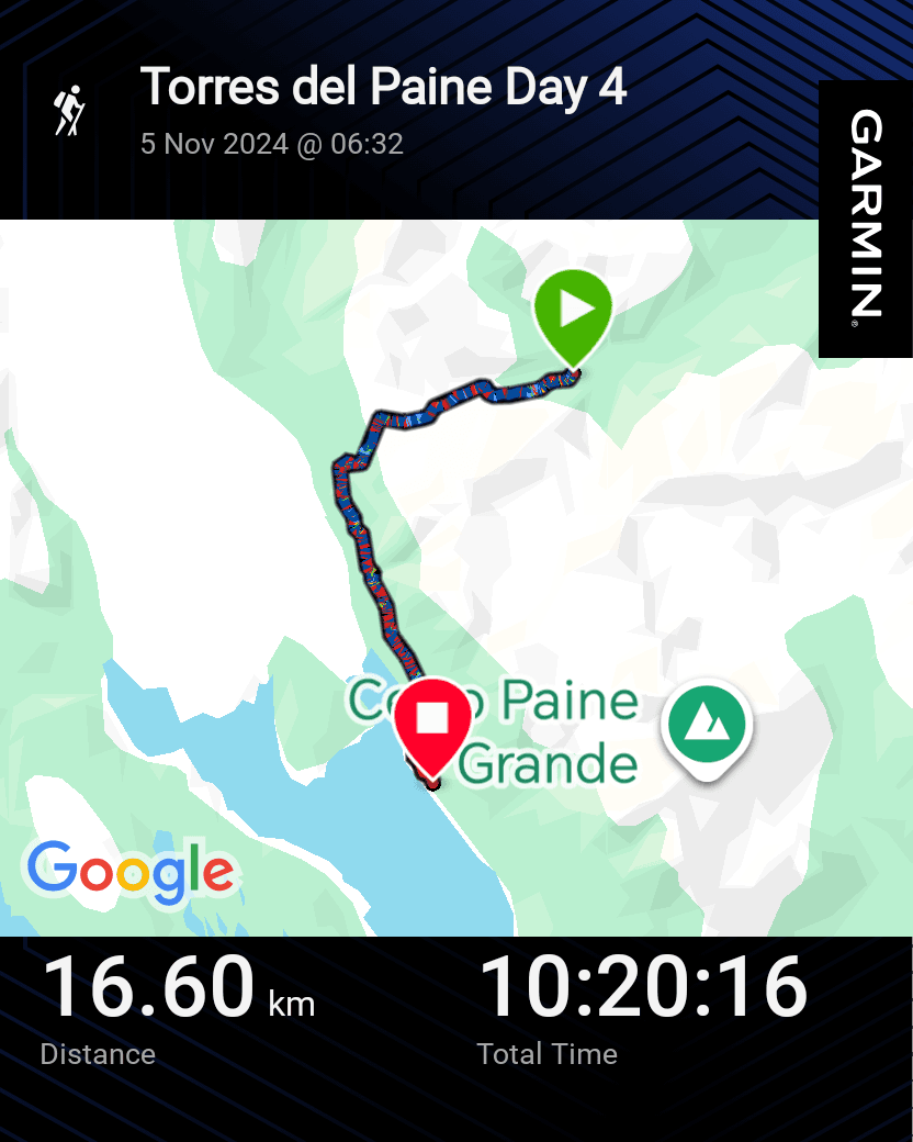
Day 4 of the O Circuit tackles the highest elevation on the trek, crossing the John Gardner Pass at 1200m. Stage 4 marks the transition from the remote northern section of Torres del Paine to the glacier-filled western valleys. The first panoramic view of Grey Glacier is one of the most unforgettable moments on the trek and a reward that more than justifies the early start and long, hard 600m and 4km climb to start with. The view from the top is of the Southern Patagonian Icefield, which spans for miles and completely fills the valley below. It is one of the key differentiators between the O Circuit and W Trek, so was a viewpoint I was eager to see.
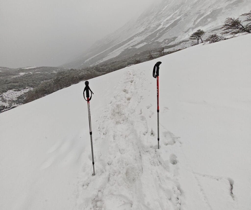
However, the unpredictably Patagonian weather had different plans. After 3 nice days of trekking in good temperatures, little rain or even wind, things got much more difficult! Overnight, a snowstorm had hit Los Perros Camp and John Gardner Pass, where I added many layers and down jackets to survive sleeping in -5°C. My bones felt frozen, so many layers were added, a stiff tent packed away, and then I set off. It seemed as though most of camp had already set off from Los Perros to avoid the stronger winds battering the Pass in the afternoon; therefore, I left Los Perros by 6:30. There is another very important reason to leave early that will become clear soon…
John Gardner Pass
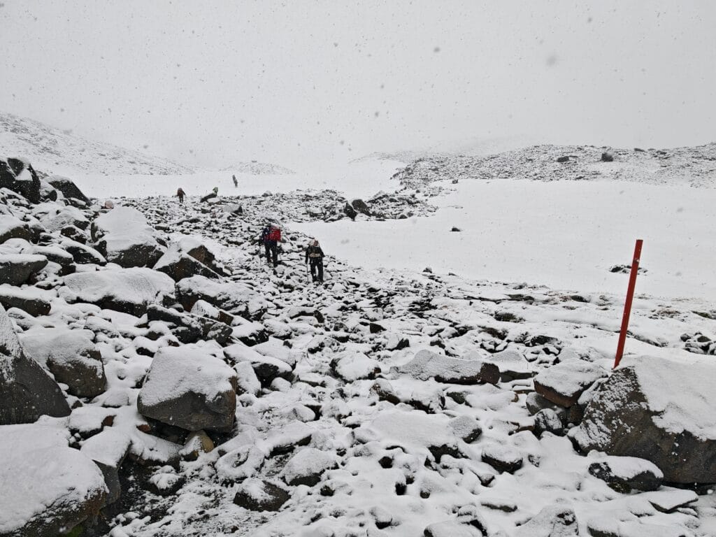
What started as a little wet trail through alpine trees soon turned into a snow hike. The 4km trek from Los Perros to John Gardner Pass had suddenly become dangerous. I hadn’t packed any crampons but had my poles and approach shoes to tackle this unexpected challenge. My fitness was good after the first 3 days, so I was climbing fast and getting ahead of a few trekking mates.
However, the navigation became tricky as I followed a faint trail over rocks and used the red markers. The snow was slippery on the steeper gradients and sapped the energy from my legs. All the trekkers helped each other with directions and checked on each other. I began hiking with the older American Couple up the steep switchbacks and made sure I had all my insulating and waterproof layers and covers on. I was very thankful for my Arc’teryx Beta AR jacket on this day!
I knew at this point there would be no magical view from the top of John Gardner Pass, which was a disappointment to say the least. The path was harder given the conditions, and my reward for arriving at the highest elevation on the Patagonia O Circuit was gale-force winds. It was pointless to stand around in freezing conditions being battered by the famous Patagonian wind, so I started down the incredibly steep slope. I thought the climb was dangerous, but the reality was shattered as I skidded down the mountain slope on several occasions.
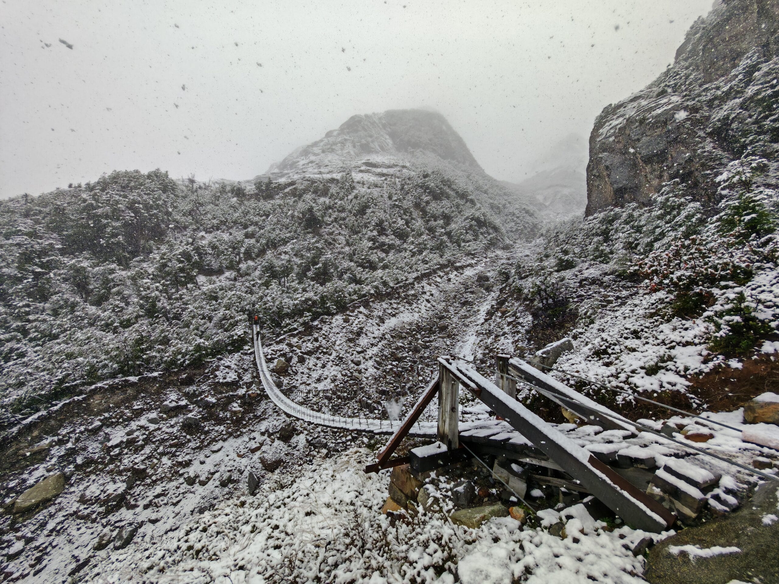
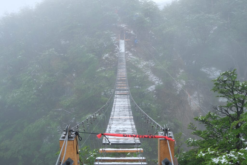
I caught up with Henry and Christina from the previous night, and we all had numerous falls on the icy trail down from the Pass. The confidence was bruised, but I was happy to have new friends for the company. We all stopped and sheltered from the snow at Paso Ranger Station with a long hike along the cloud-filled glacial valley to Grey Camp. The Circuit undulated along the mountainside, and we crossed the first of 3 Tibetan-style suspension bridges very carefully.
Zipline Crossing
Over the winter, one of the bridges was damaged, so the local Torres del Paine Rangers had arranged a zipline across the valley. We were warned before the trek about this on Day 4 and only applied to the Patagonia O Circuit, but the weather conditions now made this more precarious. I arrived there in the mid-afternoon after some power hiking and found a queue of over 10 other fellow O Trekkers. This resulted in standing still in the freezing cold rain and sleet whilst waiting for people to be harnessed up, ziplined over, and bags sent over as well. On average, it took around 5 minutes per person, so I was looking at an hour-long wait….
Whilst waiting patiently, I took the opportunity to chat with other solo hikers as we were all facing adversity trekking the mountains that day. Eventually, I made it under a temporary tarpaling canopy to get some shelter as the queue behind me now stretched to over 20 new people to wait. Finally, it was my time to put a helmet and harness on, get clipped in and fully send it off the cliff towards the other side. It was an adrenaline rush and great fun! I collected my Osprey Backpack and then started hiking to get warm again.
Grey
Slowly, the clouds started to unveil Grey Glacier and the edges of the vast Southern Patagonia Icefield despite hiking away from it. The trail was peaceful, with most people held up by the emergency zipline needed to safely get trekkers from John Gardner Pass to Grey Camp. I hiked back with a couple of German hikers who’d finished the W Trek and were exploring the trail towards Grey Glacier. After a long and knackering day hiking in terrible weather and terrain, I arrived at Grey Campsite but took a slight detour to the Grey Glacier Lookout to get the best view of the day.
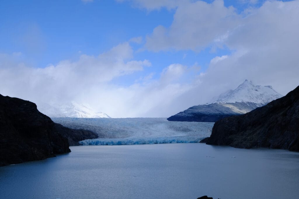
I finally went over to camp to register and then go find a quiet camp, which was tricky because Grey Camp was at the start/end of the much more popular W Trek. After a quick scout of camp, I found an empty spot in the trees for some coverage and quickly headed back to the hut for a much-needed hot shower. After trekking in snow, wind and rain, I was frozen, and slowly warmed up in the much-needed hot water. There were a few other Patagonia O Circuit Trekkers at Grey; however, it was getting darker, and some people had not entered camp just yet.
Grey Campsite
Suddenly, when walking around Camp, I saw 2 friends I met in Santiago (Emily and Jamie); it was such a coincidence after we spent a day in Santiago together, and they had completed the W Trek clockwise whilst I had trekked the north side on the O Circuit. We grabbed a table together for dinner and enjoyed some beers together before their last day in Torres del Paine National Park and Day 5 towards Paine Grande. The Patagonia O Circuit section had officially joined the W Trek and would change dramatically from the solitude of the first 4 days.
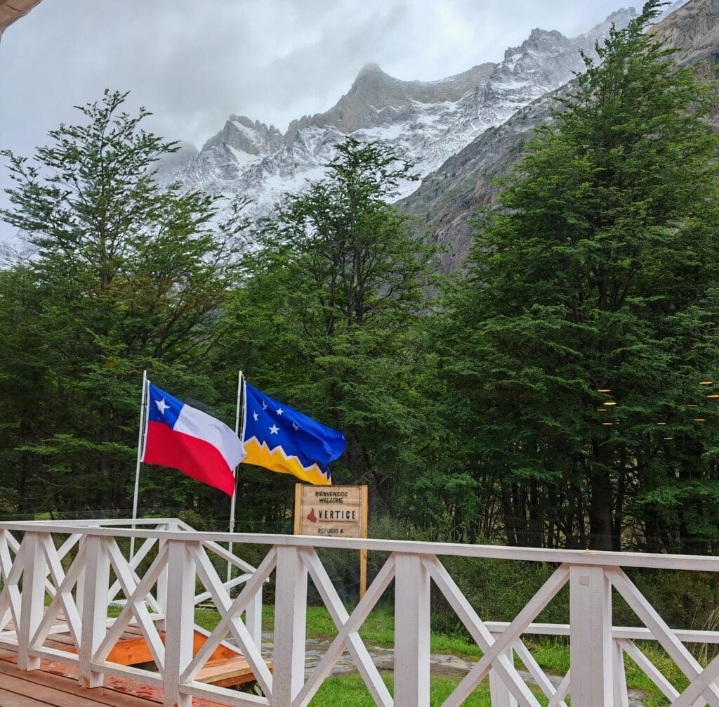
Why I mentioned it was important to hike fast on Day 4 came apparent the next morning when news trickled through from the zipline crossing. Some people arrvied at came around 10pm after crossing the zipline late in the afternoon and still trekking multiple hours in darkness to Grey. The Guides stayed late; however, there was a couple who arrived at the broken suspension bridge too late and had no way of crossing safely. They stayed the night in below-freezing temperatures, wrapped in their layers to survive with no food. Thankfully, they survived the night and were collected the next morning.
The Patagonia O Circuit does have its fatal risks, with news in 2025 about a very similar snowstorm where 5 people lost their lives on November 17th, a few weeks later in the year than I trekked in 2024. They trekked into a deadly snow blizzard with over 100mph winds, low visibility, freezing temperatures and deep snow, which made the John Gardner Pass impassable. This news hit home as the conditions I experienced were not as bad, but it shows how close an emergency can be and the unpredictability of remote mountains. This is a rarity, but with any remote trek, it’s best to read the latest weather reports and prepare to turn back to camp if needed.
The Ultimate Guide to the Torres del Paine O Circuit
Now that you’ve seen exactly how the Patagonia O Circuit unfolds day by day, it’s time to dive deeper into the planning. Learn everything you need to know about permits, campsite reservations, refugios, transport, packing lists, food, budgets, weather, and how to prepare for one of the world’s greatest trekking adventures.
Read the Complete O Circuit Guide
Plan smarter
with TrekMind
Most trek planning tools are built for tourists. I built TrekMind because nothing else let me properly compare routes before committing — interactive 3D globe, 100+ routes, full itineraries, and elevation data for the world’s best trails.
Torres del Paine O Circuit Map
Summary
The Patagonia O Circuit remains one of the finest long-distance treks anywhere in the world. While the famous towers and glacier viewpoints are undoubtedly spectacular, it is the journey itself that leaves the strongest impression. The remote campsites, changing landscapes, challenging mountain passes, and sense of isolation combine to create a true wilderness experience.
Following a structured Patagonia O Circuit itinerary makes planning significantly easier and helps set realistic expectations for each day’s distance, elevation, and hiking time. From the gentle opening stages through Serón and Dickson to the demanding climb over John Gardner Pass, every day offers something unique.
If you’re looking for a complete day-by-day breakdown of the Torres del Paine O Circuit, this itinerary should provide all the inspiration you need before tackling one of Patagonia’s most memorable adventures.
FAQs
How many days do you need for the Patagonia O Circuit?
Most hikers complete the Torres del Paine O Circuit in 7–9 days. An 8-day itinerary is one of the most popular options, providing enough time to enjoy the scenery while maintaining a comfortable pace.
Is the Patagonia O Circuit the same as the O Trek Patagonia?
Yes. The Torres del Paine O Circuit and O Trek Patagonia refer to the same multi-day trekking route that circles the Paine Massif within Torres del Paine National Park.
What is the hardest day on the Patagonia O Circuit?
The most challenging day is typically the climb from Los Perros to Grey via John Gardner Pass. This stage includes steep ascents, variable weather conditions, and some of the most dramatic glacier views on the entire route.
Is the Torres del Paine O Circuit harder than the W Trek?
Yes. The Torres del Paine O Circuit is significantly longer than the W Trek and requires more days, greater endurance, and the ability to carry backpacking gear over remote terrain.
Can beginners hike the Patagonia O Circuit?
Fit beginners can complete the Patagonia O Circuit, but it is best suited to hikers with previous multi-day trekking or backpacking experience due to the route length and changing weather conditions.
What is the best direction to hike the O Circuit?
All trekkers complete the Torres del Paine O Circuit counter-clockwise. This is the direction required by park regulations when crossing John Gardner Pass and is how virtually all itineraries are structured.
Do you need to book campsites on the Patagonia O Circuit?
Yes. Campsites and refugios along the O Circuit must be reserved in advance, particularly during the peak trekking season between November and March.
Is the Torres del Paine O Circuit worth it?
Absolutely. The combination of glaciers, mountain passes, remote campsites, wildlife, and world-class scenery makes the O Circuit one of the best multi-day treks in South America and a genuine bucket-list adventure.