The Dolomites are unlike other ranges in the Alpine region, and the idea of trekking through these jagged peaks fascinated me. These Italian pale rocky mountains make you feel like walking through a lunar landscape and offer stunning views, challenging hikes and exhilarating climbs. Renowned for climbing and the treks involved in doing Via Ferrata climbing along cables and ladders to cross the passes. I had heard previously of the famed Alta Via routes, but why did we choose Alta Via 4 over the more popular Alta Via 1 or 2?
Why Alta Via 4?
I was keen to do a European trek with 2 friends (Sam and Rachel) and explore the Dolomites. Especially the idea of doing a multi-day alpine hike, staying in mountain huts, had been on my bucket list for years. There are 6 Dolomites Alta Via routes going from North to South, each with its own challenges and history attached. Our first choice was Alta Via 1, which is the most popular trek over 120km long, but we found out quickly that reserving Rifugio (Mountain huts) bookings was difficult. For the second most popular route, Alta Via 2, we debated doing half of the 2-week itinerary (187km length) as I had budgeted 6 days of annual leave, but we preferred doing Alta Via 2 in full another time.
In the end, after reading In a Faraway Land’s Guide to Alta Via 4 (AV4 for short), I was captivated by the idea of seeing Tre Cime di Lavaredo, Cadini di Misurina, Mount Antelao and Lake Sorapiss. This sounded like the most challenging of the Alta Vias and involved exhilarating Via Ferrata. There was little information about AV4 out there, so I hope this guide detailing the journey gives helpful tips for planning your Alta Via trip! Check out the Best Highlights of Alta Via 4 in this shortened Blog Post with more useful tips and FAQs.
AV4 Stats
Total Length – 95km
Accumulated Ascent – 6271m
Accumulated Descent – 6564m
Number of days – 7
Total Time (Trekking) – 51hours 48mins
Start Point – Dobbaico / Toblach
End Point- Tai di Cadore
* Measured on my Garmin Venu 2 watch
Planning
Time of year
The best time to do Alta Via 4 is between the end of June to early September, as this is when the Rifugios are open. The high altitude trials have cleared of snow to make it safer when on the Via Ferrata. We did AV4 in the last week of July and had sunny weather on most days.
Rifugios
The hardest part of the planning by far was contacting the individual Rifugio to book accommodation. The tour companies selling the Alta Via 4 package would cost more than £2000 each, so we booked everything independently. The Rifugios offered bed-only or Half-Board options, which was useful with Rachel being Gluten intolerant and saved Sam and me carrying extra weight for food. On average across 6 Rifugios, Half Board in shared dormitory rooms cost £60. We enquired with all the Rifugios on the planned dates and then paid the deposits once all confirmed availability. After the Rifugios were confirmed, we could then finally book flights, buses and the Venice hostel.
Navigation
To help navigate through the Dolomites, I brought a Kompass Dolomiten no. 672 Map 3. We also used AllTrails and Google Maps to check the routes, but I would recommend a physical map.
Via Ferrata: For Beginners
1. What is Via Ferrata?
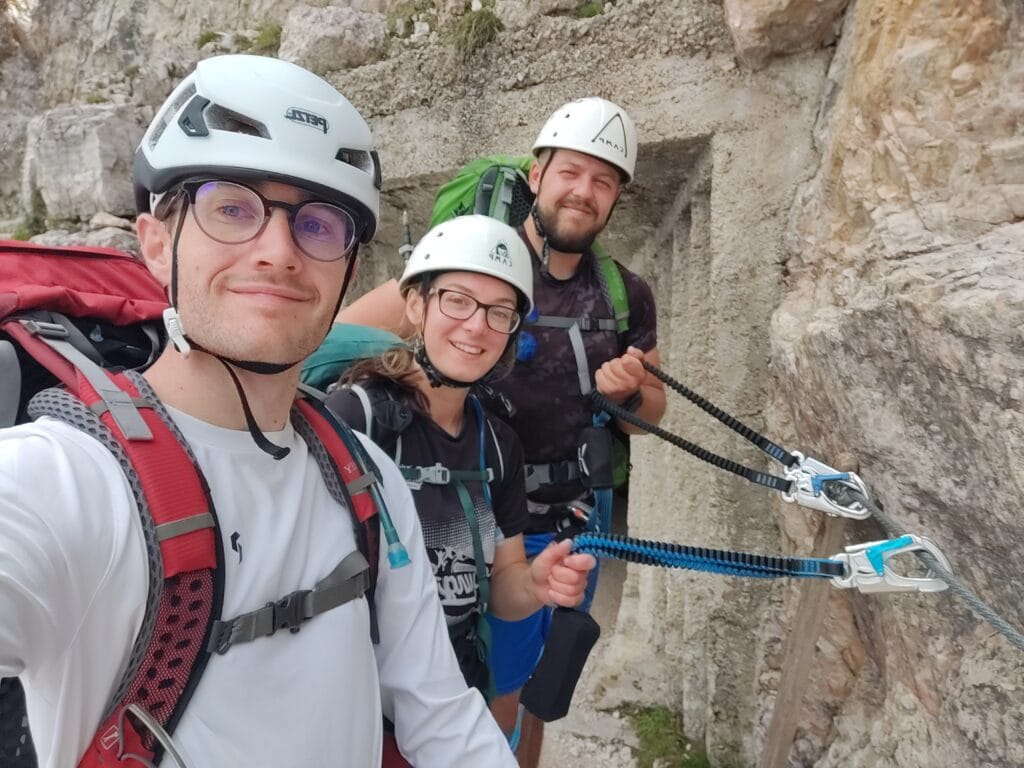
It translates as the “Iron Way” and these ladders, cables and stemples were first built by soldiers in World War 1. Fast forward 100 years, and its popularity has exploded! This assisted scrambling climbing hybrid allows you to safely hang off a mountain without needing rope and attachments like Traditional Rock Climbing.
2. Equipment
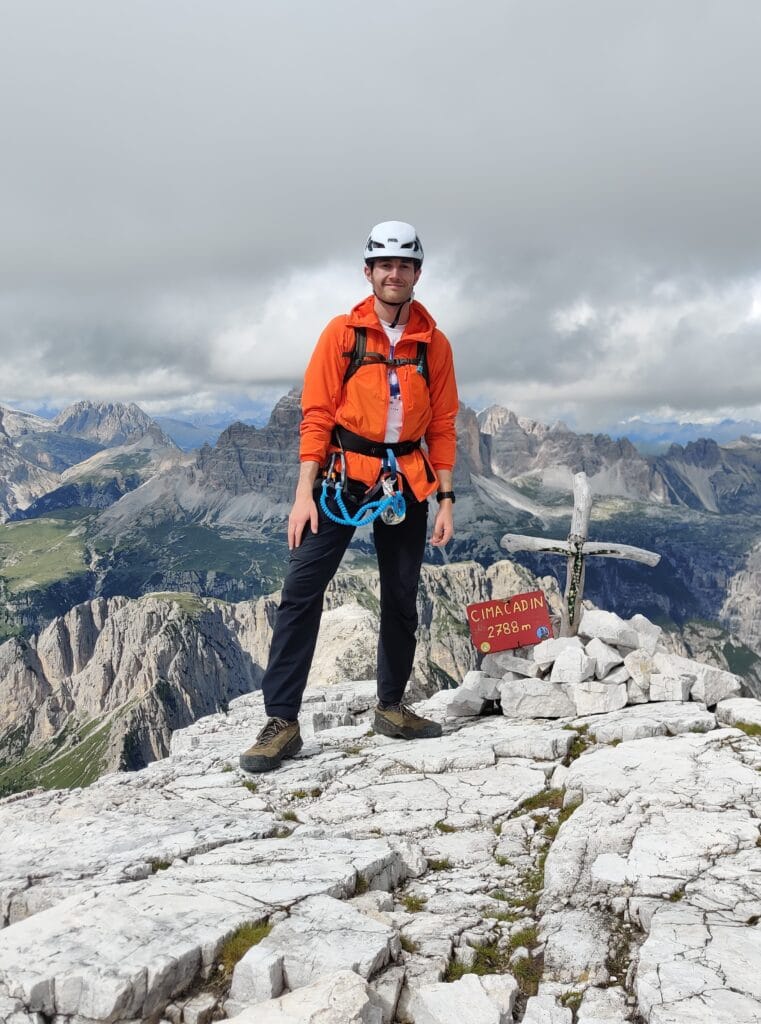
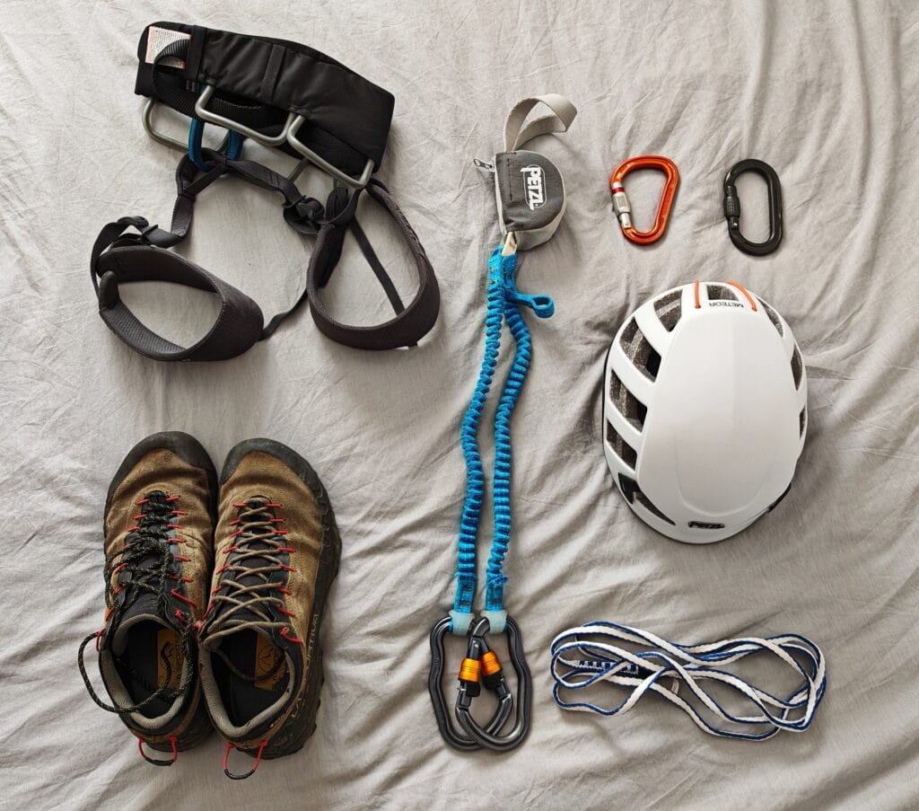
To do a Via Ferrata climb, you must have a harness, helmet and lanyard to safely ascend and descend the routes. I would also recommend another screw-gate hardness, like the Petzl Attache, to help clip on close to the cable when stationary. You don’t need any advanced climbing technique, but you should be sure-footed and have a head for heights. We self-navigated the Via Ferrata sections, and I found much enjoyment in leading these, but if you prefer support, then a Guide can be hired. I have seen climbing gloves be suggested, and I can understand why; they offer protection and grip on the cables, but we managed without them (I would be tempted next time though). A head torch is very helpful as some sections go subterranean and into tunnels, so light would be pretty essential to escape again!
3. Via Ferrata Technique
When using the Via Ferrata lanyard, the following technique is recommended. Attach the lanyard to your harness with a cow hitch knot. Next, use your fingers one-handed to open the carabiners. I learnt this technique before going to the Dolomites, and after a few goes, you’ll find it second nature. Attach BOTH carabiners to the cable and walk along, dragging them along the cable. At a metal screw, unclip the first carabiner and reclip it on the other side of the screw, then repeat this with the second carabiner. Ensure you always have 1 carabiner secured to the cable and use one hand to do the switch to reduce risk. It might sound tricky, but you’ll learn the skill quickly with practice on the trail!
4. Climbing Etiquette
There is some climbing etiquette to make sure you and your fellow climbers have a safe and enjoyable climb. When passing or overtaking someone, find a wide area and avoid doing it on ladders or metalwork. One person should wait, then the other person clips around them, half straddles them, and then brings the 2nd carabiner to clip back onto the cable. It’s a pretty intimate close passing, but it is common and necessary. It’s good practice for only 1 person to be on a section at a time.
Alta Via 4 Route
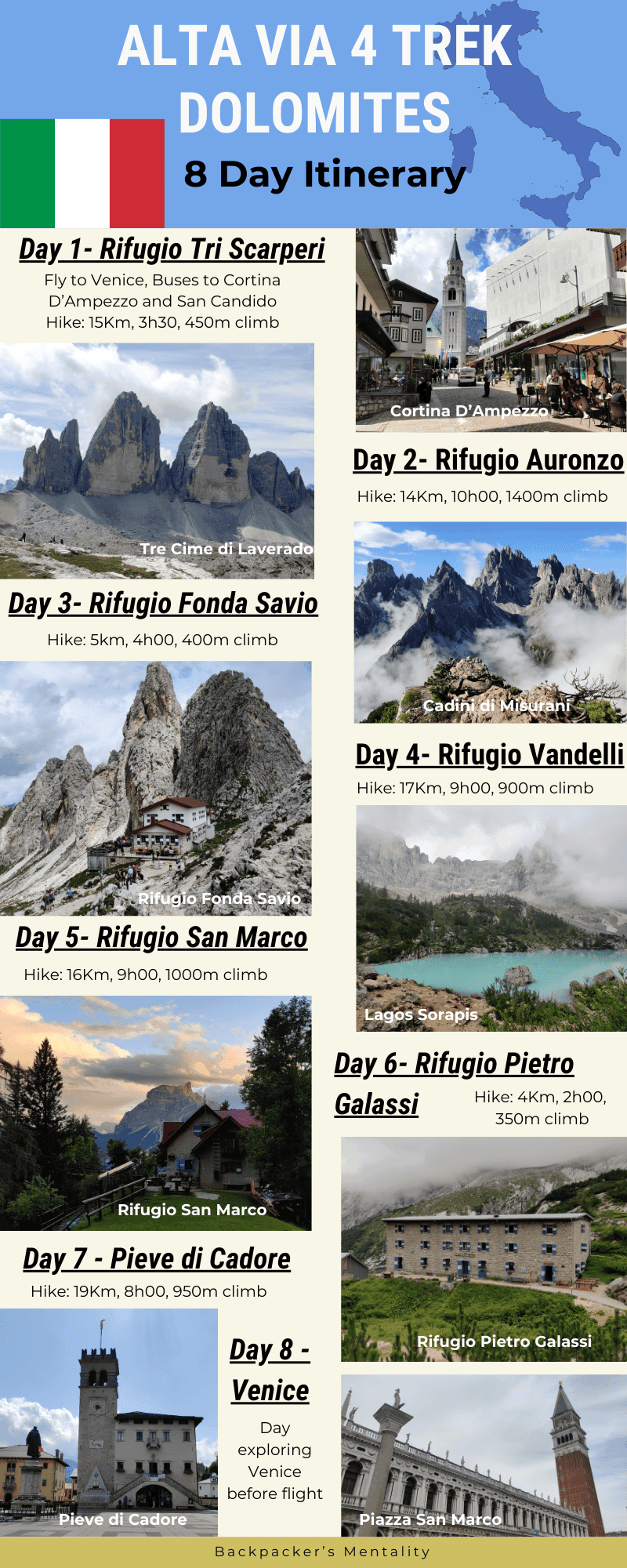
Itinerary
| Day | Start | Finish | Time | Cost |
| 1 | London | Venice | 2h15 | £86 |
| 1 | Venice | Dobbiaco/Toblach | 5h40 | £19 |
| 1 | Dobbiaco Toblach | Rifugio Tri Scarperi | 3h30 | £65 |
| 2 | Rifugio Tri Scarperi | Rifugio Auronzo | 9h45 | £60 |
| 3 | Rifugio Auronzo | Rifugio Fonda Savio | 4h00 | £62 |
| 4 | Rifugio Fonda Savio | Rifugio Vandelli | 9h00 | £60 |
| 5 | Rifugio Vandelli | Rifugio San Marco | 9h10 | £57 |
| 6 | Rifugio San Marco | Rifugio Pietro Galassi | 1h45 | £59 |
| 7 | Rifugio Pietro Galassi | Tai di Cadore | 8h25 | £19 |
| 8 | Tai di Cadore | Venice | 3h00 | £60 |
| 9 | Venice | London | 2h15 | £86 |
The main difference between this itinerary compared to the In a Faraway Land Guide was the start being in Dobbiaco/Toblach (Italian/German) instead of San Candido. This meant we stayed at Rifugio Tri di Scarperi instead of Locatelli (already booked up), and we didn’t do Torre di Toblin Via Ferrata, but we chose to do the Innerkofler climb above Locatelli instead. We both did the Via Ferrata Merlone climb from Rifugio Fonda Savio, and then days 3 & 4 were identical. We stayed at Rifugio Galassi instead of Rifugio Antelao before finishing the final day in Pozzale, and we continued on to Tai di Cadore to get the bus to Venice.
Trekking Kit List
I used primarily the same kit I took to Nepal to do the Annapurna Circuit the year before. Additionally, I carried the Via Ferrata kit mentioned above and also carried Rachel’s dehydrated meals. The Rifugios meant we did not need any tents, camping gear or cooking equipment. Additionally, as we discovered, minimal and lightweight packing made the steep sections and vertical ladders slightly easier.
Trekking Kit List
Transport
We flew from Gatwick to Venice after debating between Milan and Innsbruck, but chose the cheapest return flights. After flights, we pre-booked the Cortina Express from Venice Marco Polo airport to Cortina d’Ampezzo (the beautiful mountain town). Then, we got a local bus to Dobbiaco, which we unintentionally avoided paying for somehow. Then, we should have got a bus/train to San Candido, but we had issues, so we had to start the trek early.
On our return journey, we had nothing booked due to not knowing the finishing time, so we waited in Tai di Cadore and managed to book online a Cortina Express to Venice after missing the local bus. We arrived at Venice Mestre and then got a metro to Venice itself before walking to our hostel (no water taxi gondola for us trekkers)
Alta Via 4 – Day 1
Distance – 15.5km
Ascent – 477m
Descent – 84m
Moving Time – 3h30
Max Altitude – 1631m
Avg Pace – 13:39/km
Starting Point – Dobbiaco /Toblach
End Point –Rifugio Tri Scarperi
Weather Conditions – 20°C, Hot with clouds
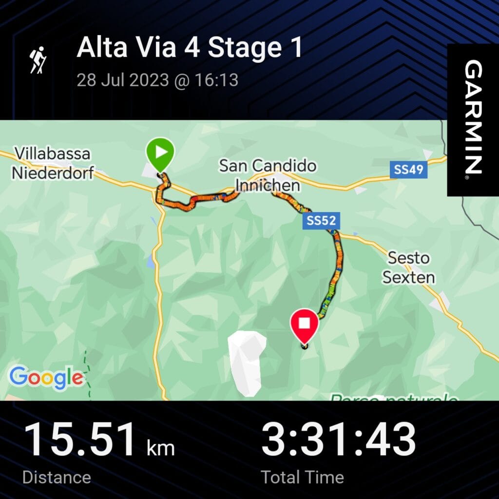
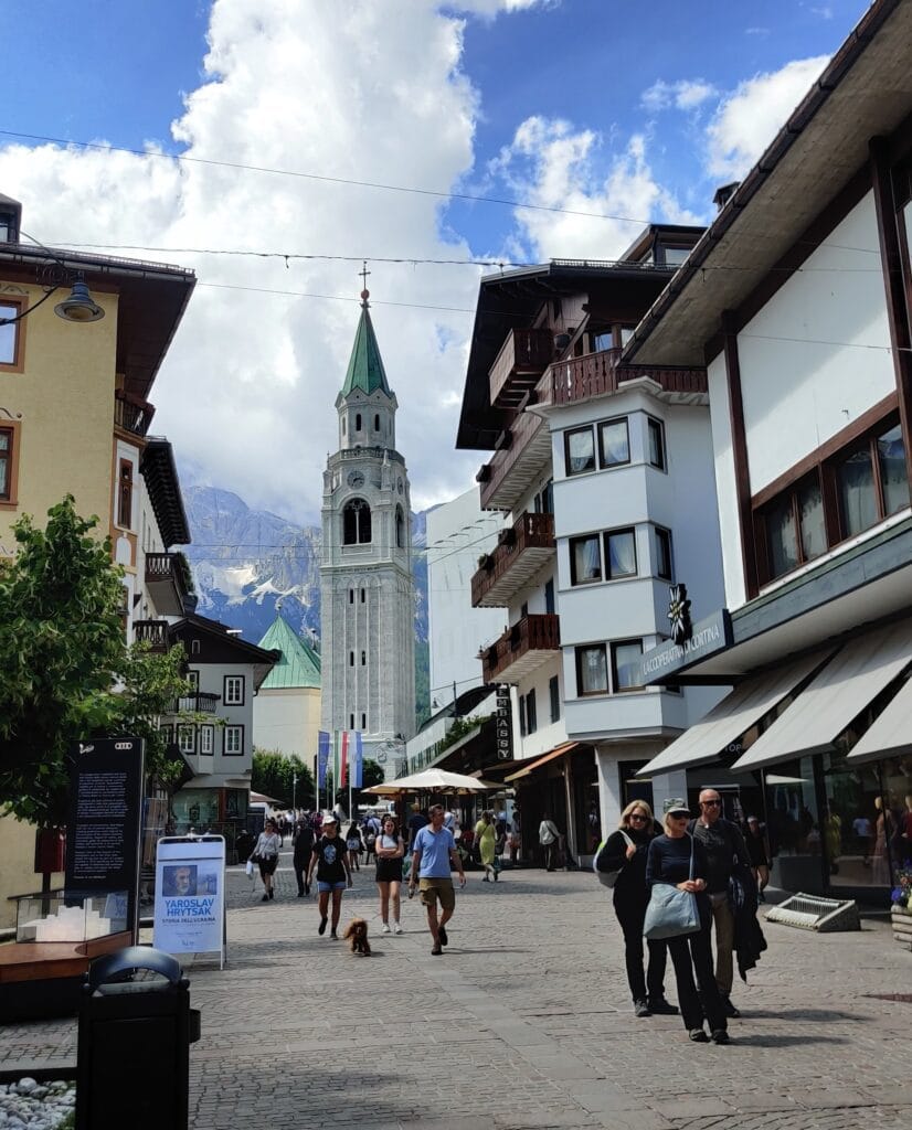
It was up at the crack of dawn to drive to Gatwick for our 6 am flight to Venice. After a rush through the airport and a run to the gate, we boarded the 2-hour flight and then collected the large hold backpacks on arrival. We waited at Marco Polo airport in the boiling sun before getting the Cortina Express to Cortina d’Ampezzo into the heart of the Dolomites. There was enough time to run to the Conad supermarket and stock up on snacks and food to make lunches for the week. After an anxious wait for a bus to Dobbiaco, we jumped on with the large backpacks and napped after a long journey. We arrived at Dobbiaco but couldn’t find any buses going to San Candido (Innichen), so we decided to walk… a questionable decision in hindsight.
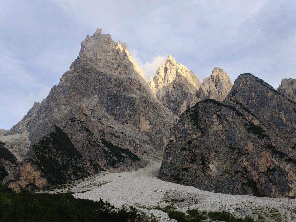
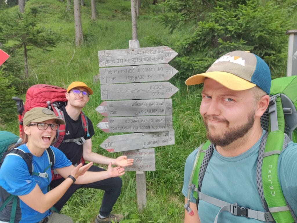
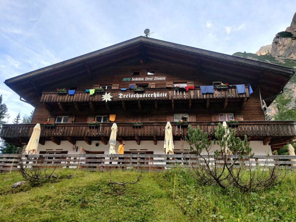
We miscalculated the length by adding 6k and an hour of hiking along the valley, meaning we called the Rifugio Tre Scarperi (Dreischusterhütte) to let them know we were running (not literally) late. We had our first taste of hiking through the trees and getting used to our backpacks at their heaviest. After 2 hours of ascent, we finally saw the Rifugio and checked in. Unfortunately, we missed dinner time, so we made a falafel baguette on the terrace benches and then had a shower before sleeping. In the night, a terrific thunderstorm roared overhead, which disrupted our rest before our first full day’s trekking ahead.
Alta Via 4 – Day 2
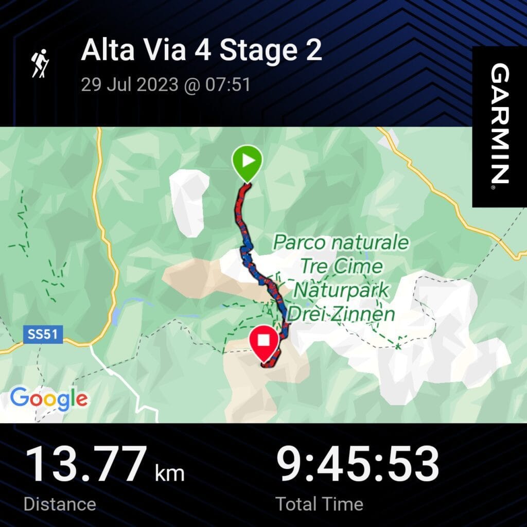
Distance – 13.8km
Ascent – 1419m
Descent – 735m
Moving Time – 9h45
Max Altitude – 2740m
Avg Pace – 42:31/km
Starting Point – Rifugio Tri Scarperi
End Point –Rifugio Auronzo
Weather Conditions – 20°C, Warm and sunny
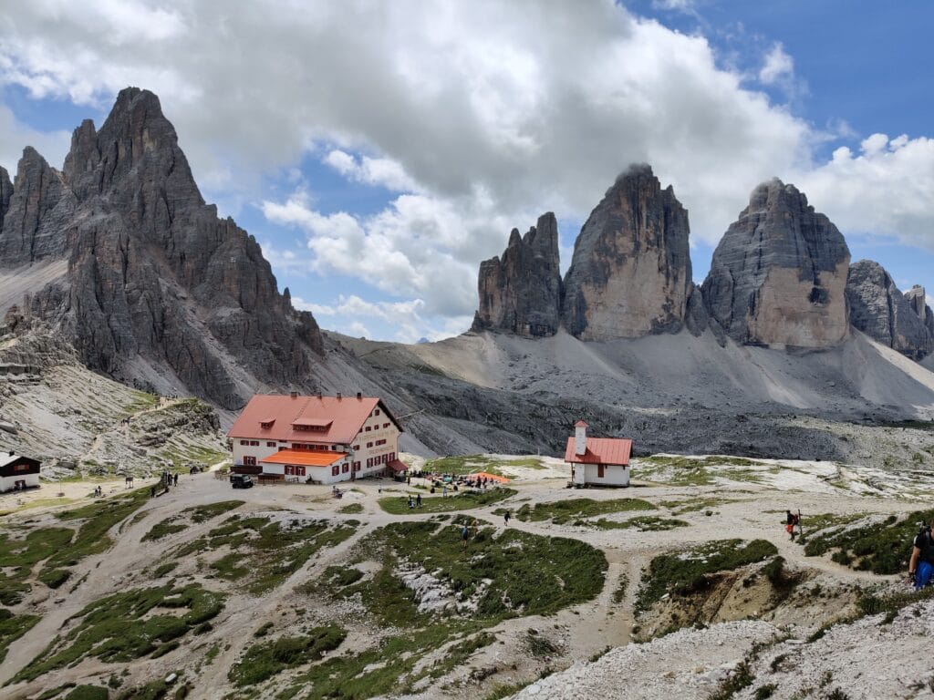
This was the day I was most excited for on Alta Via 4 because of the Tre Cime di Lavaredo (Drei Zinnen). The insanely Instagrammable and beautiful pillars are located next to Rifugio Locatelli. After a nice breakfast, we departed Tre Scarperi and started the hike up the Campo di Dentro valley in the mist along with several other groups of trekkers following Path 105. Our first test was a steep zigzag through the forests before getting above the treeline below Morgenkopf. It was fun to explore the concrete bunkers and then hike a little higher up Sextenstein to get an amazing viewpoint of the Tre Cime di Lavaredo and Toblin behind.
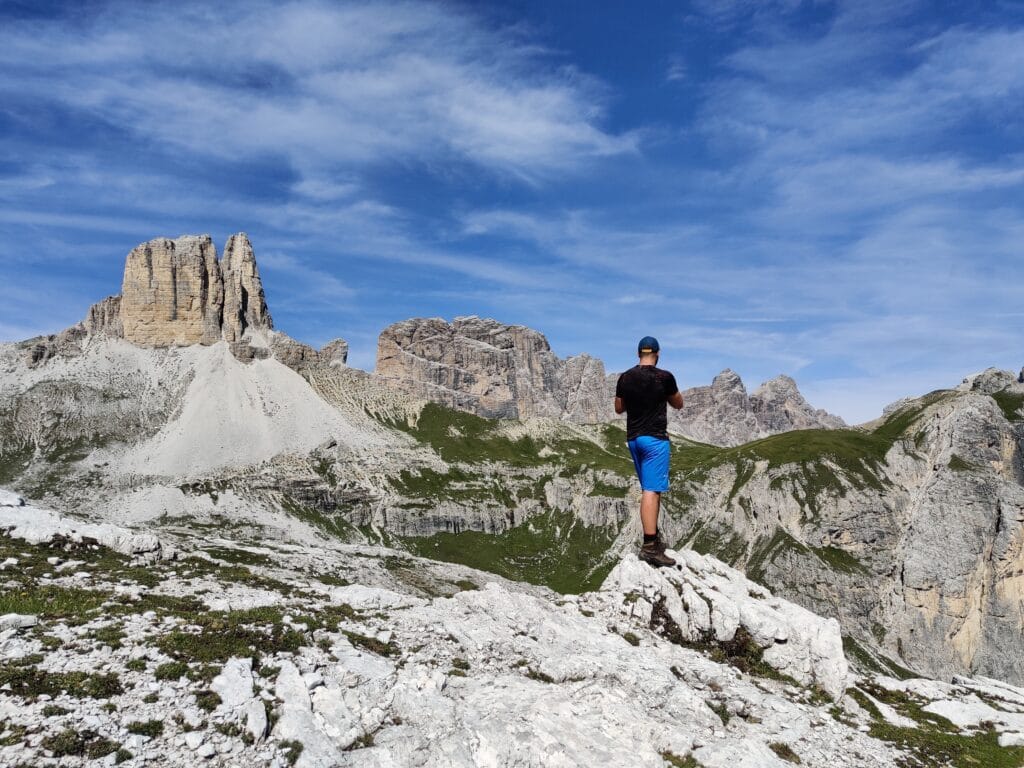
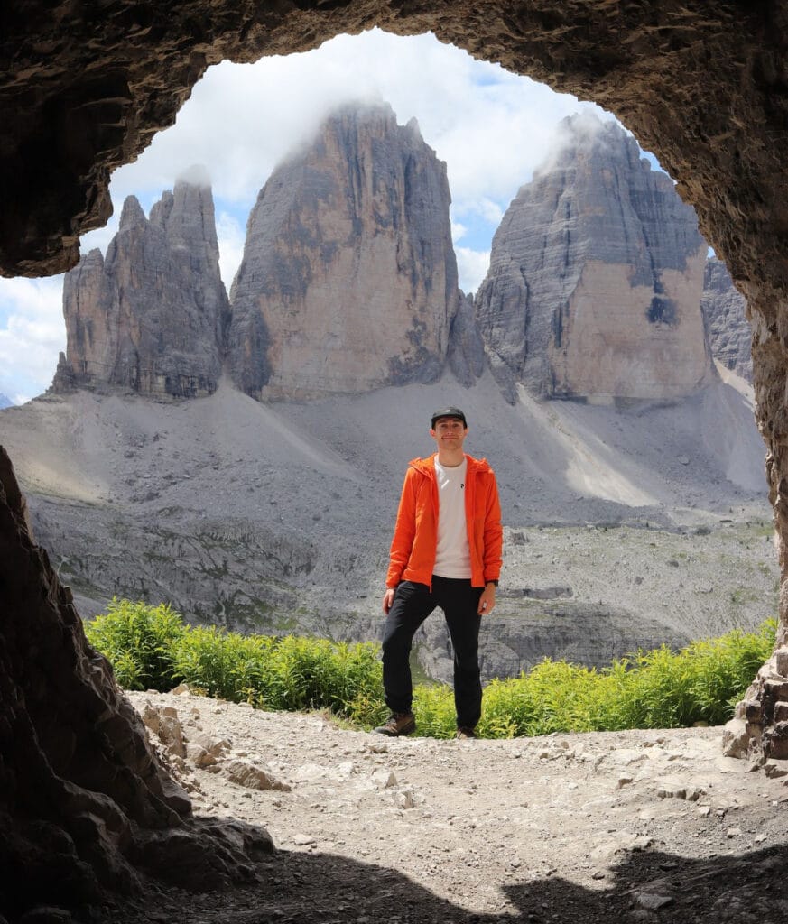
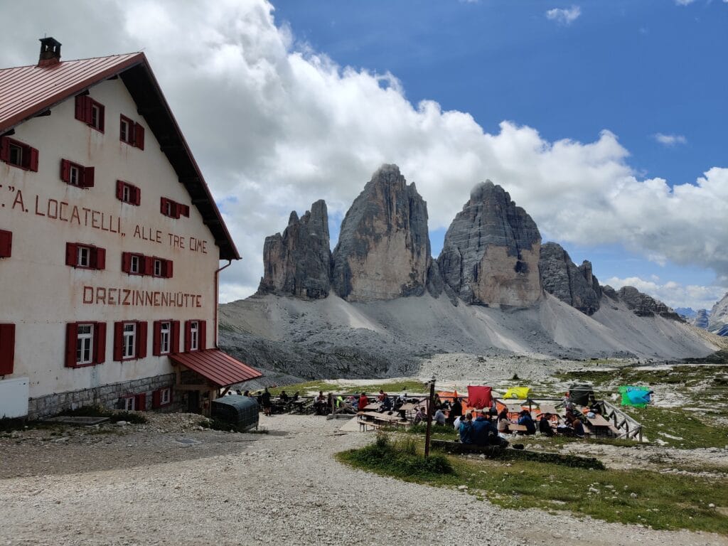
Via Ferrata Innerkofler
We planned on doing Toblin but reached Locatelli for lunch before realising we had already passed it, so decided to climb Paternkofel (Monte Paterno) via Via Ferrata Innerkofler instead. I ventured off to take pictures from the Grotto (see middle pic above), and then we had issues with Sam’s DSLR camera not reading the SD card, which put a downer on the day. Locatelli is as manic as you’d expect with many day hikers, so we left on Path 101b and started into the Tunnels to get to the start of the Via Ferrata Innerkofler. I was happy for my headtorch to see as we hiked uphill in the black tunnels built in World War 1 while appreciating the views out of the natural windows.
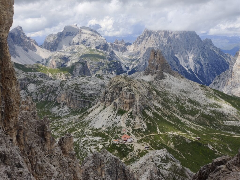
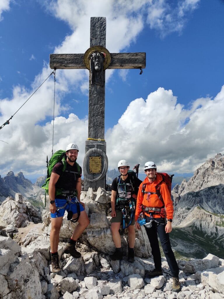
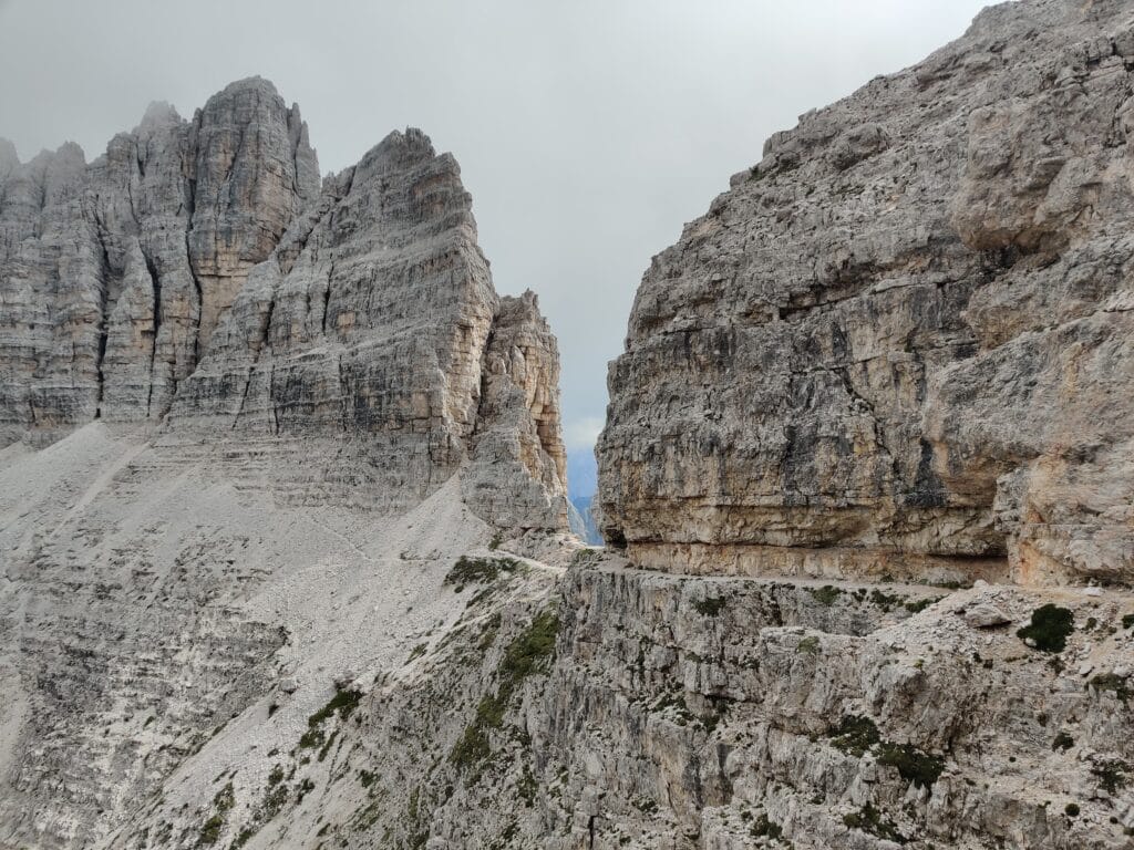
Time to harness up and start Via Ferrata climbing! I led with Rachel in the middle and Sam bringing up the rear. I enjoyed scrambling up the steep gully and got used to the clipping technique. At the Forcella del Camoscio, we decided to summit, which was a short Via Ferrata pitch after all the effort put in and we were amazed and happy once we made it to the top. We had a fast descent and a minor detour down some scree before finding the cut-out rock path to Croda Passaporto. There are short cable sections and tunnels to crawl through before getting to Forcella Lavaredo (under Tri Cime). Heavy rain started, so we powered through to Rifugio Auronzo for a night’s rest. We were soaking wet, but we were able to get warm and had one of the best dinners with a canteen-style buffet.
Alta Via 4 – Day 3
Distance – 5.16km
Ascent – 391m
Descent – 341m
Moving Time – 4h05
Max Altitude – 2368m
Avg Pace – 47:21/km
Starting Point – Rifugio Auronzo
End Point –Rifugio Fonda Savio
Weather Conditions – 15°C, warm with clouds
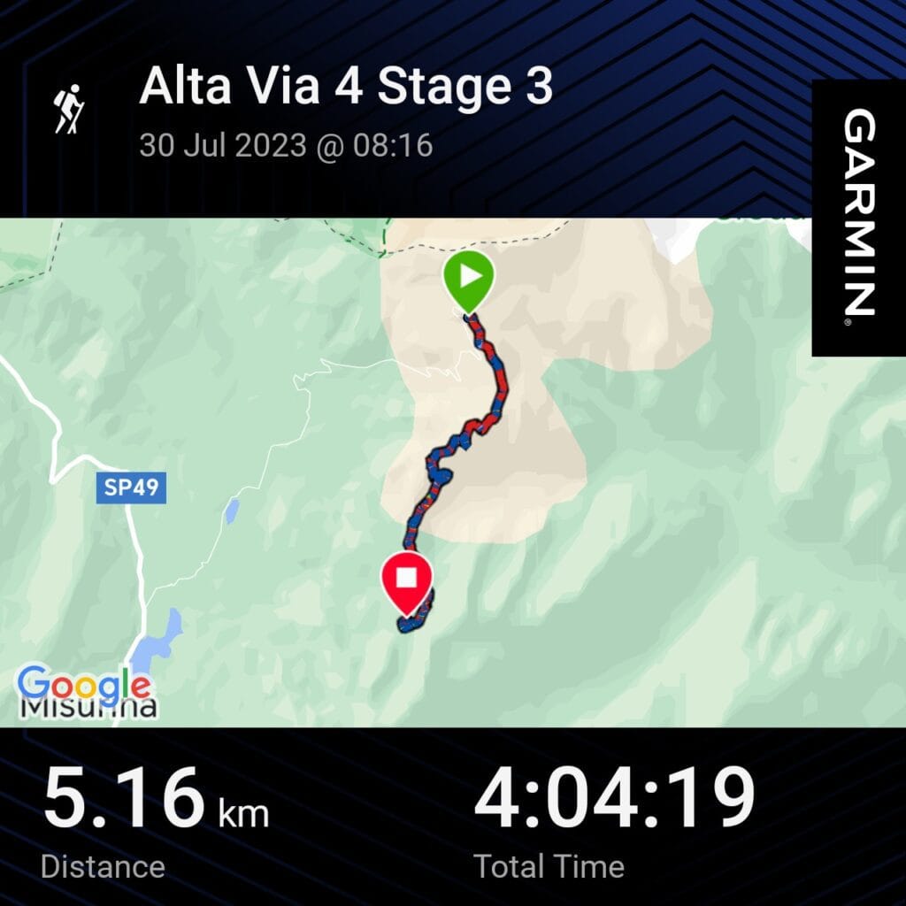
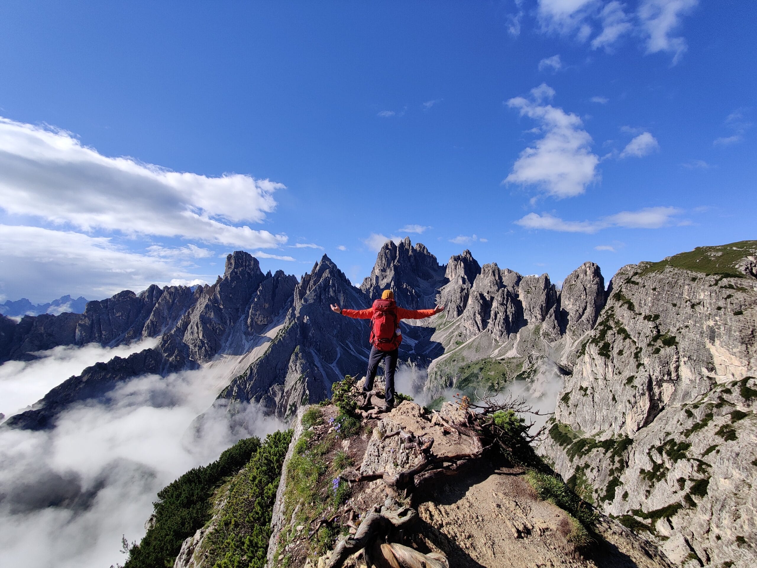
After a very filling and varied breakfast of cereals, fruits, coffee and pastries, we were ready for another day of Via Ferrata after getting our first taste on Day 2. This turned out to be my favourite day because we were away from the crowds and got the best views of the trek! The first stop was to the famous Cadini di Misurina on Path 117, which could’ve been part of Mordor with the viewpoint and peaks behind it. As expected, there was a queue to get my favourite pics, and we were glad we started early to avoid the hikers coming from the Auronzo car park. We continued away from people and descended on Path 117 into Val de la Cianpedele along Sentiero Bonacossa Via Ferrata, which is an easier section.
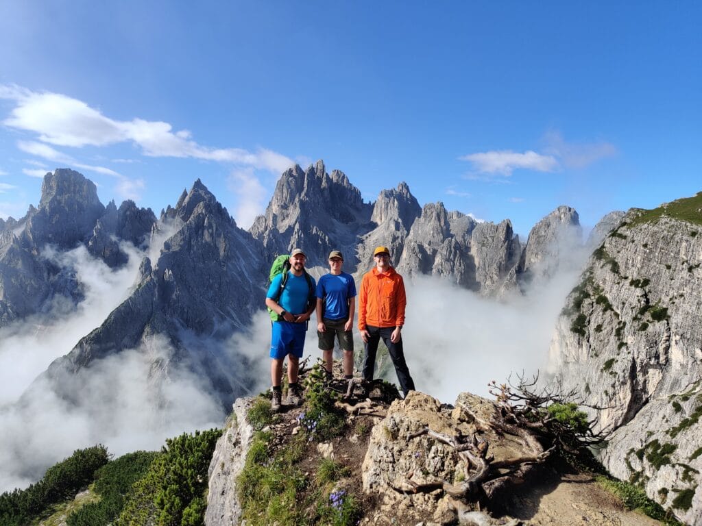
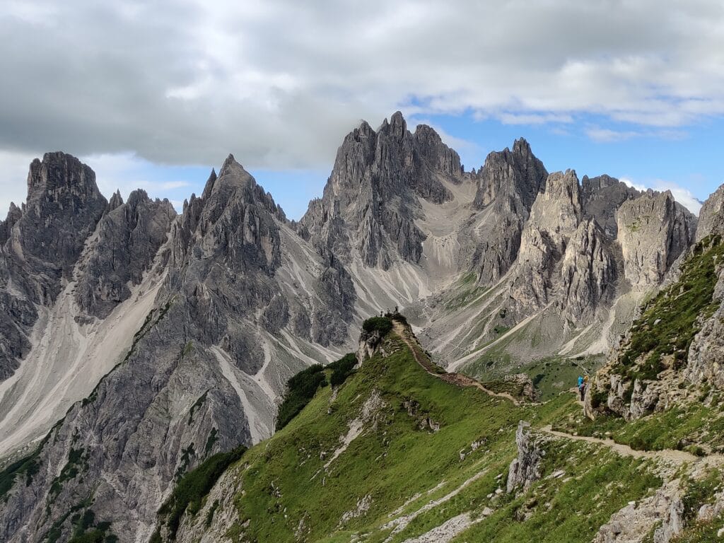
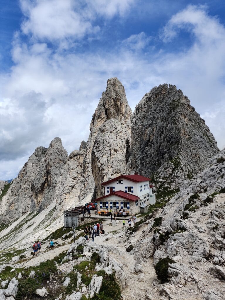
After a quick pit stop, we started the ascent up the valley to Rifugio Fonda Savio, which is perched between valleys. We were surprised by how busy the Rifugio was with day hikers having refreshments, so we found a quiet spot for a quick lunch and then dived inside to avoid the rain. As we couldn’t check in until later, the staff kindly let us store our bags, then we took our collapsible daypacks and VF gear for an afternoon excursion.
Via Ferrata Merlone
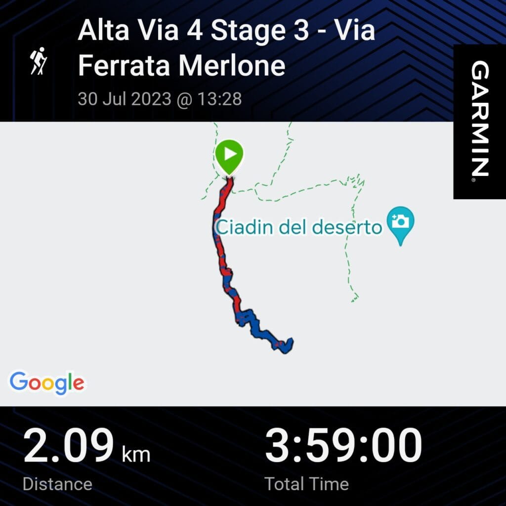
Distance – 2.1km
Ascent – 374m
Descent – 374m
Moving Time – 4h00
Max Altitude – 2769m
Start/End Point – Rifugio Fonda Savio
Weather Conditions –15°C, Cloudy with rain & thunder
I had bookmarked the Merlone climb up to Cima Cadin as a must-try! We scrambled over the rocks to get to the start and weren’t quite prepared for what felt like a vertical wall climb. It didn’t help that we could hear rumbles of thunder close by, and rain was threatening. This 3-hour Via Ferrata was my favourite section because of the numerous ladders and the mix of cables while dangling off sheer faces. It’s not for the faint-hearted, and I had some close passes with the 5 other climbers we saw.
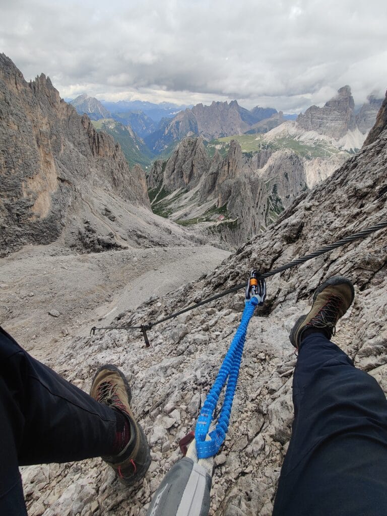
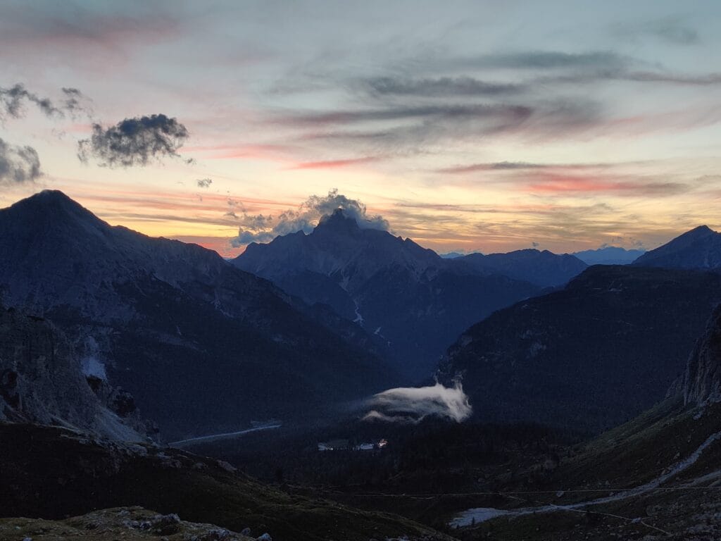
The views of the South face of Tre Cime and Fonda Savio are spectacular. Take it easy descending due to the tricky foothold, but it was truly a memory extension. Our accommodation was a cold attic with several other groups, but the food and drink made up for it in the cosy wooden area downstairs.
Alta Via 4 – Day 4
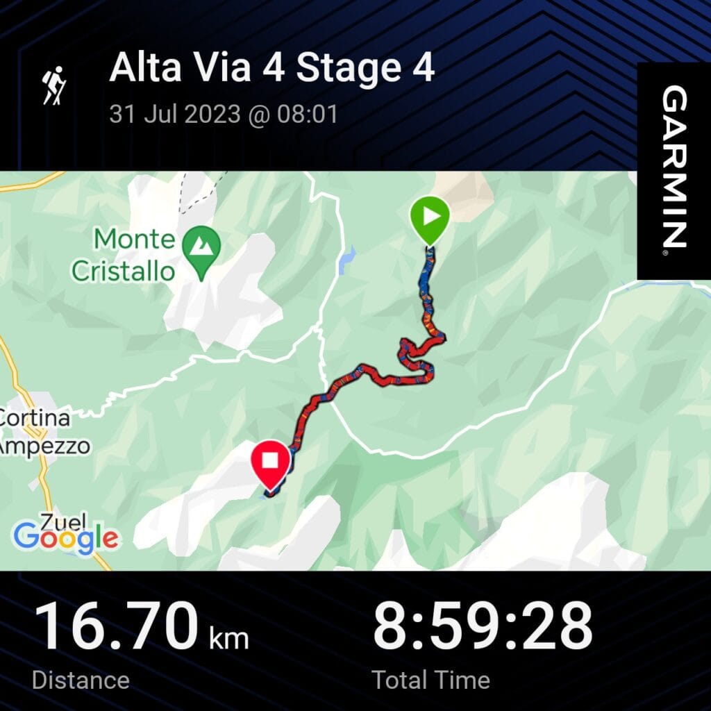
Distance – 16.7km
Ascent – 908m
Descent – 1369m
Moving Time – 9h00
Max Altitude – 2657m
Avg Pace – 32:18/km
Starting Point – Rifugio Fonda savio
End Point – Rifugio Vandelli
Weather Conditions – 15°C, very cloudy
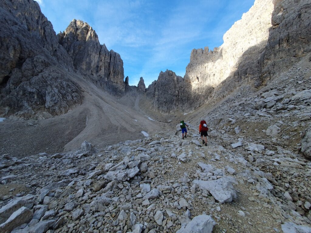
A quick buffet breakfast gave us the fuel to tackle a long day. We continued on Path 117 but lost the markers and ended up scrambling up a cliff face and scree. We were 20 metres up with no rope, but luckily had our helmets on. After some precise bouldering, I managed to get myself off the rock face and directed Sam and Rachel to safely escape the rock. We were fortunate enough to escape without any injuries, and the only casualty was Sam’s hiking poles after being thrown. This was where the carabiners and sling came in useful to pull bags over the scree. A fellow trekker offered help, so we swapped phone numbers as he was heading to the Rifugio, and luckily, we didn’t need a rescue. This detour took about 30 minutes, but it felt much longer while we were precariously perched on the rock face.
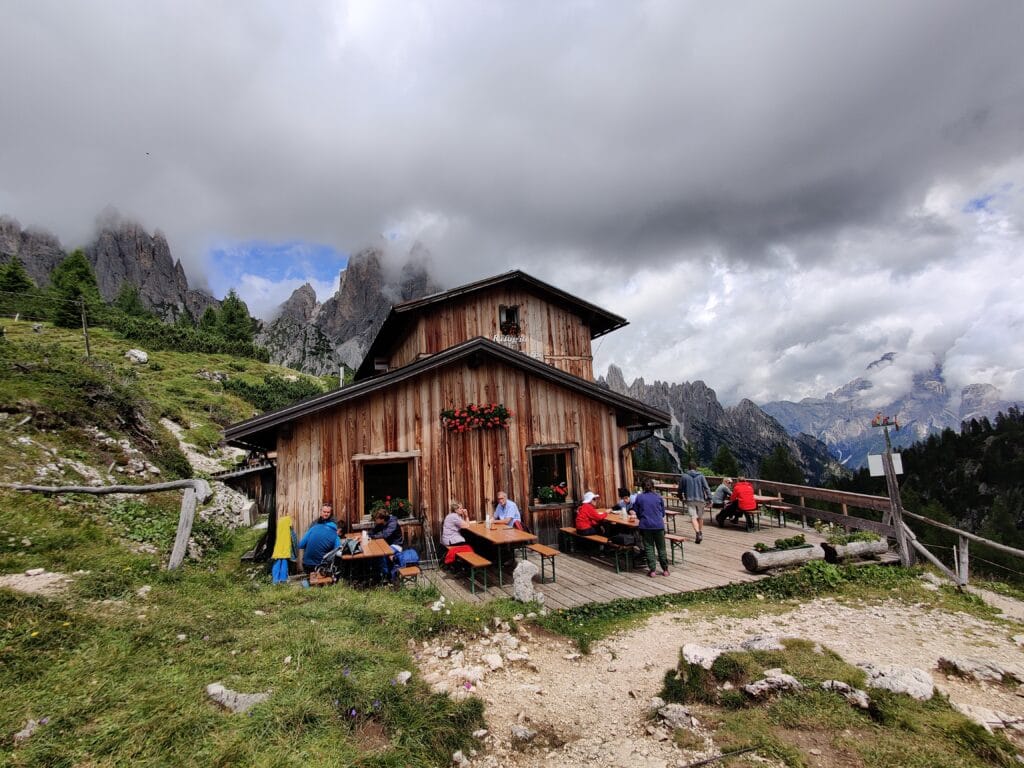
Rifugio Citta di Carpi Lunch & Vandelli Climb
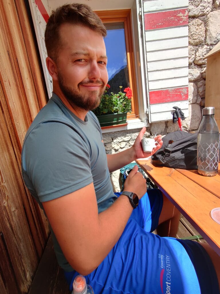
Understandably, we were a little shaken by our impromptu bouldering and took an easy descent on some Via Ferrata as we headed on Path 118 to Rifugio Citta di Carpi. A much-needed and very affordable Pasta lunch, espresso and local red wine were provided with sun and stunning views. We followed Path 120 for a very fast descent into the valley with a bog and some fallen trees to dodge. It’s worth noting there are 3 routes that Alta Via 4 takes, one via Torre del Diavolo to Rifugio Col de Varda with a chairlift down to Misurina, following Path 117 or an alternative which follows Path 112 behind Cima Cadin.
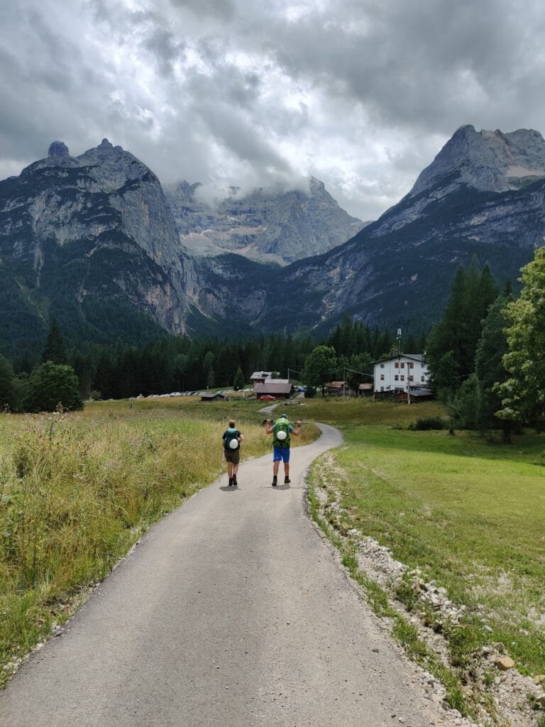
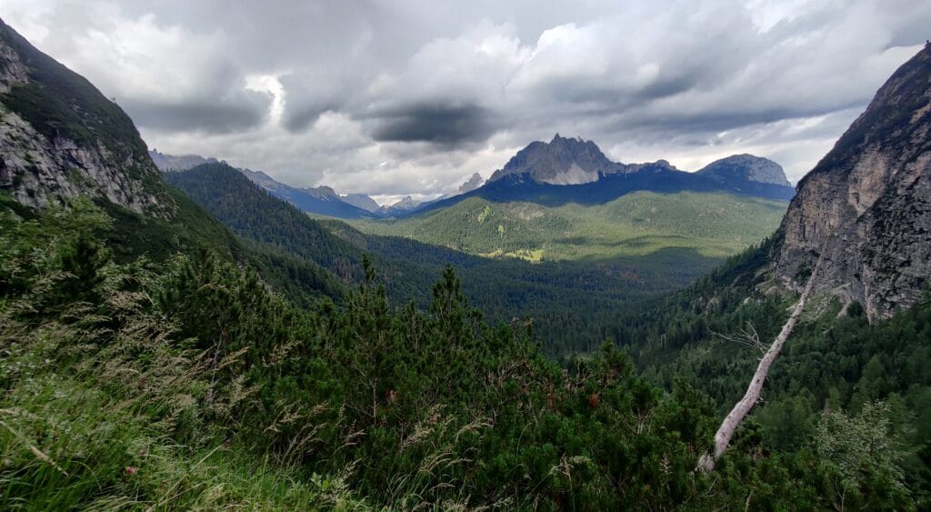
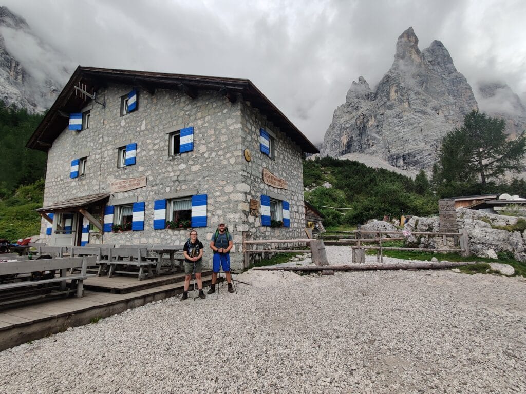
In the afternoon, follow Path 217 up the final climb to Lago Sorapis and Rifugio Vandelli. It’s a tough 90-minute climb, so we fuelled at the bottom. We arrived and marvelled at the views back across to the Misurina mountains. Vandelli has nice hot showers that cost a few euros, a large terrace and the best interior! The dorms and beds were comfy, and I felt this had the best atmosphere. I very much enjoyed the dinner in the half-board option, and they catered for Rachel very well- my fav Rifugio overall!
Alta Via 4 – Day 5
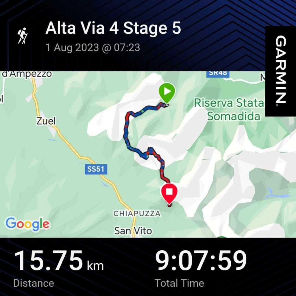
Distance – 15.8km
Ascent – 1042m
Descent – 1189m
Moving Time – 9h10
Max Altitude – 2670m
Avg Pace – 34:48/km
Starting Point – Rifugio Vandelli
End Point – Rifugio San Marco
Weather Conditions – 10°C, very cloudy and rain late on
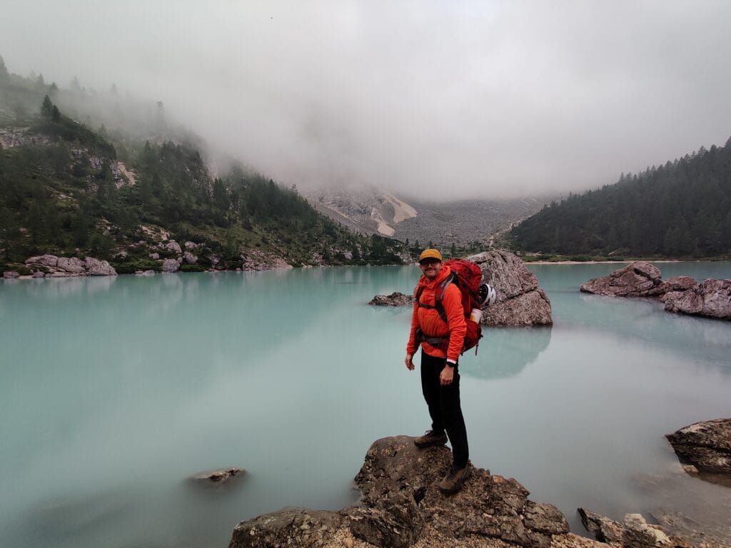
This was a day that stuck with me for a long time after Alta Via 4 and not for the right reasons. There was low cloud over Lago del Sorapis, which gave it a moody feel as we hiked up the valley. The serenity was peaceful, but maybe a sign of things to come. The Via Ferrata on this was the most physically and mentally demanding of the trek. There is a larger VF circuit called the Giro del Sorapis, with 2 of these sections being included. We decided to follow Path 215 and tackle Sentiero Ferrata F.Berti instead of Path 243 and do Via Ferrata Vandelli. One day, I will do the complete Giro loop and decide if we made the right decision.
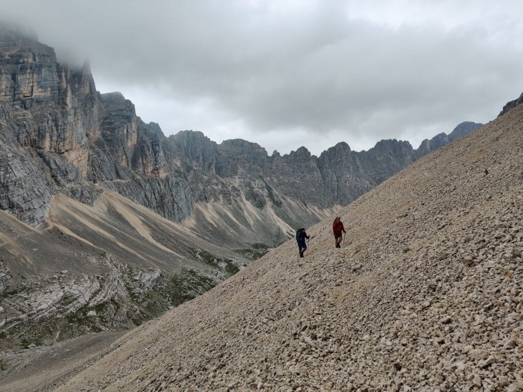
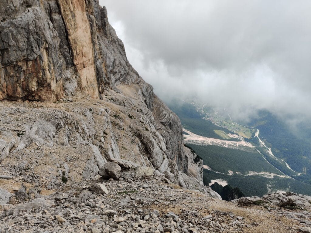
Death Scree / Via Ferrata F.Berti
We harnessed up after the scree and then scrambled higher following vague markers. This was where the fun stopped. We turned the corner and found a foot-wide sloped loose path, no Via Ferrata and a 1500m vertical drop below…. There was no turning back as we had to get to San Marco, so I led up carefully along this path for what felt like hours. We took our time and could not afford to slip on this ledge as that could have been potentially fatal… we even debated using the slings to join up but didn’t risk it… Quickly, this was referred to (by us) as Death Scree a.k.a Cengia del Banco. Sam and I are experienced hikers, but had to use all of that to help navigate this safely and try to keep composed.
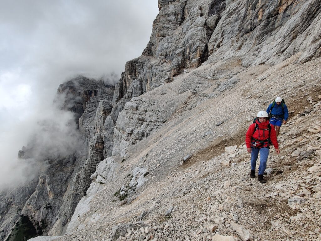
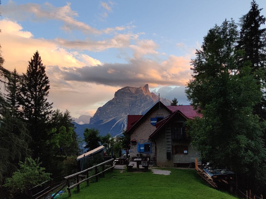
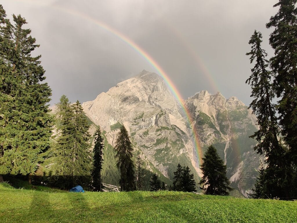
Finally, we were safe and started the Via Ferrata and gave a warning to other climbers heading the opposite way (with the customary close passing). After some slippery ladder descents, the rain started, and we had to haul ourselves along narrow ledges, not knowing how much more we had to go. Then, a final leap of faith over a metre-wide crack in the ground, we stopped in the Bivouac Slataper to have a much-needed quiet lunch before descending. After a few wrong turns, we found the path, and each took some time to hike alone as the torrential rain started. We made it to Rifugio San Marco, rather soaked and exhausted after 9 hours out trekking. We had our 3-bed dorm and enjoyed a delicious dinner before ending the day by watching a beautiful double rainbow and then sunset over Mount Pelmo.
Alta Via 4 – Day 6
Distance – 3.8km
Ascent – 340m
Descent – 130m
Moving Time –1h45
Max Altitude – 2137m
Avg Pace – 27:36/km
Starting Point – Rifugio San Marco
End Point – Rifugio Galassi
Weather Conditions – 15°C, cloudy with sunny spells
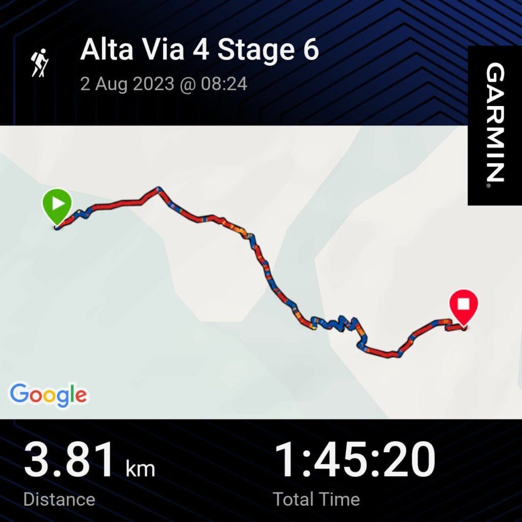
After the last few days, we had our short, relaxed day ahead with a 4km hike along Path 227 to Rifugio Galassi. We left San Marco and traversed across the scree slopes and then ascended a steeper section, spotting Ibex higher up. Before long, we could see the signs to Mount Antelao, and then Rifguio Galassi appeared shortly afterwards. We arrived by 10:30, so we decided to chill outside until the Rifugio opened and we could get a coffee, check in and have some lunch. We shared a bottle of red wine, which, when mixed with altitude, made for an amusing afternoon.
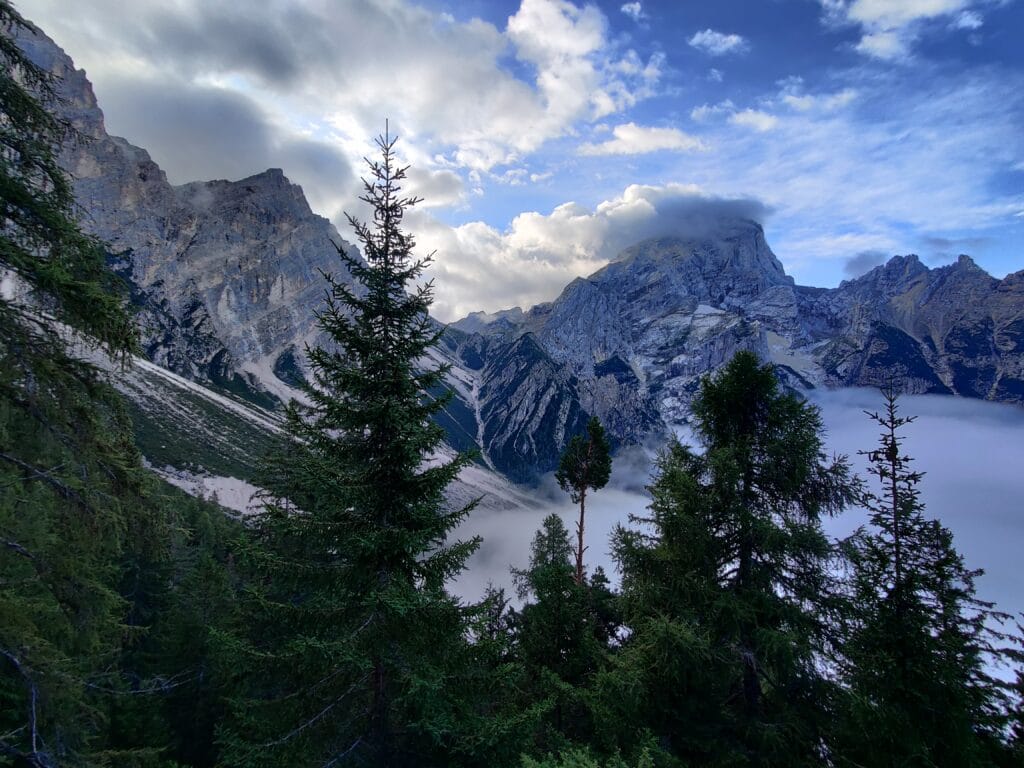
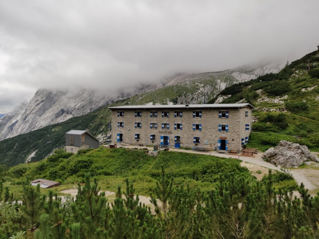
We debated whether to try and ascend Mount Anteleo (3263m), but the weather was not looking great, and we realised we would need longer than an afternoon to summit. So we decided to start the hike up and then explore some of the lower slopes before a relaxed afternoon playing cards and recharging. After a cold shower, we played more cards and chilled before a tasty 3-course dinner, and Rachel could have gluten-free pasta.
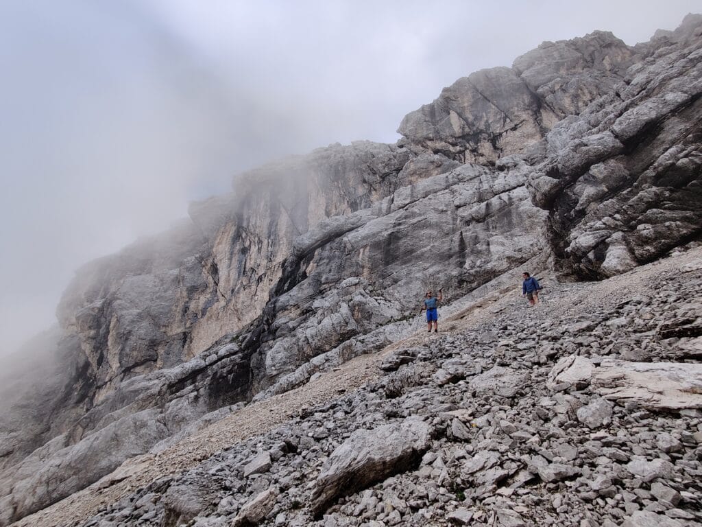
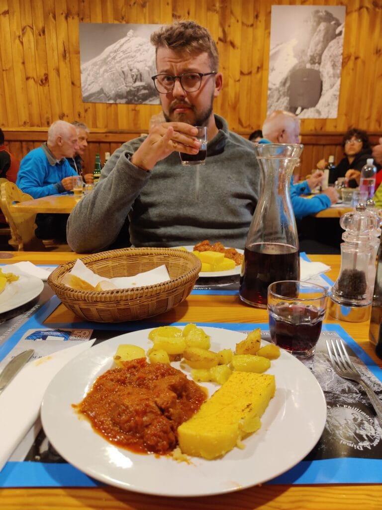
Alta Via 4 – Day 7
Distance – 19km
Ascent – 961m
Descent – 2023m
Moving Time – 8h25
Max Altitude – 2565m
Starting Point – Rifugio Galassi
End Point – Tai di Cadore
Weather Conditions – 20°C, cloudy morning and sunny afternoon
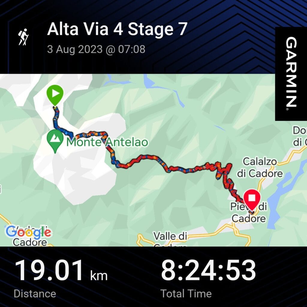
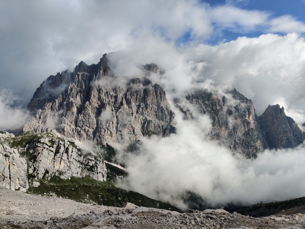
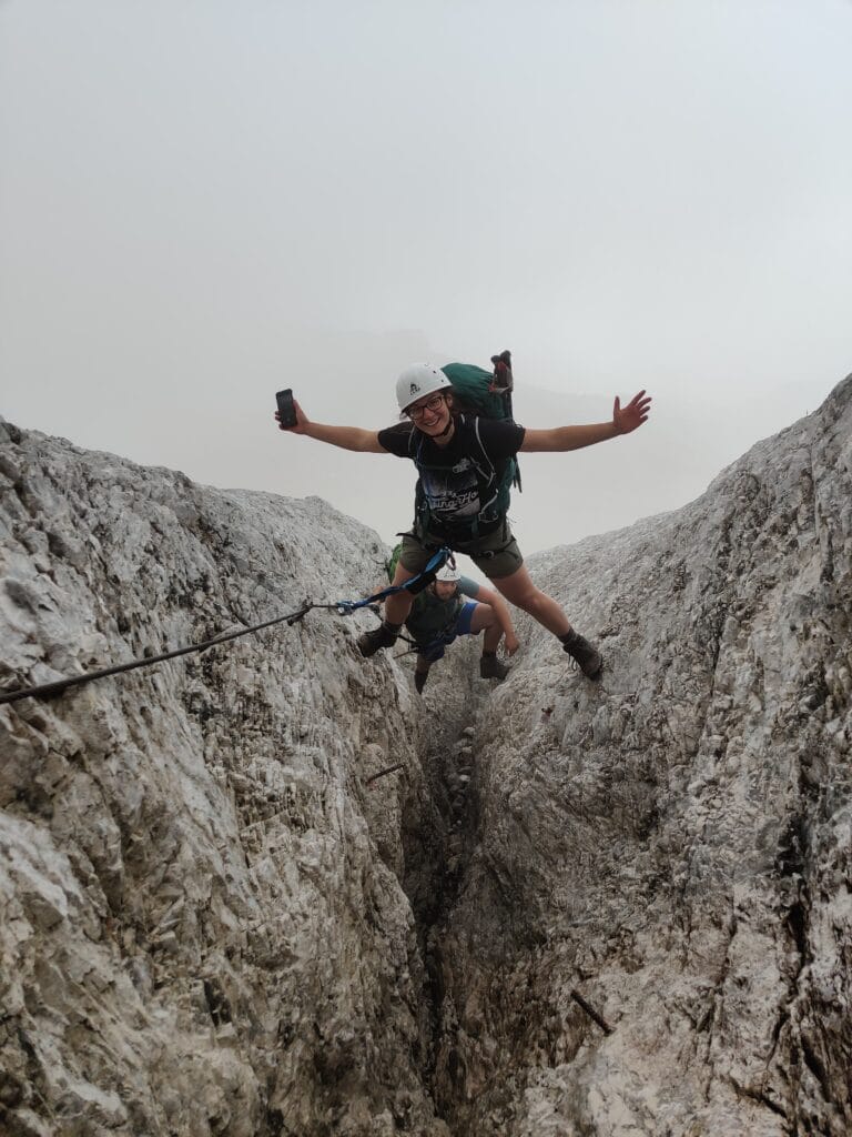
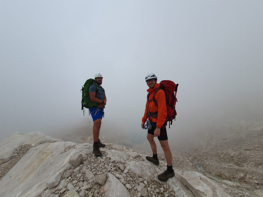
The final day of the trek was to be the longest distance with some final Via Ferrata. The breakfast at Galassi was filling, and we got everything packed up to hit the trail. Once again, there was a low cloud level which slowly started to lift as the morning went on. It was hard work at first with varying temperatures, and we needed breaks as we worked our way over snow and rocks under the Glaciers above. We got the VF kit on and I led us up Via Ferrata del Cadorin up to Forcella del Ghiacciaio, we only saw one other group this day, so we felt very alone in the mountains. I loved this Via Ferrata climb as I could challenge my climbing abilities a bit before a sharp descent along Path 250 and the final VF section.
Finish Descent
We were now hiking towards Rifugio Antelao and noticed more people after passing over Forcella Piria. It was pretty much all downhill from here, along good gravel tracks in the forest, but in the scorching sun along Path 252 as we reached Pozzale. This wasn’t a natural stopping point for us, so we continued and ended the Garmin 19km hike in Pieve di Cadore by the town hall. Only to realise then, we had a 1.5km walk to Tai di Caodre to catch the bus, which was already dragging after a long 19km in the legs.
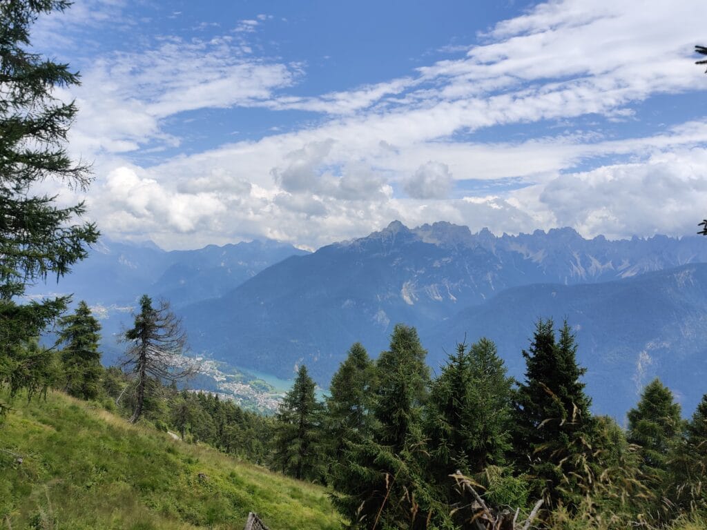
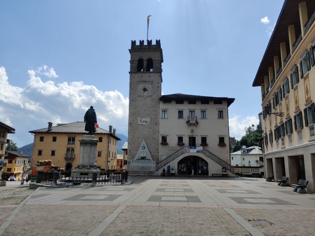
We had not booked a bus as we couldn’t guess our timings to finish the trek, so we had to wait for a Cortina Express to Venice we managed to book online. It meant we had an hour to kill, which was fine to read our books and sunbathe with a sense of accomplishment from the last 7 days. As expected, we crashed on the coach back to Venice Mestre before hopping on a metro into the main station. There were many odd looks from tourists as 3 backpackers with climbing gear hanging off walked through Venice. The Combo Venice hostel was interesting as it felt like a nightclub, but was comfy enough with much-needed showers. We searched for dinner and were not disappointed at La Piazza (13,000 reviews), where we luckily got a table as it was 9:30 pm.
Day 8 – Venice Day Trip
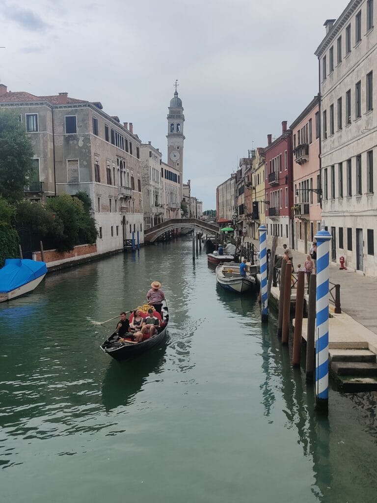
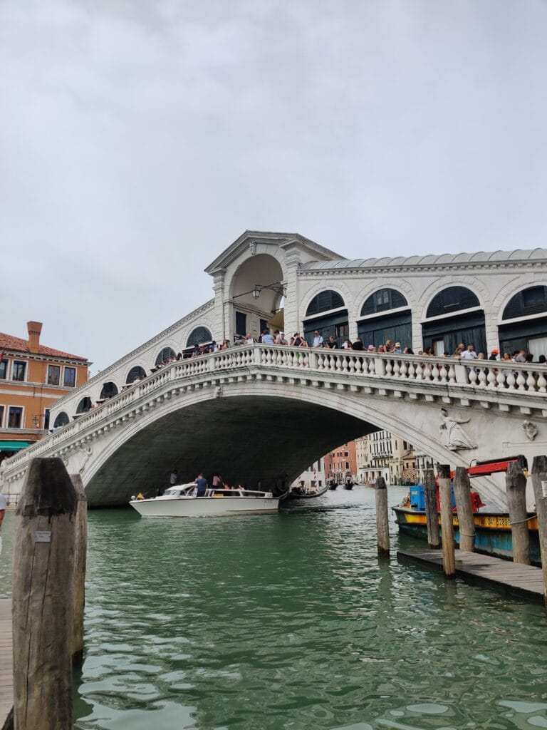
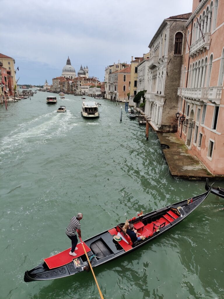
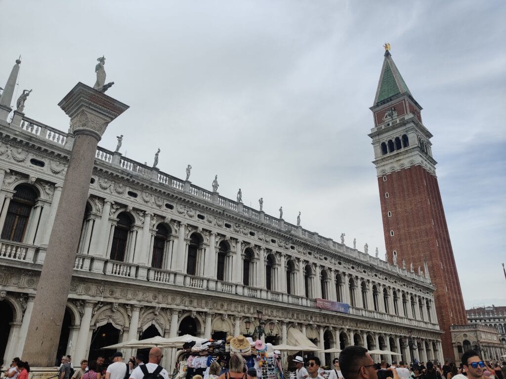
From the serenity in the Dolomites to the tourism hell of Venice. We had nearly a full day to explore Venice and enjoy not carrying our trekking backpacks around for the day. I don’t think we were ready for how overcrowded and the intensity of people in a city like Venice after Alta Via 4. We had a delicious breakfast at the hostel and left the bags in storage while we went out. Venice was cloudy, but the gondolas and bridges were charming. We saw most of the main attractions like Ponte di Rialto, Ponte dell’Accademia, and Piazza San Marco, and I was happy being an Assassin’s Creed 2 fan roaming around.
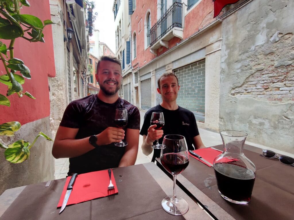
We were in no rush and found a nice gluten-free pizza restaurant and took our time reminiscing on the Alta Via 4 trek over a large bottle of wine. After, we fancied another drink so headed back towards the hostel and eventually just went to the hostel as we needed to collect the bags anyway. We trusted Rachel to finally navigate us safely to the bus station, where we got the bus to the airport (30 minutes), where our adventure in Italy ended once we were on the flight back to the UK. I’m not in a rush to go back to Venice, but it worked well for getting to the Dolomites easily.
Budget
The plan was for a low-budget trip to accommodate all 3 of us. However, the hardest part was finding dates that worked for each of us, which meant flights weren’t the cheapest. The Rifugios for Half-Board were reasonably priced, and after stocking up on snacks and lunch before the trek, we managed to keep the daily costs low.
| Item | Cost |
| Transport – Flights & Buses | £210 |
| Accommodation – Rifugios and Hostel | £429 |
| Cash – Food & Drink & Other | £210 |
| Sub Total | £850 |
Rifugio Rankings
| Rifugio | Food & Drink | Bed | Facilities | Location | Price | Staff | Style | Total |
| Tre Scaperi | 6 | 8 | 7 | 6 | 7 | 7 | 9 | 7.1 |
| Auronzo | 8 | 9 | 6 | 8 | 7 | 5 | 6 | 7 |
| Fonda Savio | 7 | 5 | 5 | 9 | 6 | 8 | 6 | 6.5 |
| Vandelli | 9 | 6 | 8 | 9 | 8 | 10 | 8 | 8.3 |
| San Marco | 8 | 9 | 6 | 10 | 8 | 9 | 8 | 8.3 |
| Galassi | 8 | 6 | 9 | 7 | 8 | 9 | 7 | 7.7 |
| Combo | 7 | 8 | 9 | 6 | 5 | 6 | 10 | 7.3 |
The best Rifugios were Vandelli and San Marco with 8.3/10 scores. If I had to pick one, Vandelli with the proximity to Lago del Sorapis and the fond memories would top the list for me. All the Rifugios were run by locals, and the food was generally tasty and replenishing. It’s worth booking them via email or online as early as possible to reserve the dates you want.
Travel Journal Sketches & Art
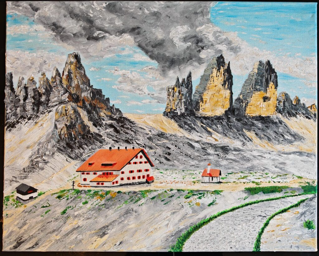
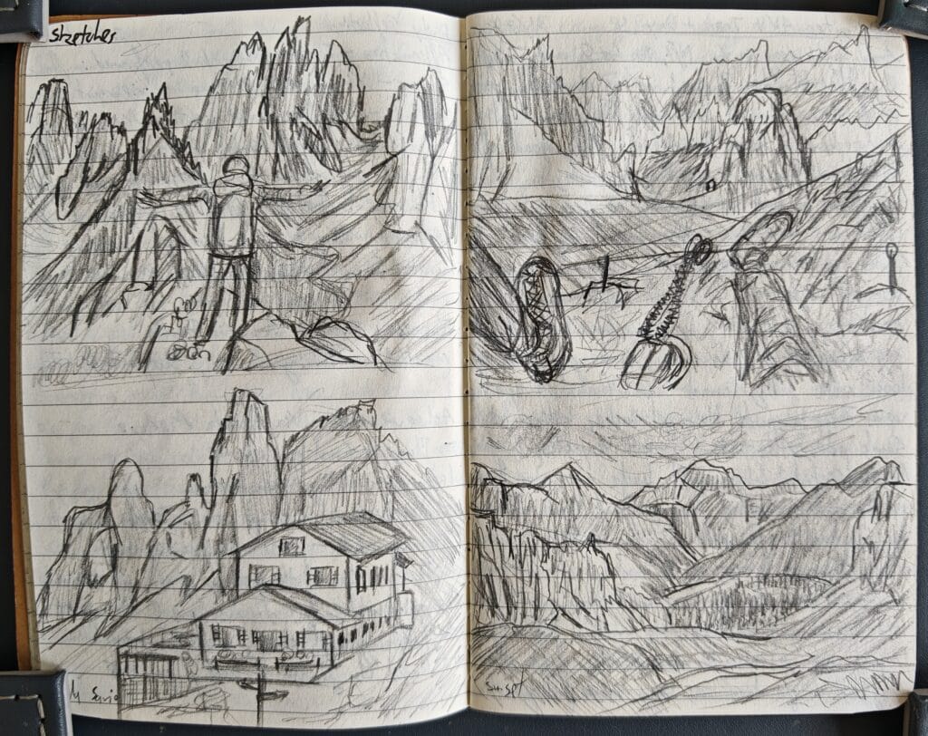
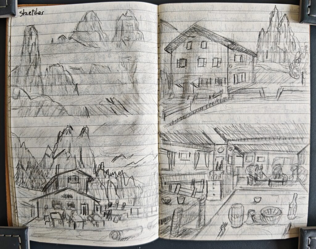
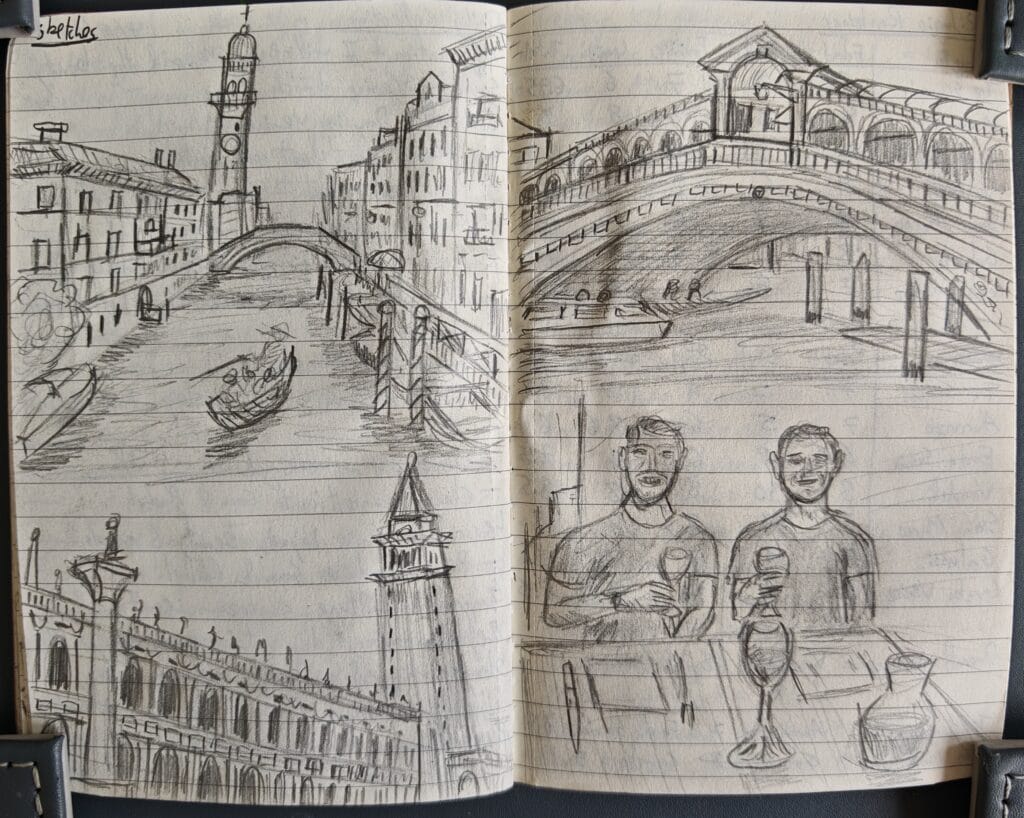
Alta Via 4 Summary
Highlights
Achievements
Lessons
Next Time
- Tre Cime di Lavaredo
- Via Ferrata Merlone
- Cadini di Misuroni
- San Marco double rainbow
- Fonda Savio sunset
- Via Ferrata Ghiacciaio
- Cards and lunch at Galassi
- Via Ferrata Paternkofel
- Climbing leadership
- Calm and composed in tricky situations
- Rock climbing technique
- Hiking fitness, and Cardio
- Fun and humour
- Contentment and presence hiking
- Navigation skills
- Friendship with Sam and Rachel
- Teamwork and playing to our strengths
- Different card games
- Openness and trust
- Living with introverted people for a week
- Climbing in the Dolomites and rock
- Staying in Rifugios and the half-board options
- Mount Antelao summit
- Via Ferrata Toblin
- Learn more Italian to help on the route
- More stretching and meditation
- Find time for journal sketches
- Lighter pack weight
Pingback: Annapurna Circuit Trek: Everything you need for an Epic Adventure - Backpacker's Mentality
Pingback: How to Experience the Best of Tuscany in 8 Days - Backpacker's Mentality
Pingback: Dolomites Via Ferrata: Best Highlights of the Alta Via 4 - Backpacker's Mentality