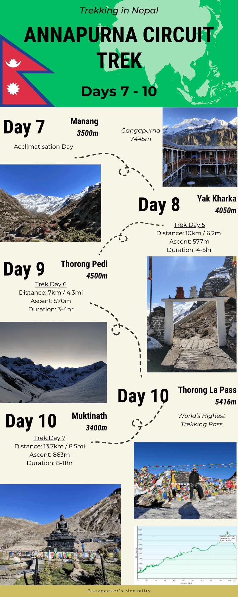
Part 2 – Manang to Muktinath
The prize of the Annapurna Circuit is crossing the Thorong La Pass. Standing at 5416m, it is the World’s Highest Trekking Pass and has become one of Nepal’s most famous Treks. The Annapurna Circuit Part 1 from Kathmandu all the way up to Manang is a stunning introduction to the Annapurna Region. And what lies beyond Manang up to Thorong La focuses on physical, mental and altitude preparation for the challenging pass. Starting with what to do on acclimatisation days, excursions and exploring Manang. Part 2 will transport you up into the high-altitude Himalayas including tips on best acclimatising. My favourite trekking day was the climb from Thorong Phedi to Thorong La to the maximum elevation of the Circuit and see why below.
Map
Annapurna Circuit: Day 5 – Manang Acclimation Day
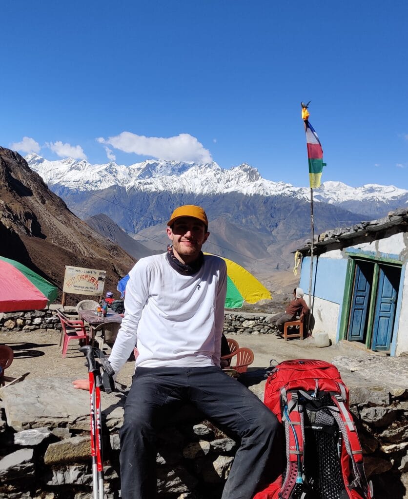
Most tours will have an acclimatisation day in Manang (3500m) in the itinerary to help trekkers adapt to the thin air. Popular excursions include Tilicho Lake which is a 2-day additional trek onto the Circuit taking you up to 4919m. There are many Buddhist monasteries and gompas around the area to visit and learn about the religious influence. Ice Lake (Kicho Tal) is a 16km day hike from Manang up to 4600m and I was gutted not to challenge myself on this test. However, my Guide felt it was too much elevation gain to be safe in a day, so we did Chorkang Viewpoint instead.
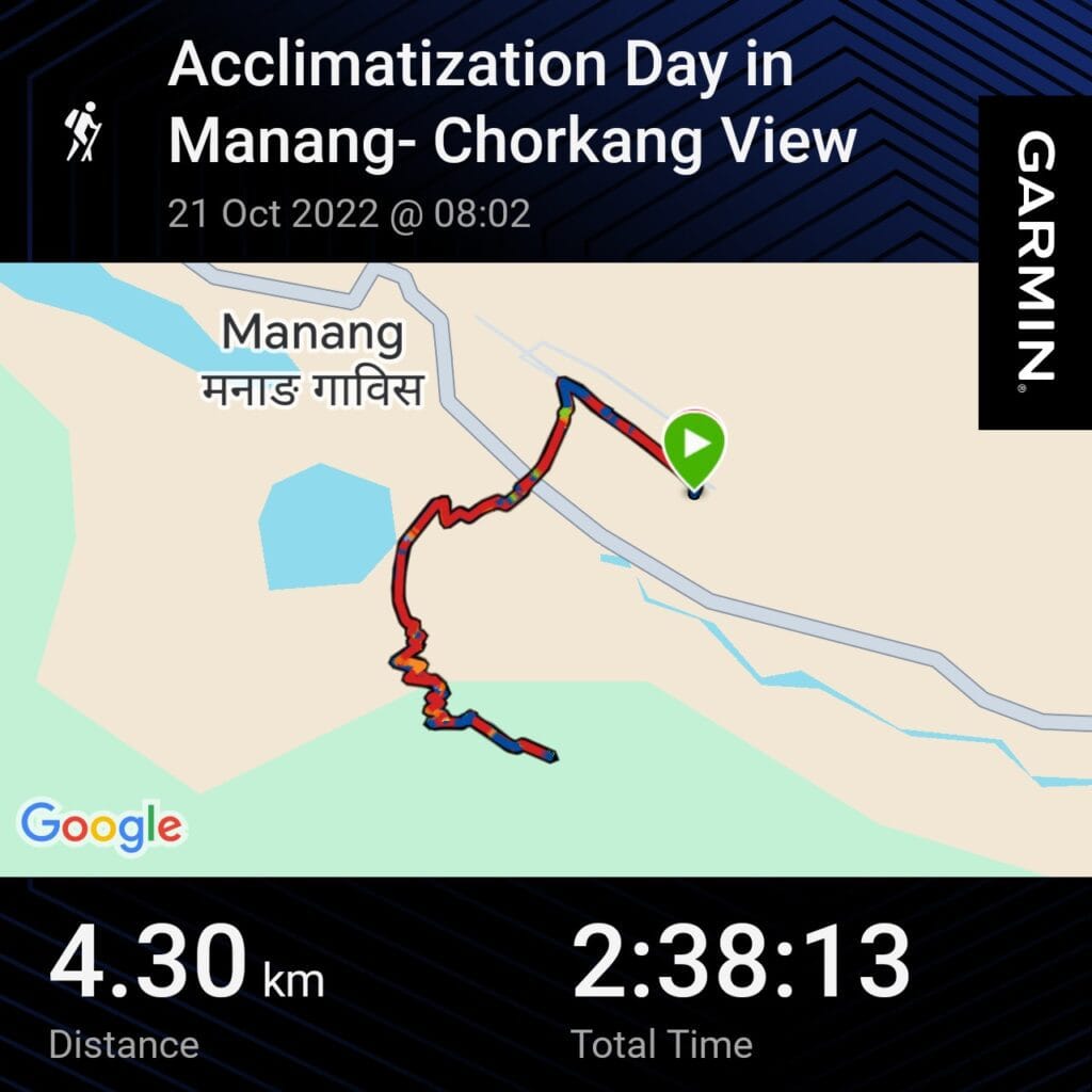
Distance – 4.3km
Ascent – 329m
Descent – 334m
Moving Time – 1h00
Max Altitude – 3715m
Avg Pace – 36:48/km
Starting Point – Manang (3500m)
End Point – Chorkang (3715m)
Weather Conditions –Sunny day, cooler temperatures, high clouds, 15°C
Chorkang Hike
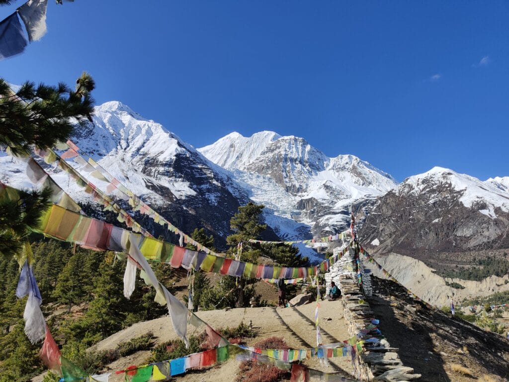
The hike up to Chorkang Viewpoint is a short morning walk which gives fantastic views of Manang, Chulu Range and Gangapurna. It starts in Manang and exits the village to cross the river and start hiking up past Gangapurna Lake. The path is steep as it zig-zags up the forest to the viewpoint. We walked up the trail with the shop owner who serves tea at the top. The panoramic views around the valley are exceptional with the likely clear skies and little haze. There are prayer flags hung from trees and monuments to make it feel very Nepalese. The climb gained 329m which is within the normal 500m recommended maximum altitude gain to acclimatise well for Thorong La Pass.
Monastery
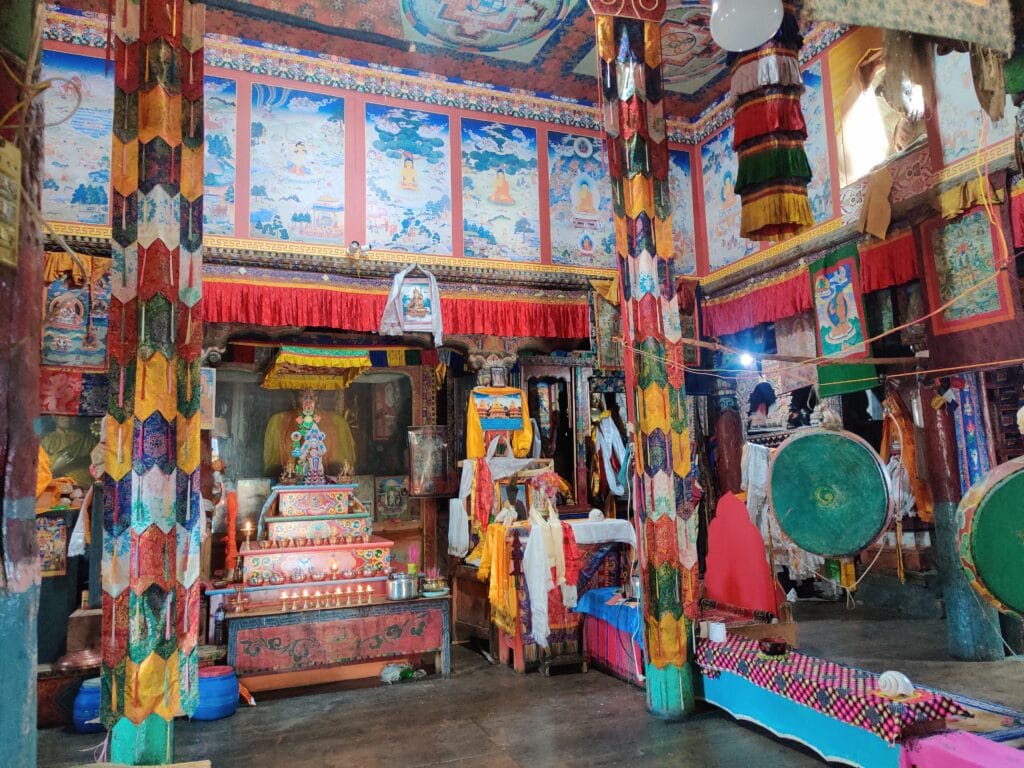
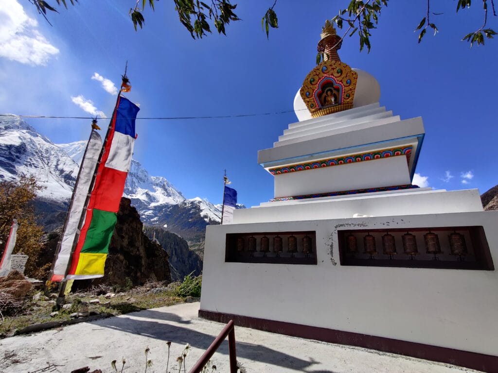
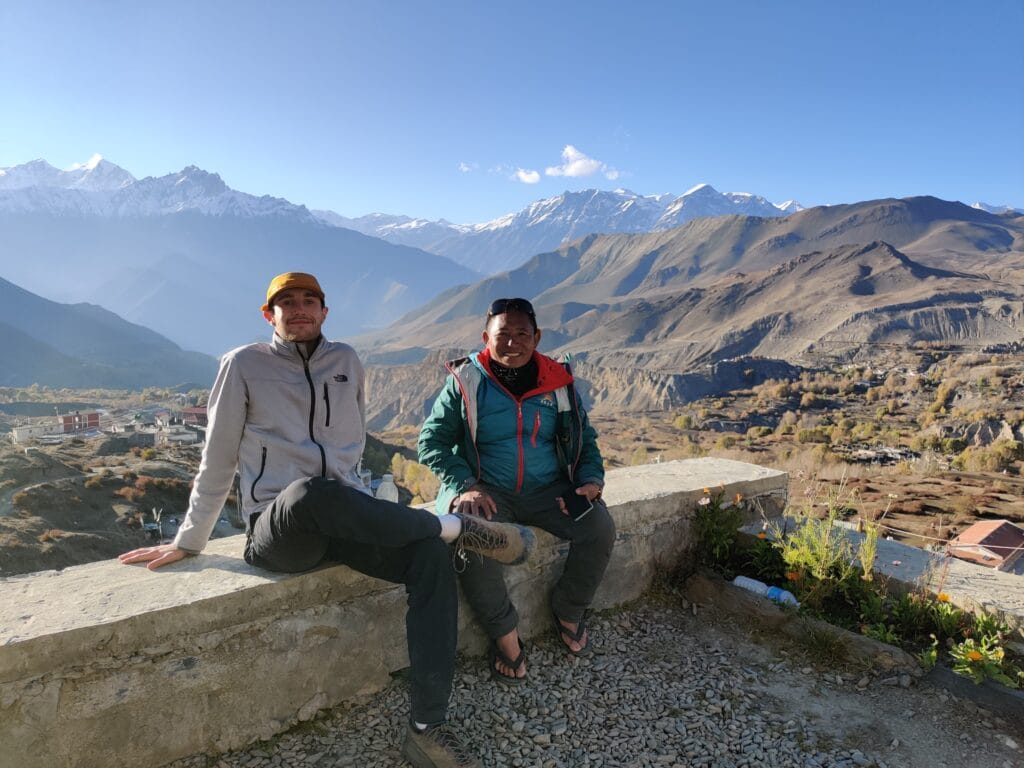
In the afternoon, Dawa and I walked to the Bhojo Buddhist Monastery just outside Manang. It was my first time visiting a Monastery and I was captivated by the ornamentation. The first impression of ascending up to it and walking around the Stupa before entering the Monastery. There were prayer flags everywhere with intricate paintings, statues and decorations. We paid our respects with a candle and said a prayer for safe passage over Thorong La Pass. I was shown ancient books over 1000 years old and took in all of the symbolism. I left feeling a sense of calm and further curiosity about the Buddhist teachings.
Manang
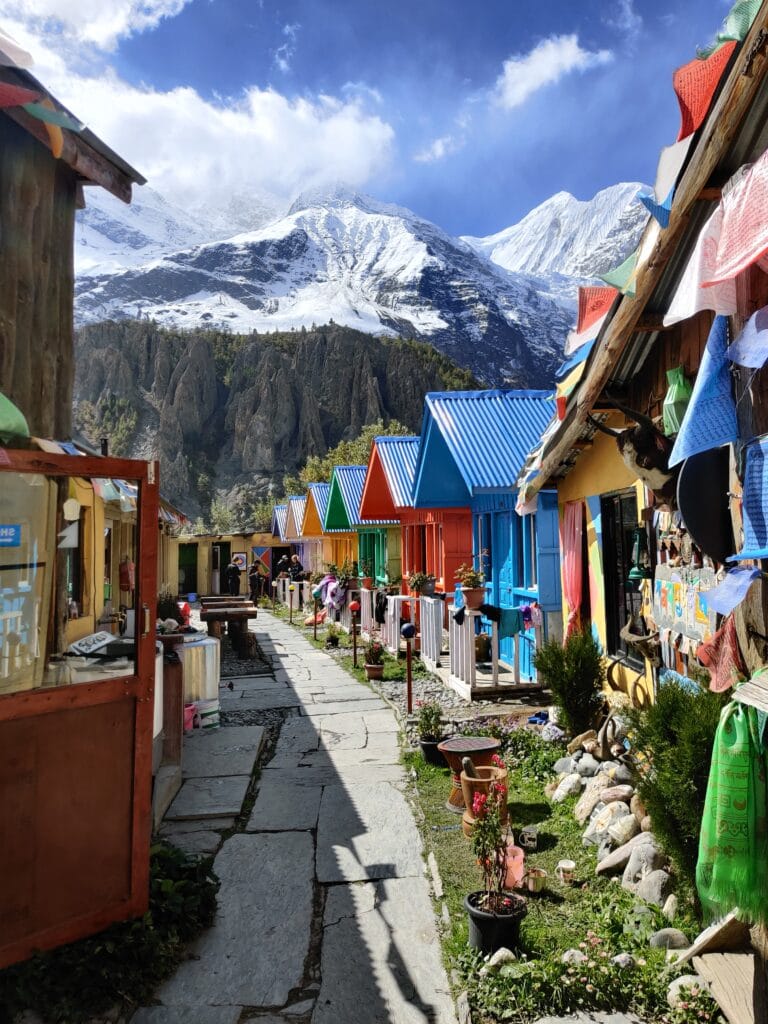
What I liked most about Manang was the sense of trekkers gathering together and everyone relaxing. It’s a great place to recharge and get accustomed to the thin oxygen at the altitude. Not carrying the trekking backpack is a nice rest for the shoulders and back as trekking is physically tiring. There are plenty of shops selling souvenirs, hiking/climbing gear and food supplies to stock up. After Manang, there are not many options to buy snacks or items before Thorong La which would be extortionately priced.
Annapurna Circuit: Day 6 – Manang to Yak Kharka
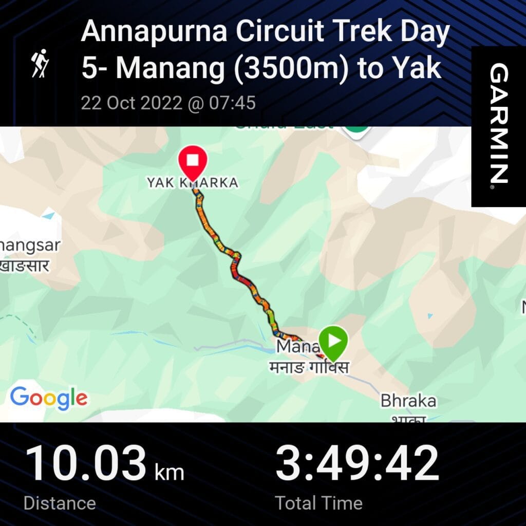
Distance – 10km
Ascent – 577m
Descent – 92m
Moving Time – 2h15
Max Altitude – 4050m
Avg Pace – 22:54/km
Starting Point – Manang (3500m)
End Point – Yak Kharka (4050m)
Weather Conditions –Clear skies and sun but cooler at altitude, 10°C
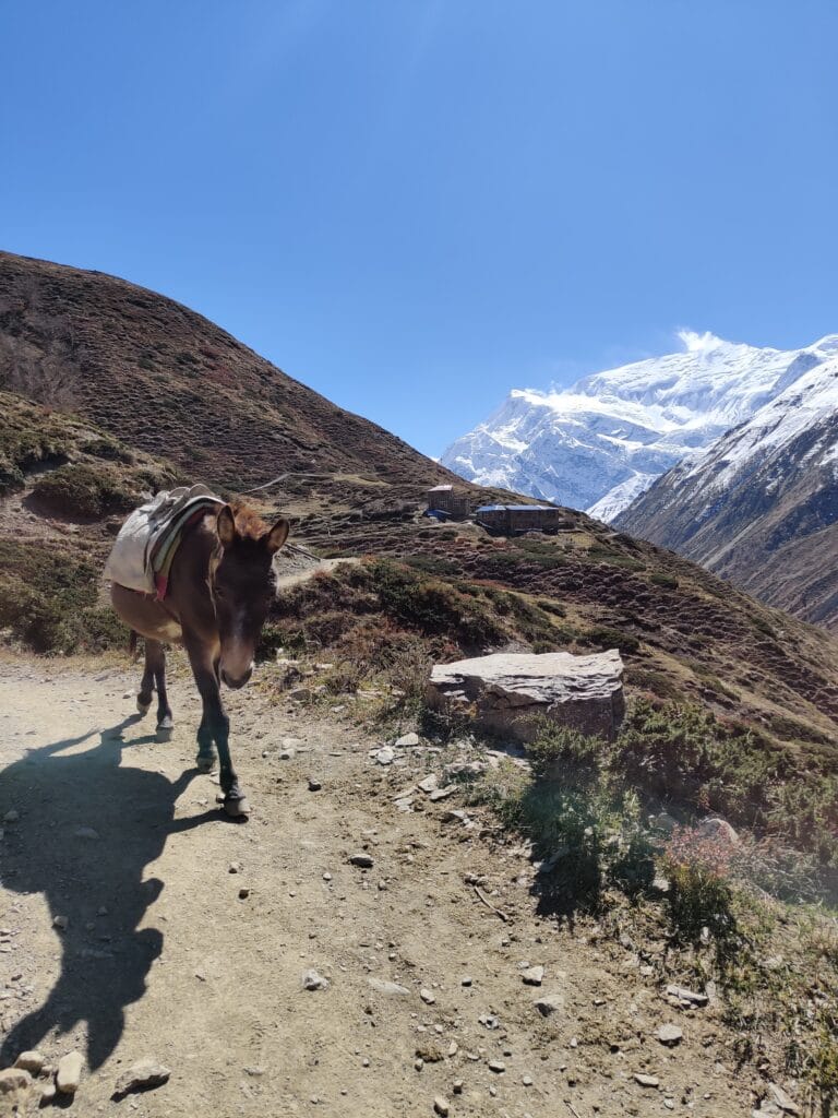
After the acclimatisation/rest day, the trekking days are much shorter as you begin to face the higher altitudes. The 1st stop is to check in at the ANCAP checkpoint before winding your way out of the old streets. The path climbs fairly sharply to Tanki Manang giving good views back over the town and towards Annapurna 2. There are fewer teahouses higher up the valley to stop for a beak or drinks. Along the route, there are more herds of goats or mule trains moving along with the trekkers to deliver goods. The Chulu Range can be seen spectacularly crossing a suspension bridge as you get views up the valley towards Yak Kharka & Ledar. The trail from Tilicho Lake can be seen on the other side of the valley.
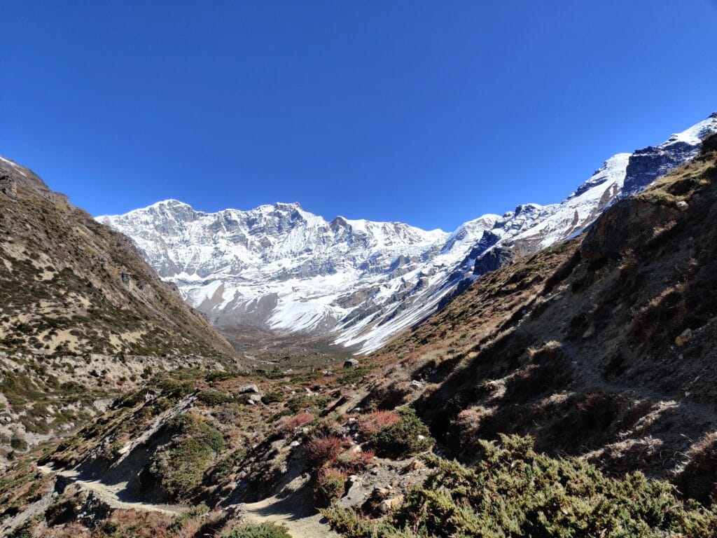
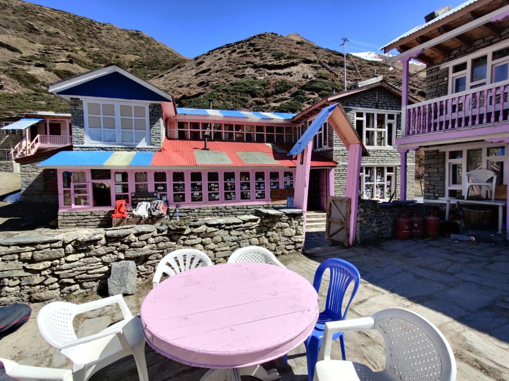
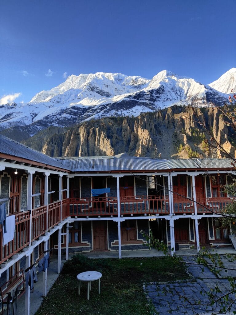
The next 2 days before the Pass will have a lot more downtime due to limiting the ascent per day to a recommended 500m. We arrived at Yak Kharka at midday to enjoy lunch at Gangapurna Hotel and get settled into our rooms. The accommodation was massive with pink-painted exteriors and 2 comfy lounges for food & drinks. To help acclimatise further, we hiked slowly up to Ledar before returning for a relaxed afternoon. There aren’t any shops in Yak Kharka and you’ll notice the temperature drop once the sun leaves the valley. Take the time to enjoy the lack of WiFi or internet and try to connect with fellow backpackers over cards and tea!
Annapurna Circuit: Day 7 – Yak Kharka to Thorong Phedi
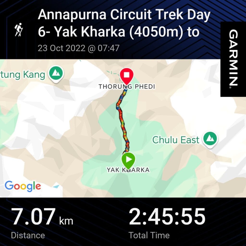
Distance – 7.07km
Ascent – 570m
Descent – 85m
Moving Time – 1h40
Max Altitude – 4560m
Avg Pace – 23:28/km
Starting Point – Yak Kharka (4050m)
End Point – Thorong Phedi (4560m)
Weather Conditions –Cold day despite sun and blue skies, 10°C
At higher altitudes, sleep is likely to be impacted due to the stress on the body with the reduced Oxygen. Luckily, the hike up to Thorong Phedi was not too strenuous and took us around 3 hours. Similar to Day 6, there are limited stops along the route for breaks with the terrain very arid and rocky past Ledar. It’s advised to take it slowly as you climb to 4000m to not increase the heart rate too much! As you approach Thorong Phedi, it’s a short descent down to cross the stream and a steep kicker up to a tea hut. The final hike was along a snow bank to reach the small settlement where several teahouses accommodated all the trekkers.
There is a buzz around Thorong Phedi as everyone has trekked for 6-9 days and is excited to cross Thorong La Pass. Some people were nervous about the Very High Altitude at 5416m and having physical issues climbing the Pass. There is not much to do apart from hike up to High Camp (5000m) to further acclimatise better for Day 8. Given how remote Thorong Phedi is, the Dal Bhat and Teahouse were very good! However, sleeping at over 4500m gave poor quality which was not ideal preparation for the long hike to Muktinath. It’s an early night in freezing cold conditions as you’ll wake at 2-3am to climb Thoron La.
Annapurna Circuit: Day 8 – Thorong Pedi to Muktinath
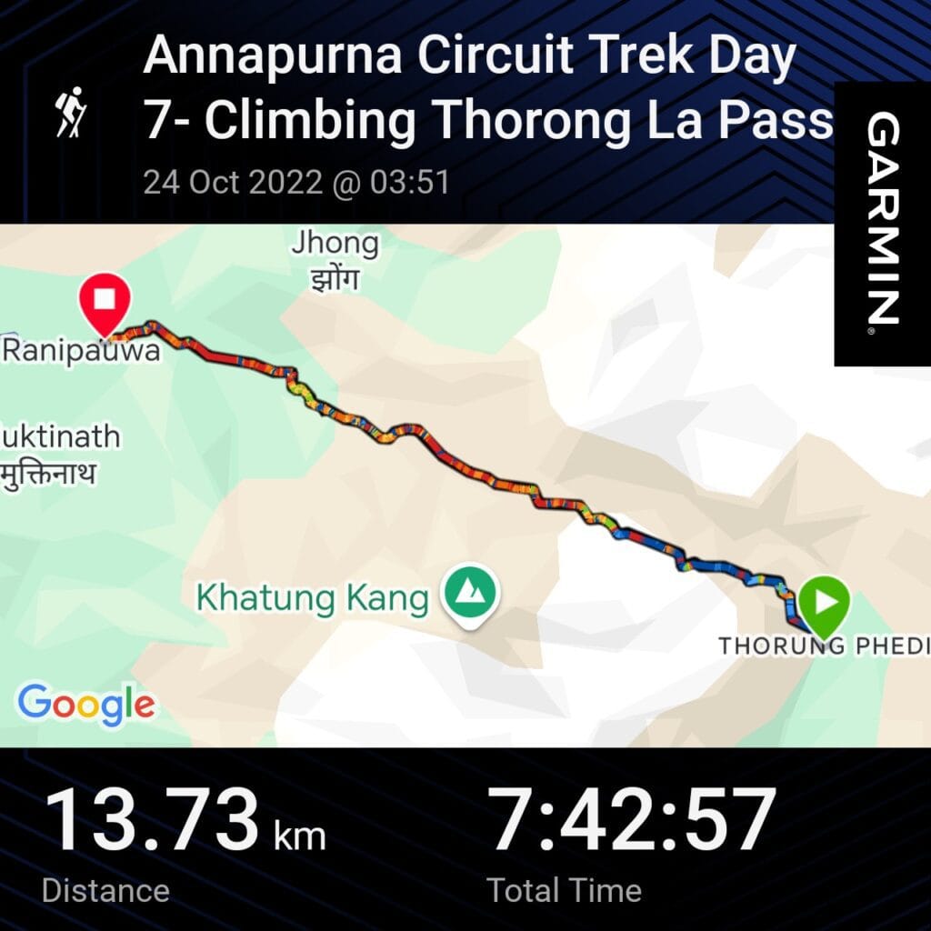
Distance – 13.73km
Ascent – 863m
Descent – 1707m
Moving Time – 3h03
Max Altitude – 5416m (Thorong La Pass)
Avg Pace – 33:44/km
Starting Point – Thorong Phedi (4450m)
End Point – Muktinath (3763m)
Weather Conditions –Starting at -20°C at 4am up to 20°C in Muktinath. Snow and sun all in one
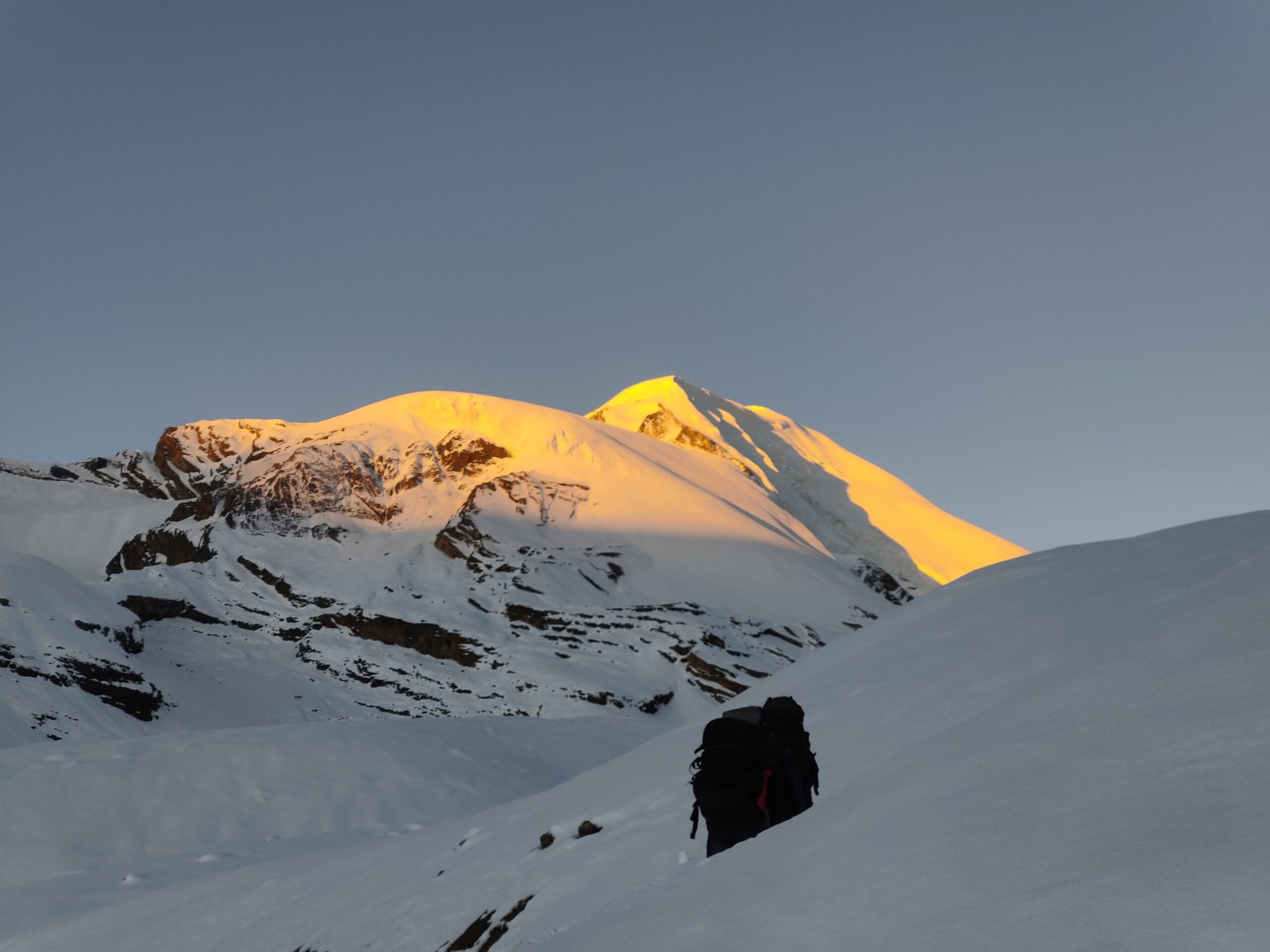
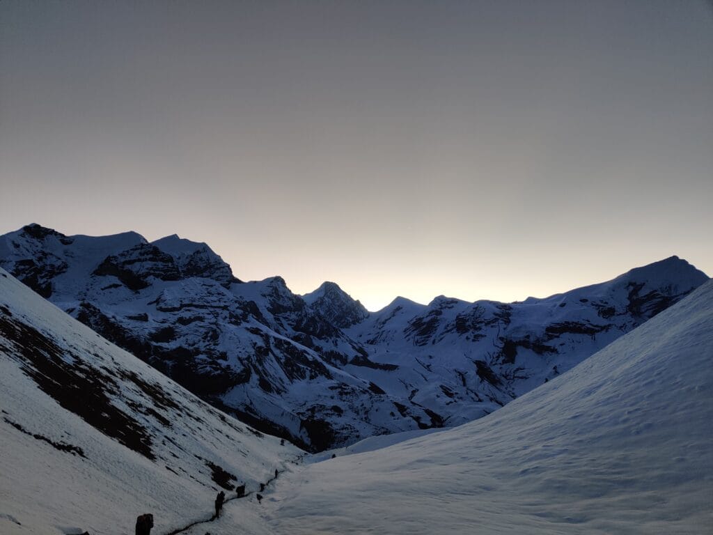
Climb to Thorong La
The alarm goes off at 2:30am. It’s -25°C outside, completely clear night sky with a mind blowing views of the stars & galaxies! The early start is because the winds will pick up later in the day at the pass and can take 10-12hours to hike to Muktinath. Thorong La Pass is 1000m climbing starting at 4500m up to 5416m with half the Oxygen than sea level. The trek starts by zigzagging up to High camp guided by headtorches. The trail will be busy with fellow trekkers, guides and porters all making their way slowly up with limited overtaking. Snow and ice cover the trail as you climb to higher and higher altitudes. Hiking in darkness under the stars is beautiful but is risky with the slippery terrain. There is a tea hut which is much needed warmth in the absolute freezing cold conditions.
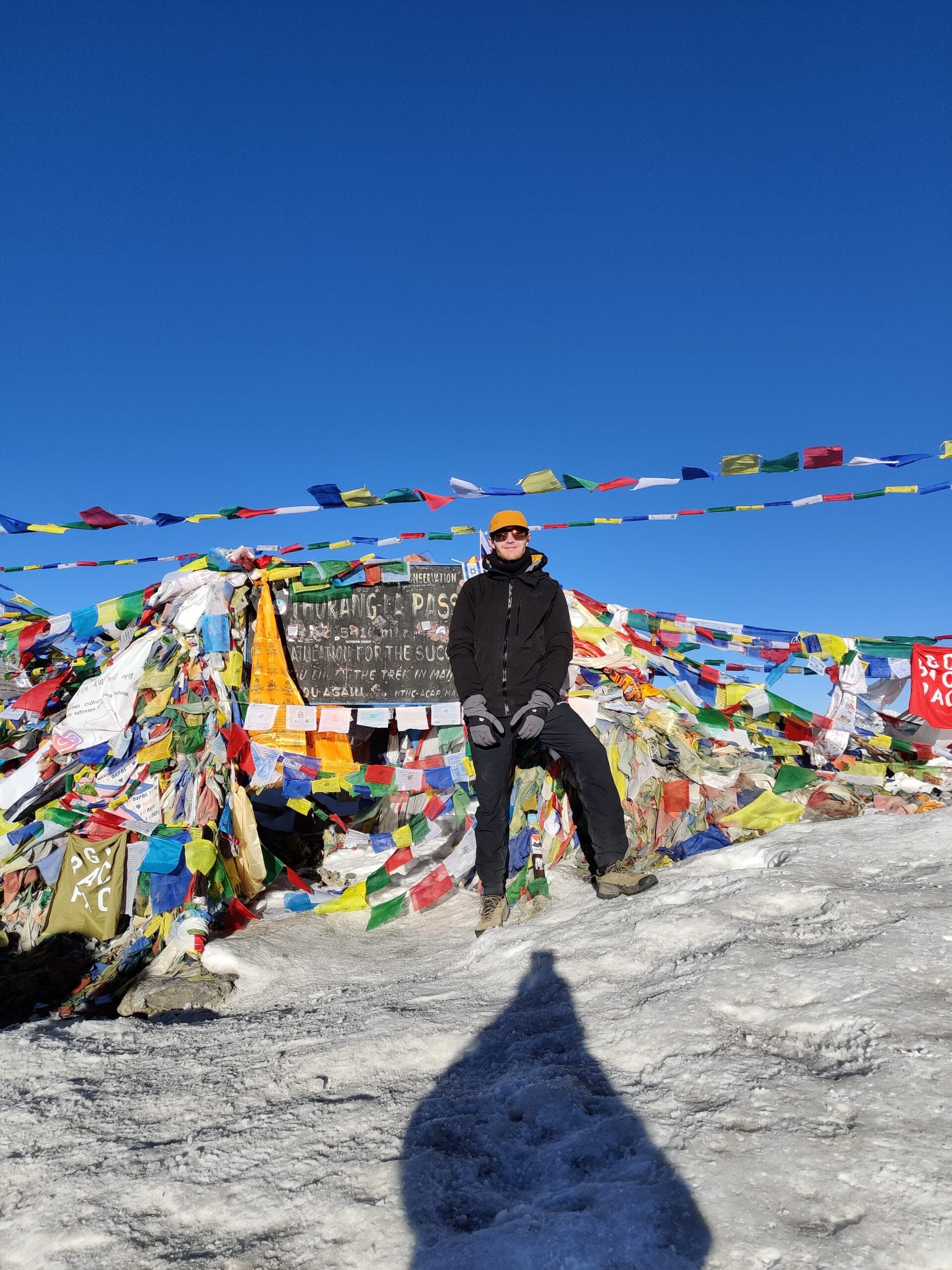
Thorong La Pass (5416m)
All of the training, preparation and acclimatisation had paid off as we smashed the climb and loved every minute! We were faster than most other trekkers and got to Thorong La Pass by 7am after 4 hours of hard work and thin air. As we climbed it wasn’t ideal using the La Sportiva TX4 Approach Shoes on the snow but on the descent, the crampons picked up in Chame were a lifesaver! As we approached Thorong La, the sun rose over the surrounding peaks which was very memorable. There’s a tea hut at the top to celebrate the highest point of the Annapurna Circuit and get many photos with the prayer flag-covered sign.
Descending off Thorong La
After soaking up the achievement, the long descent to Muktinath and Ranipauwa begins. Most of the mileage on Day 8 is on the way down which starts with snow banks which are slippery without crampons and trekking poles. It’s hard work on the knees with people helping each other navigate and find the vague path down the mountain. We had multiple stops for crampons, snacks and to rest on the long day hiking where it warmed up as you lost altitude. A good spot for a break is Phedi restaurant with views into Muktinath Valley and even Dhaulagiri. After crossing a suspension bridge, you eventually arrive in the town and find some much-needed rest after the physical battle of Thorong La Pass
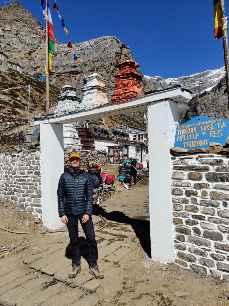
Muktinath
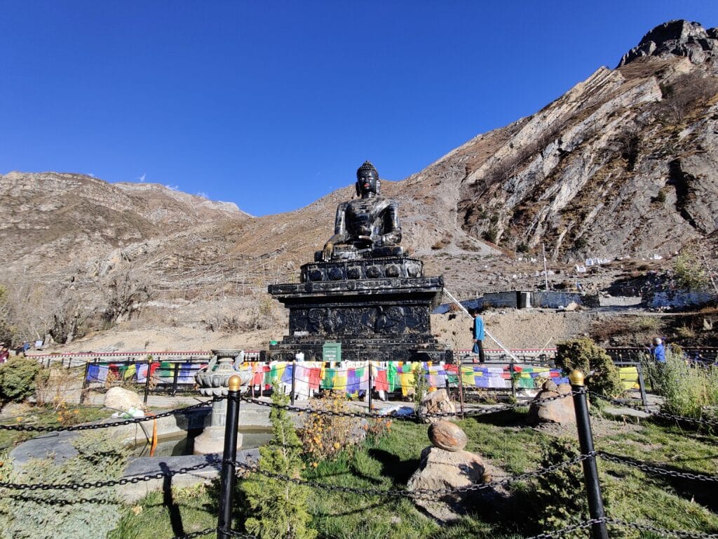
Muktinath is the valley with the famous Hindu & Buddhist temple in the town of Ranipauwa. We arrived in the middle of the afternoon so had time to explore the sacred temple. But to get to the Temple meant climbing unfriendly steps to the top after already a 1000m climbing in the legs. The Shree Muktinath Temple is the main attraction for pilgrims and tourists with free entry and is one of the world’s highest at 3800m. People travel from all over (and not just via Thorong La) to walk through the 108 water sprouts of liberation. For more information on the religious significance for both Hinduism and Buddhism then check out Trip to Temples.
Acclimation
The hot conversation topic from Manang to Thorong La Pass is the Altitude! It’s easy to overthink altitude sickness as all the trekkers will mention how you’re feeling. The lack of Oxygen can affect anyone on the trek above 2500m and is something to take seriously. The expertise of the Guides is best to listen to about the symptoms of High Altitude Sickness and have regular checks. The main pieces of advice from the Guides are to drink at least 3-4 litres of water a day and to climb high then sleep well for the body to adapt. Some Guides had Oxygen Trackers to measure your blood oxygen levels with above 90% being preferable.
I started feeling the effects above Manang at 4000m but managed to acclimatise well in time for the ascent to Thorong La Pass. When talking with other trekkers in Muktinath, the speed Dawa and I climbed and then descended was hours faster than most other groups. This was thanks to the fitness preparation and good acclimatisation. I found that Ginger chai tea helped reduce headaches and drinking more water than normal. The acclimatisation day hike in Manang, Ledar and High Camp afternoon hikes were effective in preparing. Diamox is a medication to help ease the effects of headaches and fatigue which I ordered before travelling to Nepal. I started taking Diamox after Manang for 3 days and would say it’s a last resort if you feel symptoms.
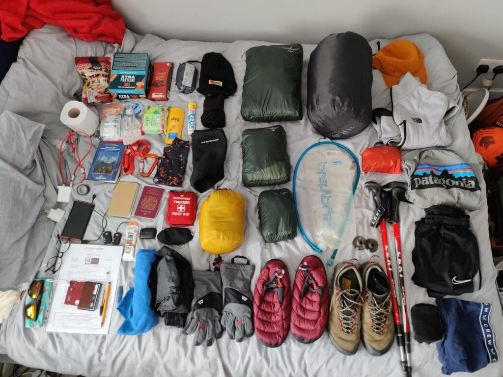
Trekking Training
As it was my first trek, I spent months physically training for the weeks of climbing a heavy backpack. To start with, it’s best to use a fully loaded pack with all the essentials for trekking (Here’s the Trekking Packing List for Annapurna Circuit). My backpack for the training hikes was around 18kg but day hikes with other packs will still be beneficial. The Circuit is on well-trodden trails, gravel roads and up rocky tracks but with days of over 1000m of climbing. So it’s best to hike 15-20km lengths where you can, ideally with lots of elevation gain. In the UK, the Lake District, Snowdonia, Peak District and Scottish Highlands are good places to hike in preparation for Nepal.
Additionally, I did a lot of running and team sports to increase my cardio fitness as much as possible. The weight of the backpack especially on the shoulders and back, can be heavy so try to improve upper body strength and core to help with the load. Unless you live somewhere with higher altitudes nearby it’s difficult to train for the acclimatisation aspect in the UK. But in America, Canada or the Alps there are much higher altitudes above 2500m to help prepare. And it’s always a good idea to test out all of the trekking equipment, clothes and boots/shoes before heading out so it’s worn in and tried.
Final Thoughts
The trek up to Thorong La Pass is one of the best days for hiking in my life. It is such a rewarding moment after 7 days from Synange to the Pass to see the top. The climb is physically and mentally demanding but the sense of accomplishment at Thorong La and then down in Muktinath is incredible. It’s not every day you get to experience high altitudes so enjoy the challenge and hopefully, the tips in this guide help make the most of the Annapurna Circuit Trek. The final part 3 will cover the journey from Muktinath to Tatopani then the last 2 days of Trekking. And my favourite moment of the Poon Hill Sunrise Hike before travelling to Pokhara and onto Kathmandu.
What’s the best Trek you’ve completed? I’m always on the lookout for new mountain adventures and would love to test myself back at high altitudes again. Please share these blog posts if you know anyone travelling to the Annapurna Region.
Pingback: Poon Hill: The Best Himalayan Mountain Sunrise Hike - Backpacker's Mentality