Ahornbahn: Filzenkogel Day Hike- A Quiet Summit Above Mayrhofen
If you’re looking for a rewarding summit hike without the crowds of Mayrhofen’s more famous trails, Filzenkogel is a standout choice. Rising above the Ahorn plateau, this lesser-known peak delivers expansive views over the Zillertal Valley, the Zillertal Alps, and on clear days even as far as the Dolomites. The trail feels refreshingly wild and peaceful, trading busy viewpoints for grassy ridgelines, rocky summit sections, and a true sense of alpine solitude.
Often combined with the Ahornbahn cable car, the Filzenkogel day hike offers a perfect balance between accessibility and adventure. By gaining elevation effortlessly at the start, you can focus on enjoying the high-alpine scenery and steady summit push rather than a long valley climb. It’s an ideal hike for those wanting a half- to full-day mountain experience near Mayrhofen that feels off the beaten path yet still logistically simple. Unfortunately, our original plan for Ahornspitze wasn’t possible due to the Ahornbahn cable car not operating in early June. Therefore, we (Shaun and I) decided to hike from Mayrhofen all the way up to Filzenkogel and back down in a huge hiking day out. This hike was included as part of an interrailing hostelling trip to Mayrhofen after visiting Munich and before travelling to Vienna.
Planning & Tips for the Filzenkogel Hike
Getting There
- Base town: Mayrhofen, Tyrol
- Access point: Ahornbahn valley station (central Mayrhofen)
- Best approach: Take the Ahornbahn cable car to the Ahorn plateau. This hike was in early June, so the cable car was not open, hence the hike from Mayrhofen town to the Filzenkogel summit.
Ahornbahn Cable Car Info
- One of Austria’s largest cable cars (capacity ~150 people)
- Ride time: ~8 minutes to Ahorn (2,000 m)
- Operating season: Typically June to mid-October (weather dependent)
- Tickets: One-way or return available; consider one-way if descending on foot
- Tip: Ride early to avoid queues, especially in July–August
Route Overview
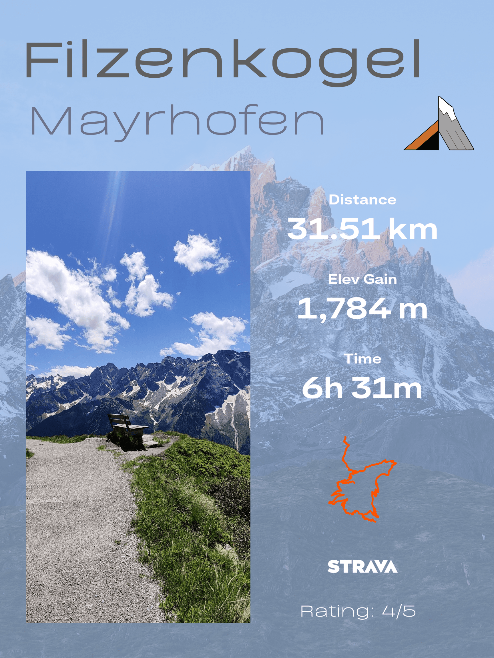
- Distance: ~8–11 km. (Challenging version: 31km)
- Elevation gain: ~600–800 m (Challenging version: 1750m)
- Time: 4–6 hours (Challenging version: 10 hours total time)
- Difficulty: Moderate (Challenging by not using the Cable Car to ascend 1000m)
- Summit elevation: ~2,227 m
Best Time to Hike
- Late June to September is ideal if the cable car is operating. July and August offer stable conditions, but can be hot on exposed sections. Early season may include lingering snow patches near the summit
What to Pack
- For a Day Hike, I would use good-quality hiking footwear, a backpack and additional layers as the altitude increases. Whilst I used a simplified version of my usual hiking gear due to this being part of an inter-city hostelling trip, I ensured we both had appropriate hiking shoes and plenty of water. Check out this Hiking Gear List Packing Guide to see the essentials to take. When the huts are not operating, it’s best to take a filtration system to refill with alpine stream water.
Trail & Navigation Tips
- Trails are well-marked from the Ahorn plateau. The trail from the town is a simple enough gravel track to navigate. Expect grassy paths transitioning to rockier terrain near the summit, which is non-technical yet a little steep. Download an offline map, as fog or cloud can roll in quickly.
Food & Facilities
- Restaurants and huts are available near the Ahorn top station
- No huts on Filzenkogel summit—carry your own food to enjoy with an epic view
- Picnic spots with valley views along the route
Safety & Weather
- Afternoon storms are common—start early
- Watch for strong winds along exposed ridgelines
- Turn around if visibility drops; navigation can be tricky in cloud
Crowd Tips
This is a popular moderate or even family hike, so it can get busy during the summer season. It’s best to start before 9 a.m. for the calmest conditions. The Ahornspitze or Penken-area hikes can be busier for more serious hikes. Overall, the weekends are busiest, which means midweek hikes offer near-total solitude.
Ahornbahn Hike to Filzenkogel
This hike was the day after the Olpererhütte – Friesenberghaus Hike, and we didn’t plan on doing a mammoth 31.5km hike due to a detour. Instead of taking any buses, we set out on foot to scale up the nearby Filzenkogel climb straight from Mayrhofen town. This hike featured No.9 in The Best Mountain Hikes 2.0 with epic panoramic views from the summit. We were very early in the hiking season with no cable cars, lifts or facilities open at Ahornbahn. This left us with no option but to hike to Mayrhofen to the summit and back. Most people do the Ahornbahn hike to Filzenkogel from the top station, taking a few hours instead of a full day of hiking.
The Climb
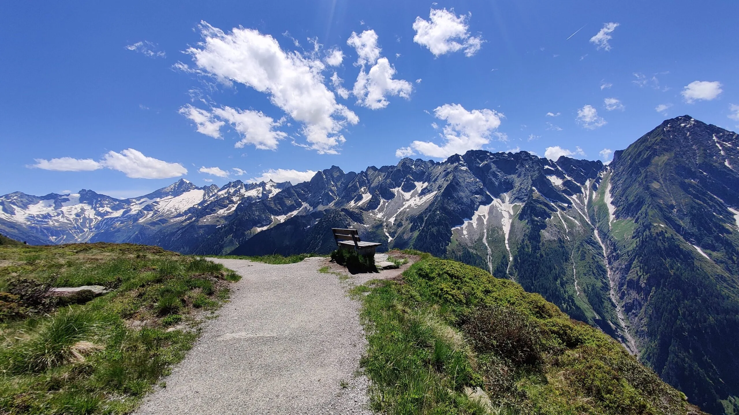
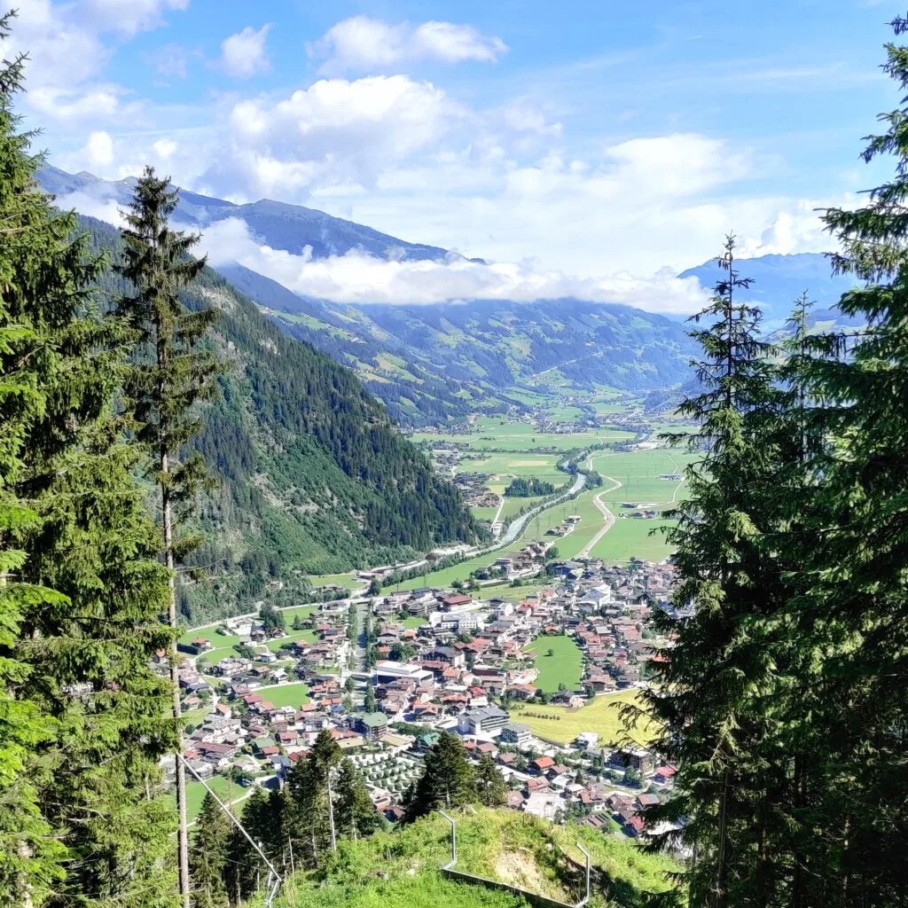
We started at the bottom of the Ahornbahn station and hiked up through the trees along good gravel tracks. The path was steady as it climbed the 1000m needed to get to the top Ahornbahn station. The sun was hot with little tree shade as the altitude increased. The views back across to Mayrhofen were good, even if the trails were a little uninspiring. To keep our minds occupied, we played a few Top 5 lists for different cars, which is the logical game for 2 automotive engineers on a hike. On the ascent, we turned towards the valley and found a perfect 10/10 bench with a beautiful mountain ridgeline opposite us.
Ahornbahn
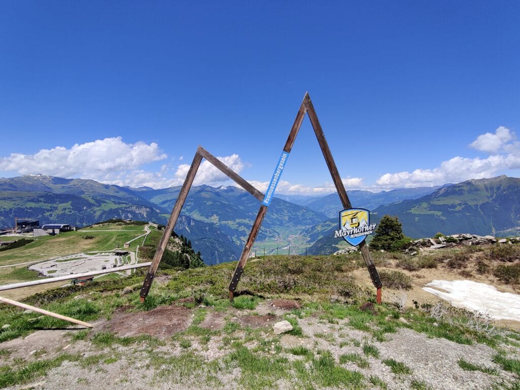
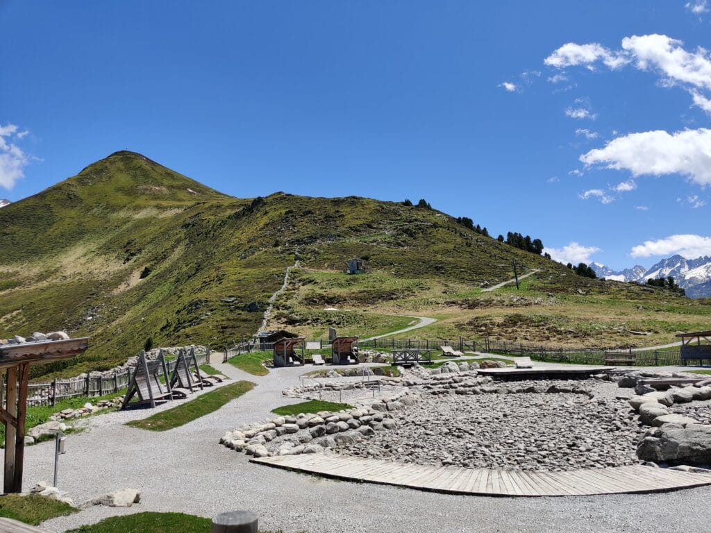
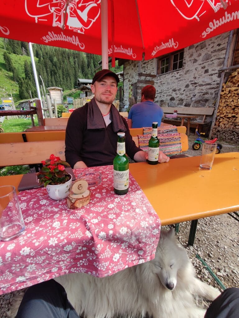
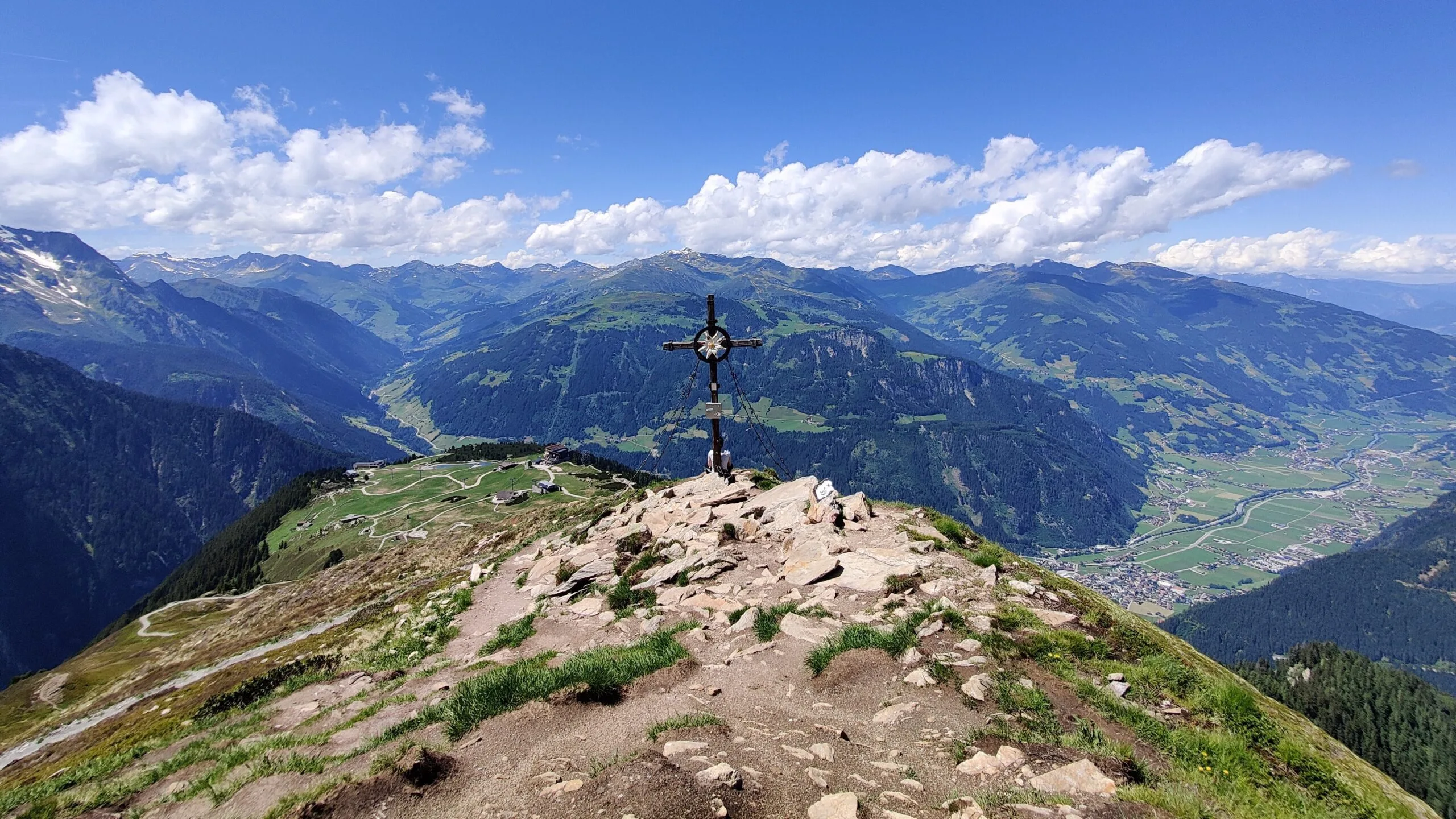
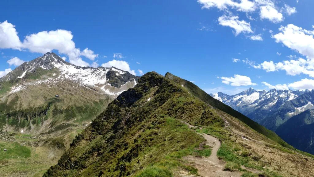
We reached the Cable Car station, which was deserted and stopped for lunch in some precious shade to avoid the burning sun and heat before the last few 3km of climbing. Ahorn Plateau has a playground for children as well as the usual restaurants and facilities you expect at a mountain resort. We had finally joined the Ahornbahn hike to Filzenkogel that most people hike (6km and a few hundred metres climbed). As we ascended, the views of Ahornspitze and the neighbouring valleys were magical. The summit overlooks the Zillertal mountains with a fantastic 360-degree view, which we made the most of. We had the peak to ourselves for the hour we stayed before descending towards the Ahornbahn cable car station.
The Descent
We chose to descend into the next valley near the Karl von Edelhütte and enjoyed the peaceful valley. There were loose rock areas, and we saw a couple of other hikers for the first time. We stopped at Alpengasthaus Alpenrose for a much-needed cold lemonade and were given helpful advice from the Hut owner that the fast route down was shut, so we had to take a long detour. What we didn’t realise was that the detour added almost 10km and an hour to our hike along more gravel tracks with a few fields and forest trails mixed in. After 31.5km and almost 10 hours of hiking in hot summer weather, we were shattered and in much need of a refreshing Austrian beer and burger.